MyTopo
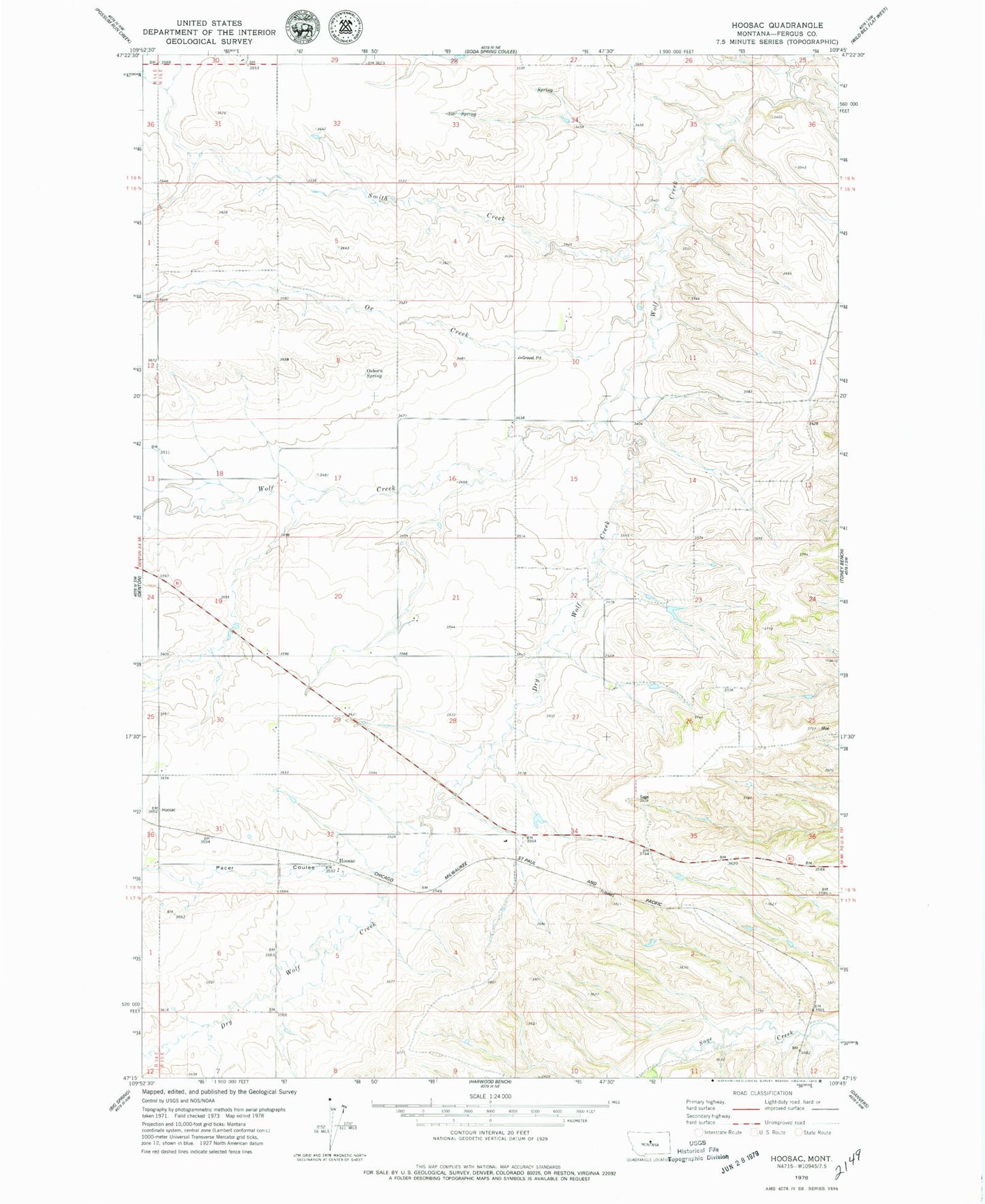
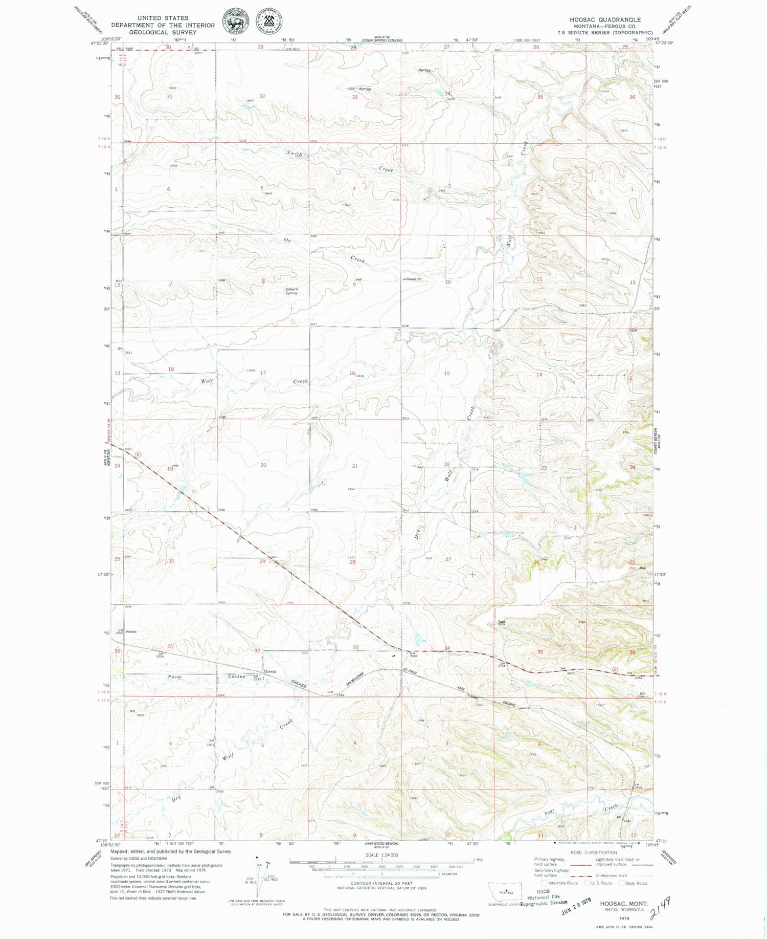
Classic USGS Hoosac Montana 7.5'x7.5' Topo Map
Couldn't load pickup availability
Historical USGS topographic quad map of Hoosac in the state of Montana. Map scale may vary for some years, but is generally around 1:24,000. Print size is approximately 24" x 27"
This quadrangle is in the following counties: Fergus.
The map contains contour lines, roads, rivers, towns, and lakes. Printed on high-quality waterproof paper with UV fade-resistant inks, and shipped rolled.
Contains the following named places: 17N15E06BCAB01 Well, 17N15E06CD__01 Well, 17N15E07ABAA01 Well, 18N14E01DAD_01 Well, 18N15E33DAB_01 Well, 19N15E28DDB_01 Well, Dry Wolf Creek, Hoosac, Hoosac Post Office, Hoosac School, Mason School, Osborn Spring, Ox Creek, Pacer Coulee, Smith Creek, Stone School, Washington Bench School, Wet Mutt Dam