MyTopo
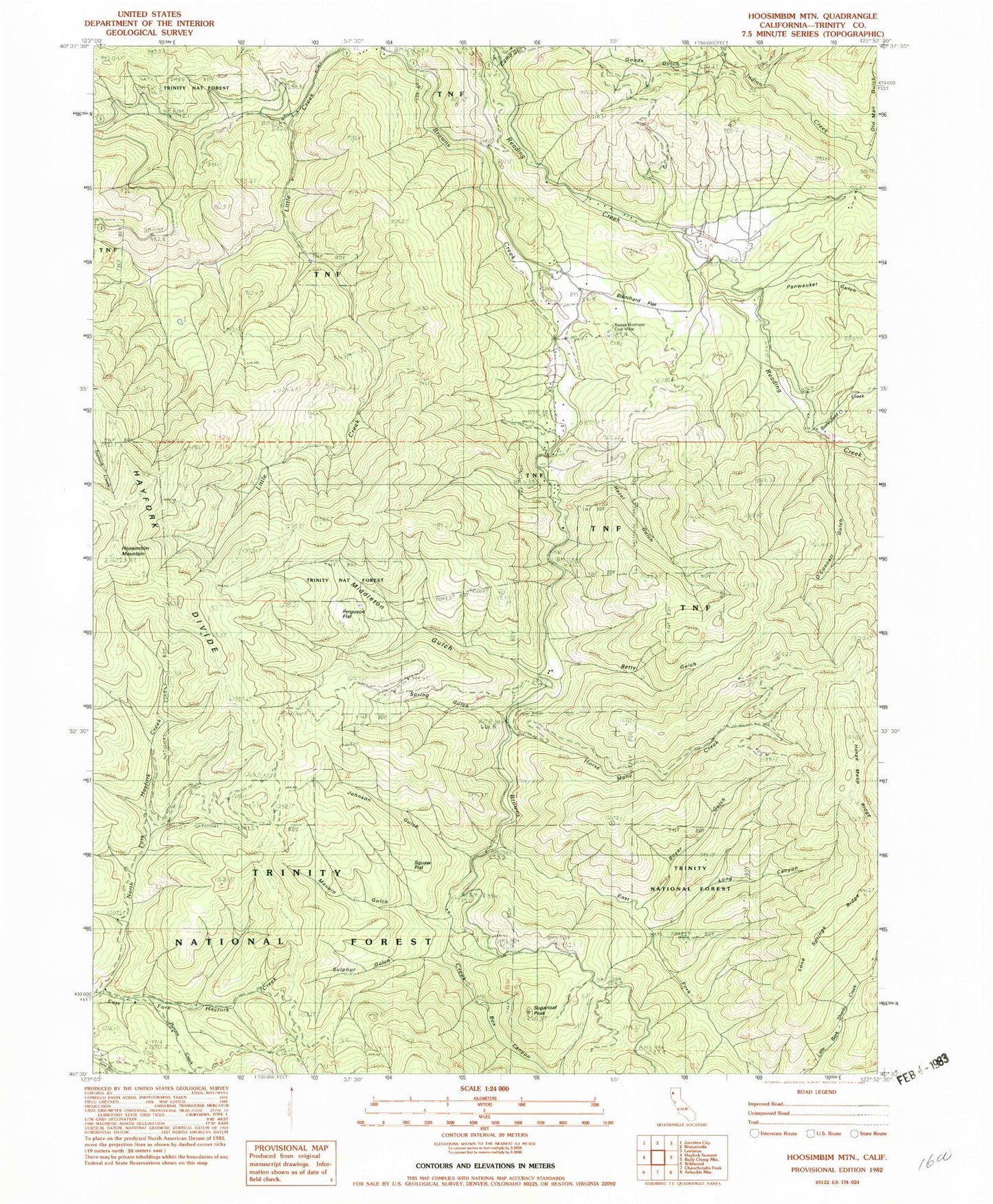
Classic USGS Hoosimbim Mountain California 7.5'x7.5' Topo Map
Couldn't load pickup availability
Historical USGS topographic quad map of Hoosimbim Mountain in the state of California. Map scale may vary for some years, but is generally around 1:24,000. Print size is approximately 24" x 27"
This quadrangle is in the following counties: Trinity.
The map contains contour lines, roads, rivers, towns, and lakes. Printed on high-quality waterproof paper with UV fade-resistant inks, and shipped rolled.
Contains the following named places: Barleyfield Creek, Barleyfield Gulch, Betty Gulch, Blanchard Flat, Blanchard Flat School, Box Canyon, Boyer Gulch, Byrons Creek, Camp Gulch, Clements Ranch, Dinkles Ranch, East Fork Browns Creek, Ferguson Flat, Goods Gulch, Hazel Gulch, Hoosimbim Mountain, Horse Mane Creek, Horse Mane Ridge, Johnson Gulch, Lone Springs Ridge, Long Canyon, Maupin Gulch, Middleton Gulch, North Fork Hayfork Creek, O'Connell Gulch, Old Man Gulch, Panwauket Gulch, Reese Brothers Coal Mine, Spring Gulch, Squaw Flat, Sugarloaf Peak, Sulphur Gulch, ZIP Code: 96024