
MyTopo
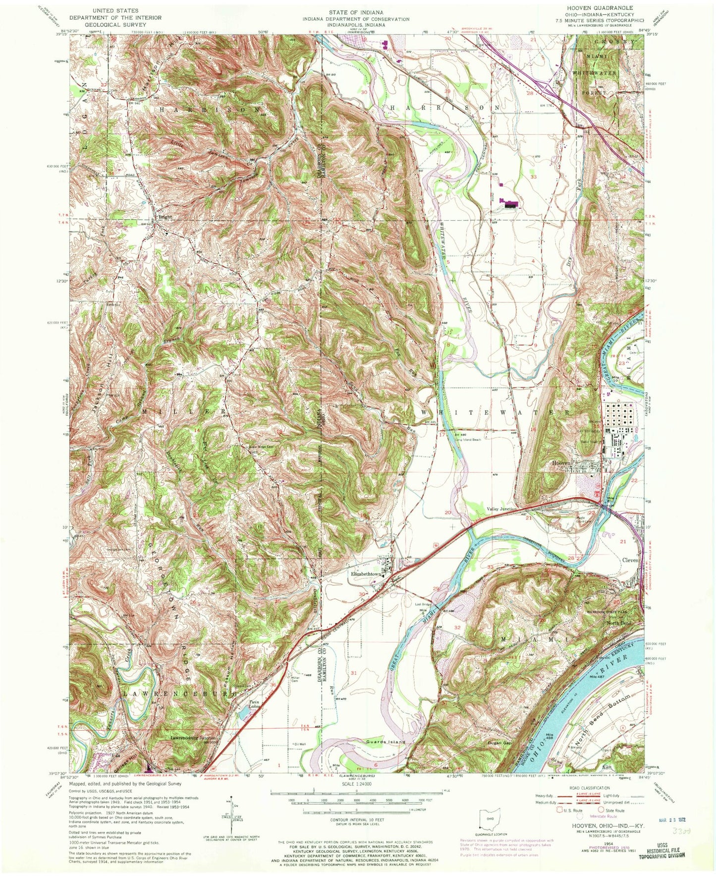
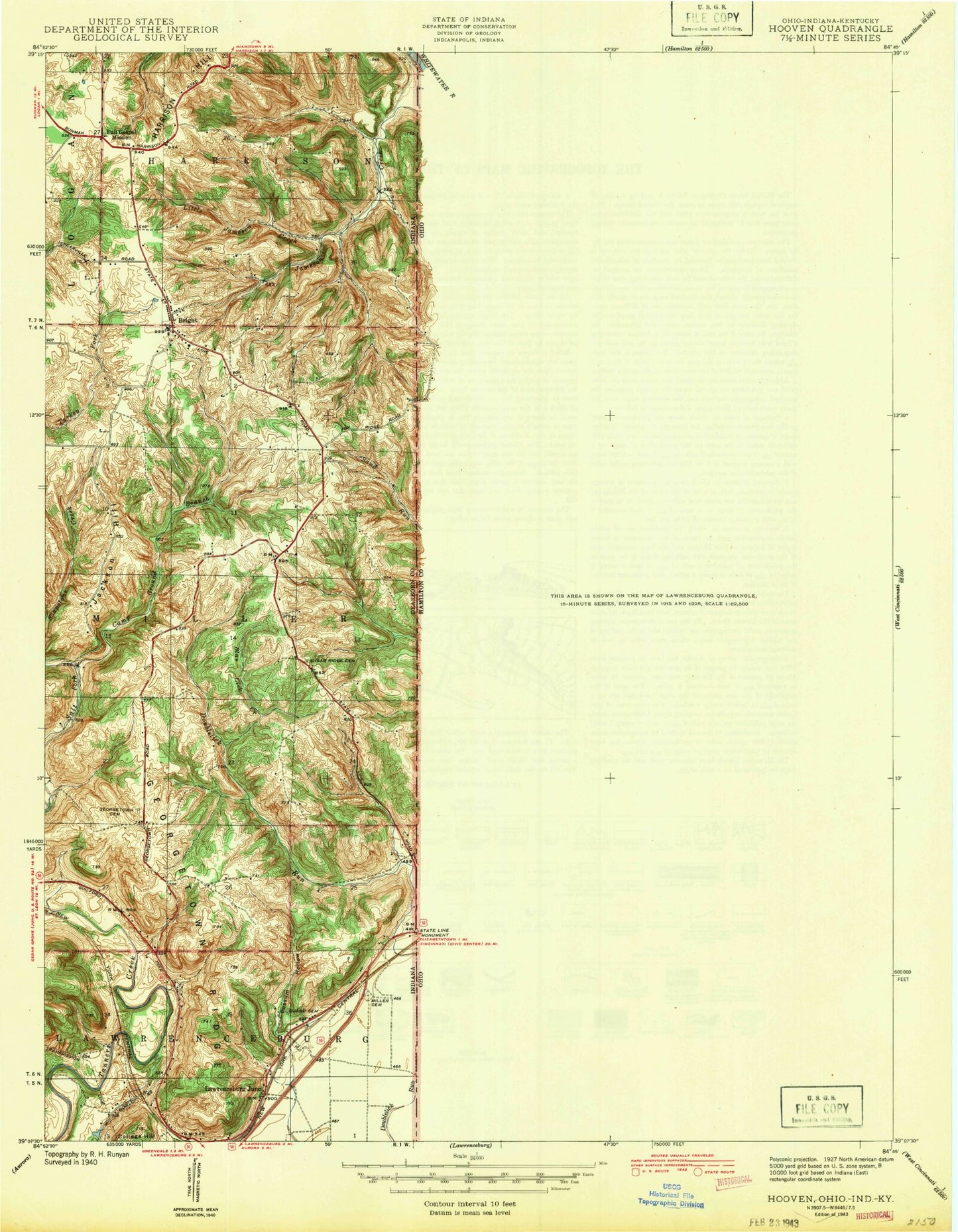
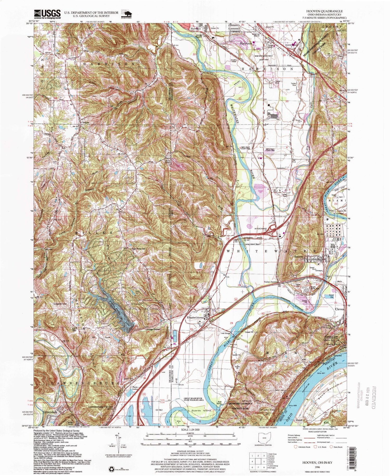
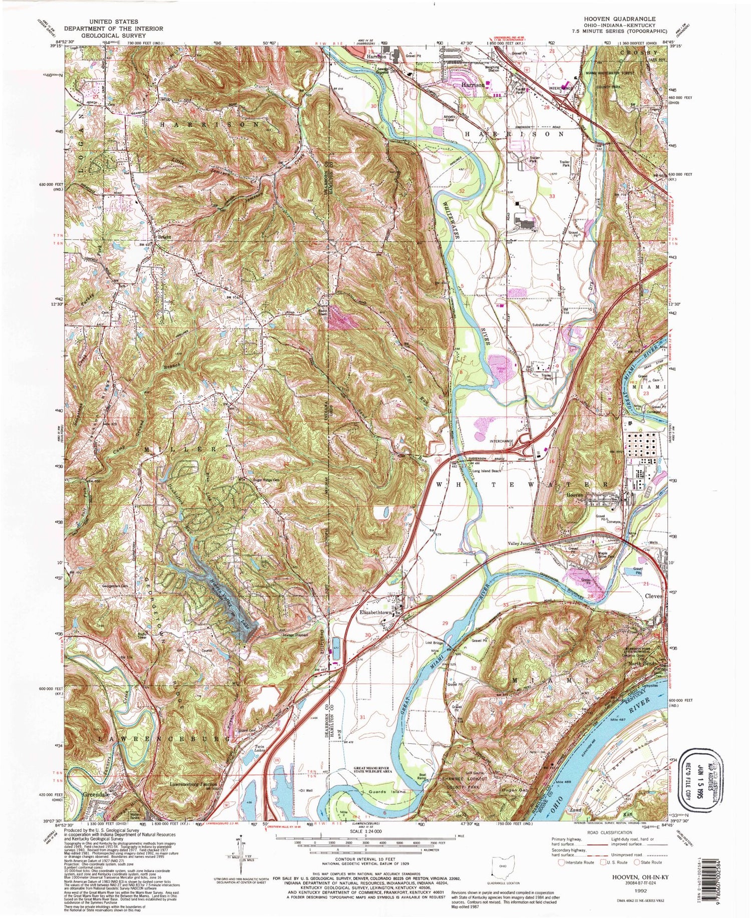
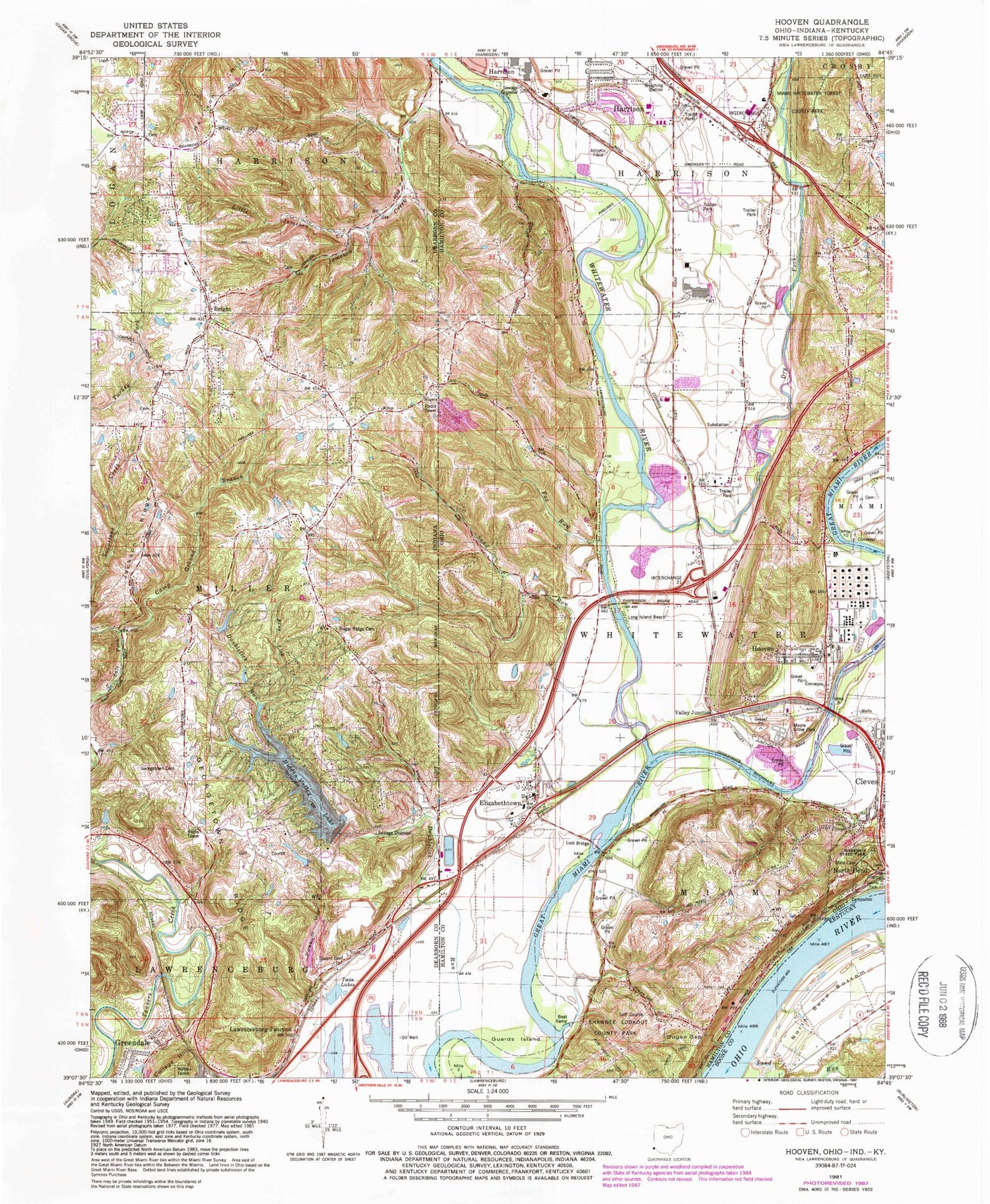
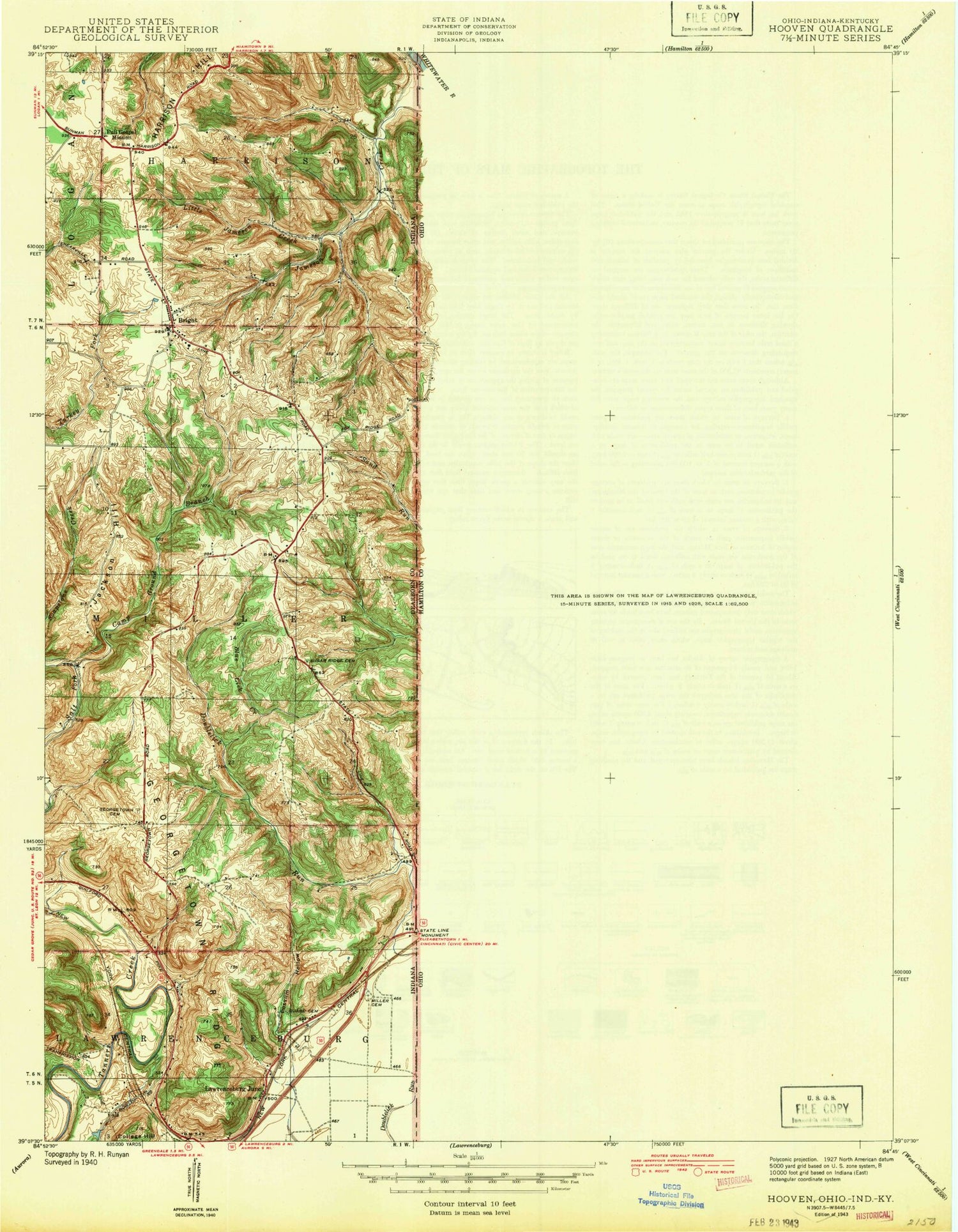
Classic USGS Hooven Ohio 7.5'x7.5' Topo Map
Couldn't load pickup availability
Historical USGS topographic quad map of Hooven in the states of Ohio, Indiana, Kentucky. Map scale may vary for some years, but is generally around 1:24,000. Print size is approximately 24" x 27"
This quadrangle is in the following counties: Boone, Dearborn, Hamilton.
The map contains contour lines, roads, rivers, towns, and lakes. Printed on high-quality waterproof paper with UV fade-resistant inks, and shipped rolled.
Contains the following named places: Berea Cemetery, Blue Jacket Trail, Blue Lick Creek, Bond Road Landfill, Bright, Bright Census Designated Place, Bright Volunteer Fire Company Station 1, Bright Volunteer Fire Company Station 2, Bright Volunteer Fire Department Station 1, Bright Volunteer Fire Department Station 2, Bullitts Bottom, Bullittsburg, Bullittsburg Baptist Church, Bullittsburg Post Office, Camp Ground Branch, Cilley, Cleves Community Church, Colonial Industrial Park, Dry Fork Whitewater River, Dugan Gap, Edgewater Park, Eighteenmile House, Elizabethtown, Elizabethtown Cemetery, Elizabethtown Census Designated Place, Elizabethtown Elementary School, Elizabethtown Post Office, Fort Gass, Fox Run, Georgetown Cemetery, Georgetown Ridge, Guard Cemetery, Guards Island, Gulf Community Park, Harmony Field Park, Harrison Hill, Harrison State Park, Hidden Valley, Hidden Valley Census Designated Place, Hidden Valley Lake, Hidden Valley Lake Dam, Hidden Valley Lake Rangers, Hooven, Hooven Census Designated Place, Hooven Elementary School, Hooven Post Office, Jackson Ridge, Jameson Creek, Kirtley Pond, Lawrenceburg Junction, Lawrenceburg Road Landfill, Little Jameson Creek, Little Turtle Trail, Locust Grove School, Long Island Beach, Lost Bridge, Lost Bridge Airport, Maple Grove Cemetery, Miami Township Fire Department Station 68, Miami Whitewater Forest County Park, Miller Hayes Cemetery, Minges Farm Cemetery, Mount Nebo School, Perryville, Possum Hollow, Potato Creek, Salt Fork, Sand Run, Sand Run Lick, Shawnee Census Designated Place, Shawnee Lookout County Park, Simonsons, Smith Tract County Park, State Cemetery, Sugar Grove, Sugar Ridge Cemetery, Suspension Bridge, Township of Miller, Township of Whitewater, Tumlin Lake, Tumlin Lake Dam, Twin Lakes, Valley Junction, Valley Juntion Post Office, Weneeda Post Office, White Water Park, Whitewater River, Whitewater School, Whitewater Township Fire Department Station 104, Whitewater Township Fire Department Station 95, Whitewater Township Hall, William Henry Harrison Memorial, ZIP Codes: 45002, 45033, 45052, 47025