MyTopo
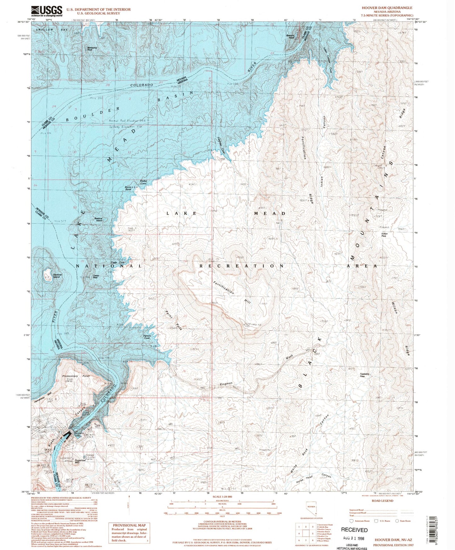
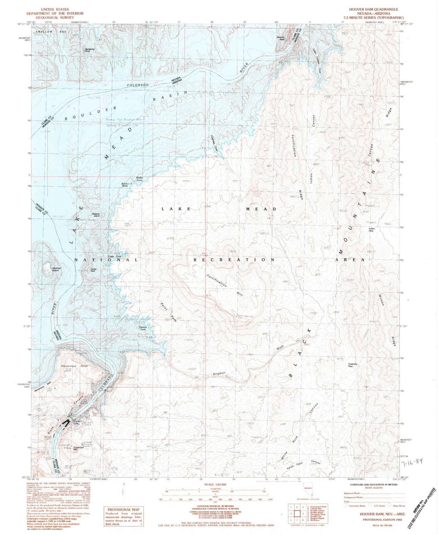
Classic USGS Hoover Dam Nevada 7.5'x7.5' Topo Map
Couldn't load pickup availability
Historical USGS topographic quad map of Hoover Dam in the states of Nevada, Arizona. Map scale may vary for some years, but is generally around 1:24,000. Print size is approximately 24" x 27"
This quadrangle is in the following counties: Clark, Mohave.
The map contains contour lines, roads, rivers, towns, and lakes. Printed on high-quality waterproof paper with UV fade-resistant inks, and shipped rolled.
Contains the following named places: Battleship Rock, Beacon Rock, Beehive Island, Burro Point, Callville Dam Site, Callville Post Office, Canyon Ridge, Cape Horn, Cashman Landing, Castle Cove, Castle Reef, Fishfinder Cove, Fort Callville, Fortification Hill, Fortification Ridge, Goldstrike Canyon, Hemenway Wall, Hesse Camp, Himix, Hoover Dam, Horse Thief Canyon, Indian Canyon, Indian Canyon Cove, Indian Pass, Jamestown, Kingman Wash, Lomix Plant, Lookout Point, Nevada Hot Spring, Old Pope Mine, Paint Pots, Painters Cove, Promontory Point, Pupfish Springs, Sentinel Island, Shelter Cove, Sugarloaf Mountain, Sugarloaf Spring, Teakettle Pass, Upper Black Canyon Dam Site, US Bureau of Reclamation Hoover Dam Water Treatment Plant, Weather Raft