MyTopo
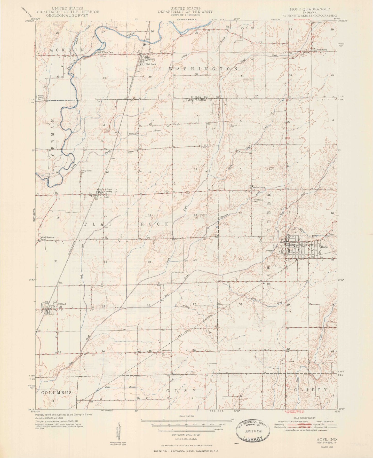
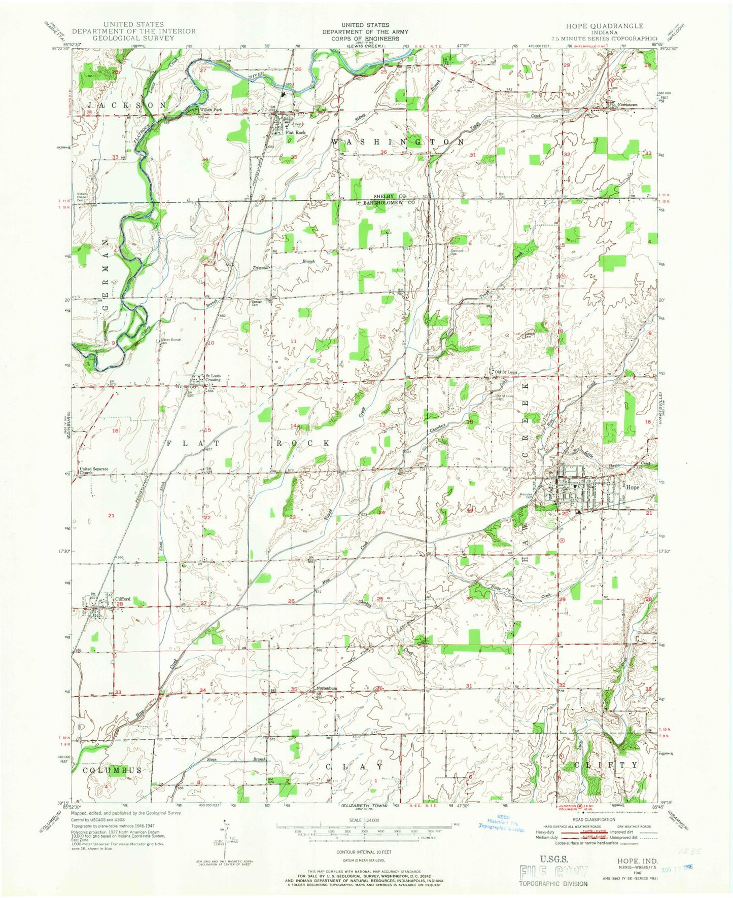
Classic USGS Hope Indiana 7.5'x7.5' Topo Map
Couldn't load pickup availability
Historical USGS topographic quad map of Hope in the state of Indiana. Map scale may vary for some years, but is generally around 1:24,000. Print size is approximately 24" x 27"
This quadrangle is in the following counties: Bartholomew, Shelby.
The map contains contour lines, roads, rivers, towns, and lakes. Printed on high-quality waterproof paper with UV fade-resistant inks, and shipped rolled.
Contains the following named places: Chambers Ditch, Chicken Creek, Clifford, Clifford Post Office, Clifford Volunteer Fire Department, Compton Ditch, Cross Cliff Elementary School, Flat Rock, Flat Rock Post Office, Flat Rock Volunteer Fire Department, Hauser Junior-Senior High School, Hope, Hope Elementary School, Hope Police Department, Hope Post Office, Hope Volunteer Fire Department, Horse Creek, Lewis Creek, Little Haw Creek, Little Tough Creek, Moravian Cemetery, New Albany-Floyd County Park, Norristown, Nortonburg, Old Saint Louis, Old Saint Louis Cemetery, Roberts Chapel Cemetery, Saint Louis Crossing, Schaefer Lake, Schaefer Lake Dam, Sidener Cemetery, Sidney Branch, Sidney Branch Cemetery, Simmons Cemetery, Slash-Loesch Ditch, Spaugh Cemetery, Tough Creek, Town of Clifford, Town of Hope, Township of Flat Rock, Trimnell Branch, United Separate Church, WDGS-AM (New Albany), Willow Park, ZIP Codes: 47226, 47246