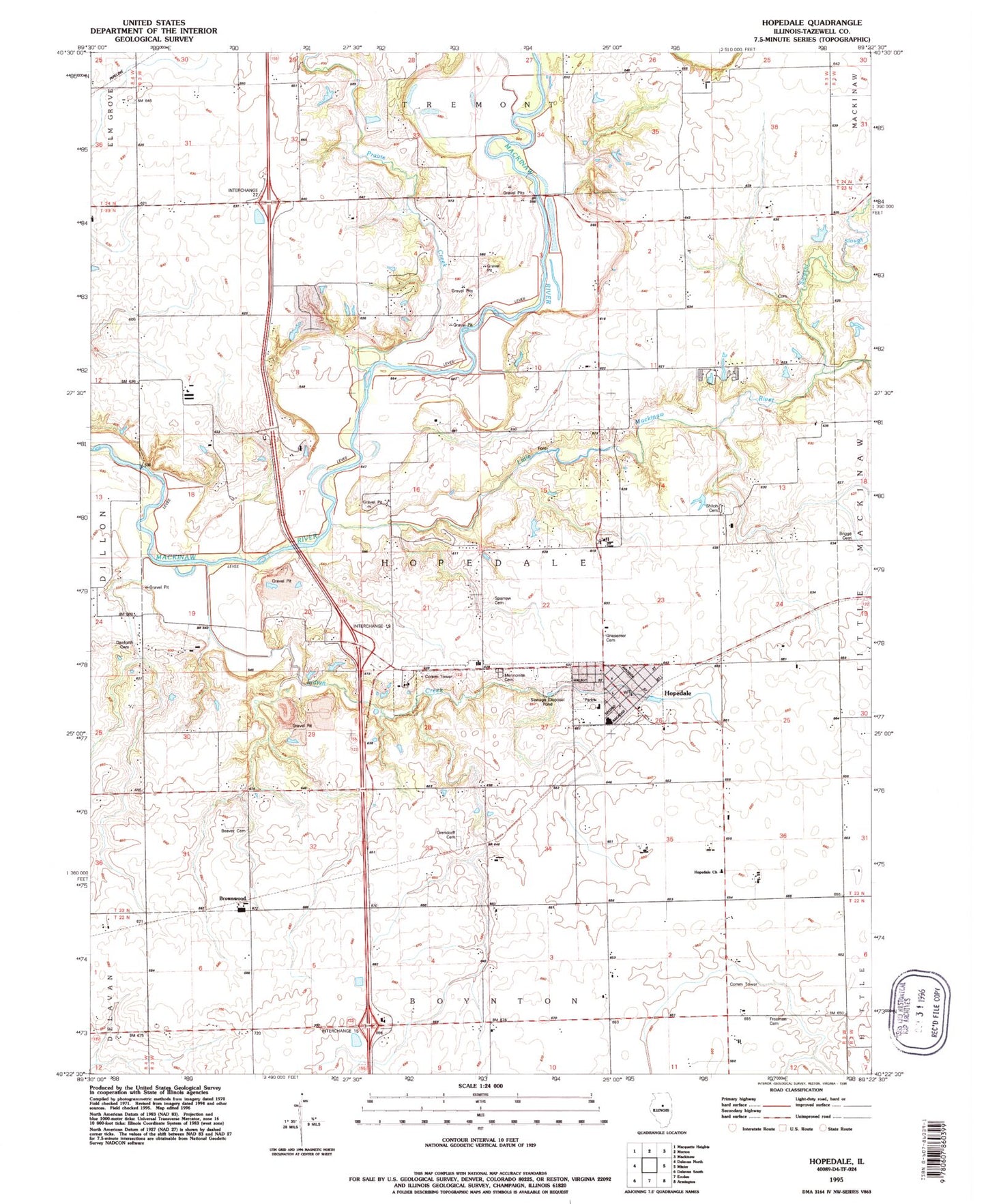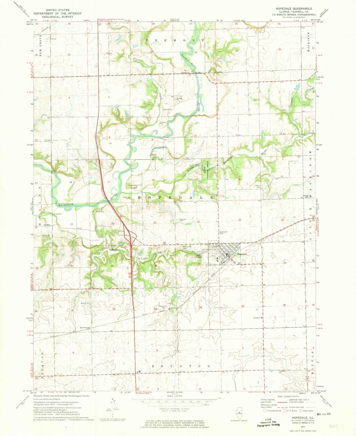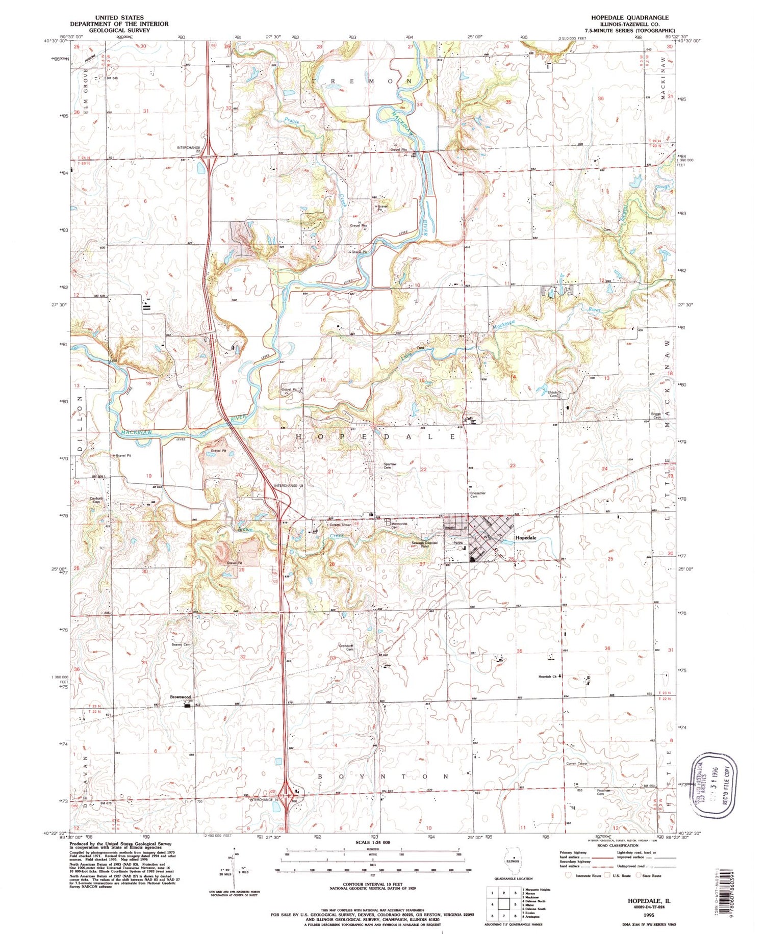

MyTopo
Classic USGS Hopedale Illinois 7.5'x7.5' Topo Map
Couldn't load pickup availability
Historical USGS topographic quad map of Hopedale in the state of Illinois. Map scale may vary for some years, but is generally around 1:24,000. Print size is approximately 24" x 27"
This quadrangle is in the following counties: Tazewell.
The map contains contour lines, roads, rivers, towns, and lakes. Printed on high-quality waterproof paper with UV fade-resistant inks, and shipped rolled.
Contains the following named places: Bever Cemetery, Boynton Church, Briggs Cemetery, Brownwood, Danforth Cemetery, Freeman Cemetery, Griesemer Cemetery, Hopedale, Hopedale Church, Hopedale Elementary School, Hopedale Fire Protection District, Hopedale Medical Complex, Hopedale Mennonite Cemetery, Hopedale Post Office, Indian Creek, Klemm Memorial Woods, Little Mackinaw River, Maiden Lane School, McClure Cemetery, Orendorff Cemetery, Prairie Creek, Sargent Slough, Shiloh Cemetery, Sparrow Cemetery, Township of Hopedale, Village of Hopedale, ZIP Code: 61747