MyTopo
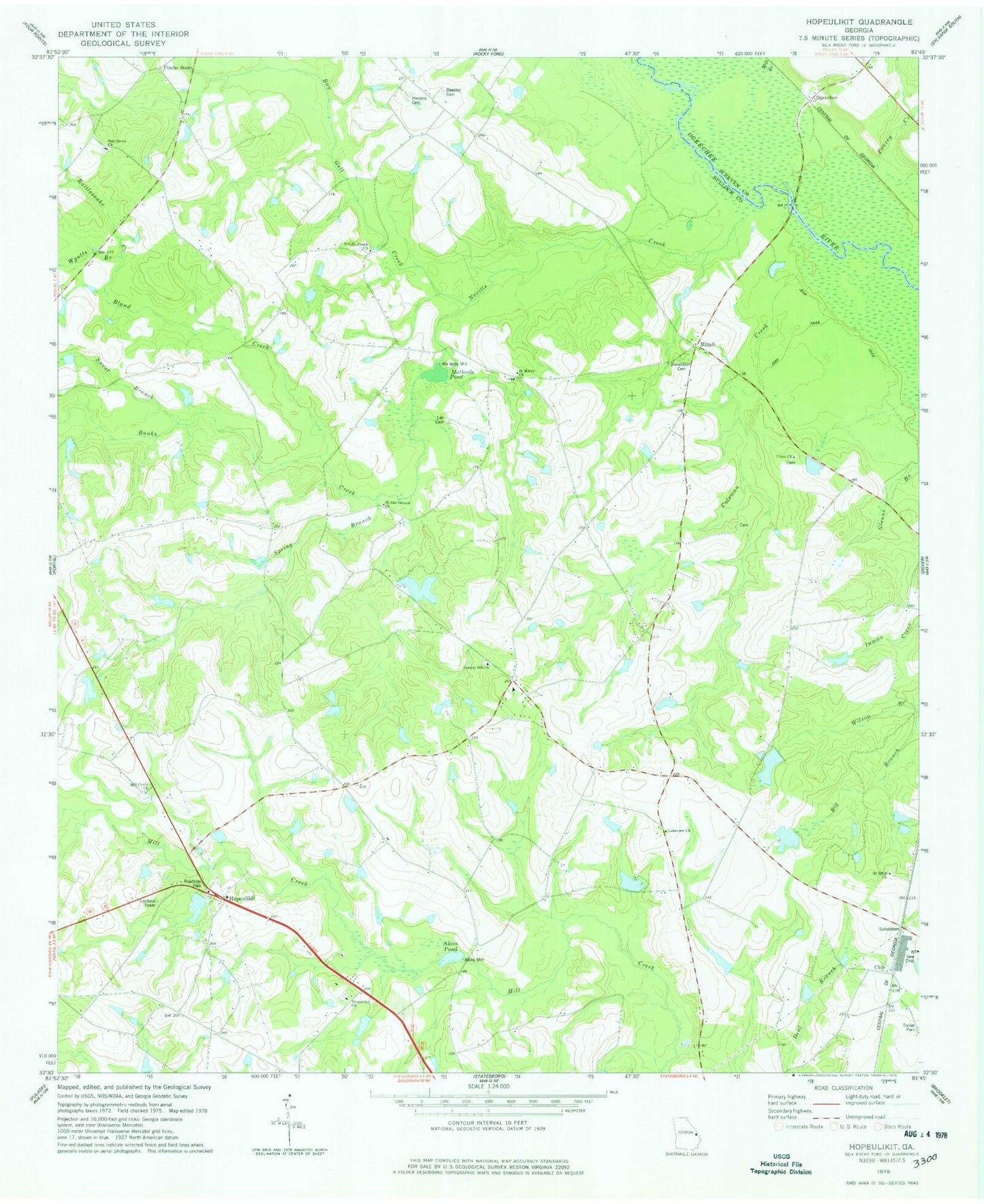
Classic USGS Hopeulikit Georgia 7.5'x7.5' Topo Map
Couldn't load pickup availability
Historical USGS topographic quad map of Hopeulikit in the state of Georgia. Map scale may vary for some years, but is generally around 1:24,000. Print size is approximately 24" x 27"
This quadrangle is in the following counties: Bulloch, Screven.
The map contains contour lines, roads, rivers, towns, and lakes. Printed on high-quality waterproof paper with UV fade-resistant inks, and shipped rolled.
Contains the following named places: Akins Mill, Akins Pond, Alexander School, Banks Creek, Bay Gall Creek, Beasley Cemetery, Bland Creek, Blitch, Brown Chapel, Clito, Coleman Creek, Donaldson Cemetery, E S Lane Bridge, Finchs Store, Free Chapel, Friendship Church, Friendship Church Cemetery, Hendrix Cemetery, HIA Airport, Hopeulikit, Lakeview Church, Lee Cemetery, Little Bethel Church, Lone Bridge, Mallards Mill, Mallards Pond, Marsh Pond, Marsh Pond Dam, Middle Ground Church, Mill Branch, Mill Creek Church, Mill Creek School, Mount Oliff Church Cemetery, Mount Olliff Church, Nevills Creek, Nevills Creek Church, Nevills Creek School, Oak Grove Baptist Church, Oak Grove Cemetery, Ogeechee, Peavey Creek, Rattlesnake Creek, Saint Marys Cemetery, Saint Marys Church, Spring Branch, Sweat Branch, Swint Pond, Swint Pond Dam, Temple Hill Baptist Church, Temple Hill Church, Temple Hill Church Cemetery, Tillman Pond, Tillman Pond Dam, Union Cemetery, Union Church, Williams Chapel, Wyatts Branch