MyTopo
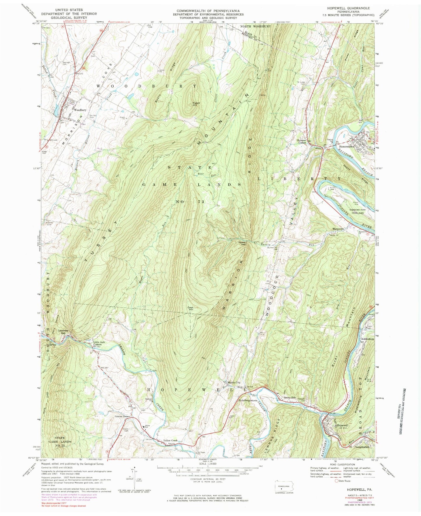
Classic USGS Hopewell Pennsylvania 7.5'x7.5' Topo Map
Couldn't load pickup availability
Historical USGS topographic quad map of Hopewell in the state of Pennsylvania. Map scale may vary for some years, but is generally around 1:24,000. Print size is approximately 24" x 27"
This quadrangle is in the following counties: Bedford, Blair.
The map contains contour lines, roads, rivers, towns, and lakes. Printed on high-quality waterproof paper with UV fade-resistant inks, and shipped rolled.
Contains the following named places: Abbot Ridge, Bank Run, Bear Run, Beaver Creek, Bedford Church, Bedford Forge Cemetery, Borough of Hopewell, Borough of Woodbury, Brumbaugh Cemetery, Bunker Hill Cemetery, Byers Ridge, Coot Hill, Cottles Corner, Dark Hollow, Dry Hill Cemetery, Dry Run, Eichelbergertown, Eshelman Cemetery, Grace Church, Hickory Bottom Cemetery, Homans Corner, Hopewell, Hopewell Cemetery, Hopewell Post Office, Keagy Cemetery, Langdondale, Little Jack Corners, Longs Run, Loysburg Gap, Maple Run, Marble City, Marysville, Morrisons Cove, Piney Ridge, Pulpit Hill, Raven Church, Ravers Gap, Ravers Run, Raystown Church, Replogle Cemetery, Riddleburg Post Office, Riddlesburg, Riddlesburg Mountain, River Mountain, Saint Lukes Cemetery, Saint Pauls Cemetery, Saint Pauls Church, Sandy Run, Sixmile Run, Smith School, Steele Cemetery, Stonerstown, Stonerstown Cemetery, Stonerstown Census Designated Place, Sugar Camp Run, Sunny Side, Township of Liberty, Township of Woodbury, Tussey Mountain, Warriors Path State Park, Woodbury, Woodbury Mennonite Church Cemetery, Woodbury Post Office, Yellow Creek, Yellow Creek Post Office, ZIP Code: 16695


