
MyTopo
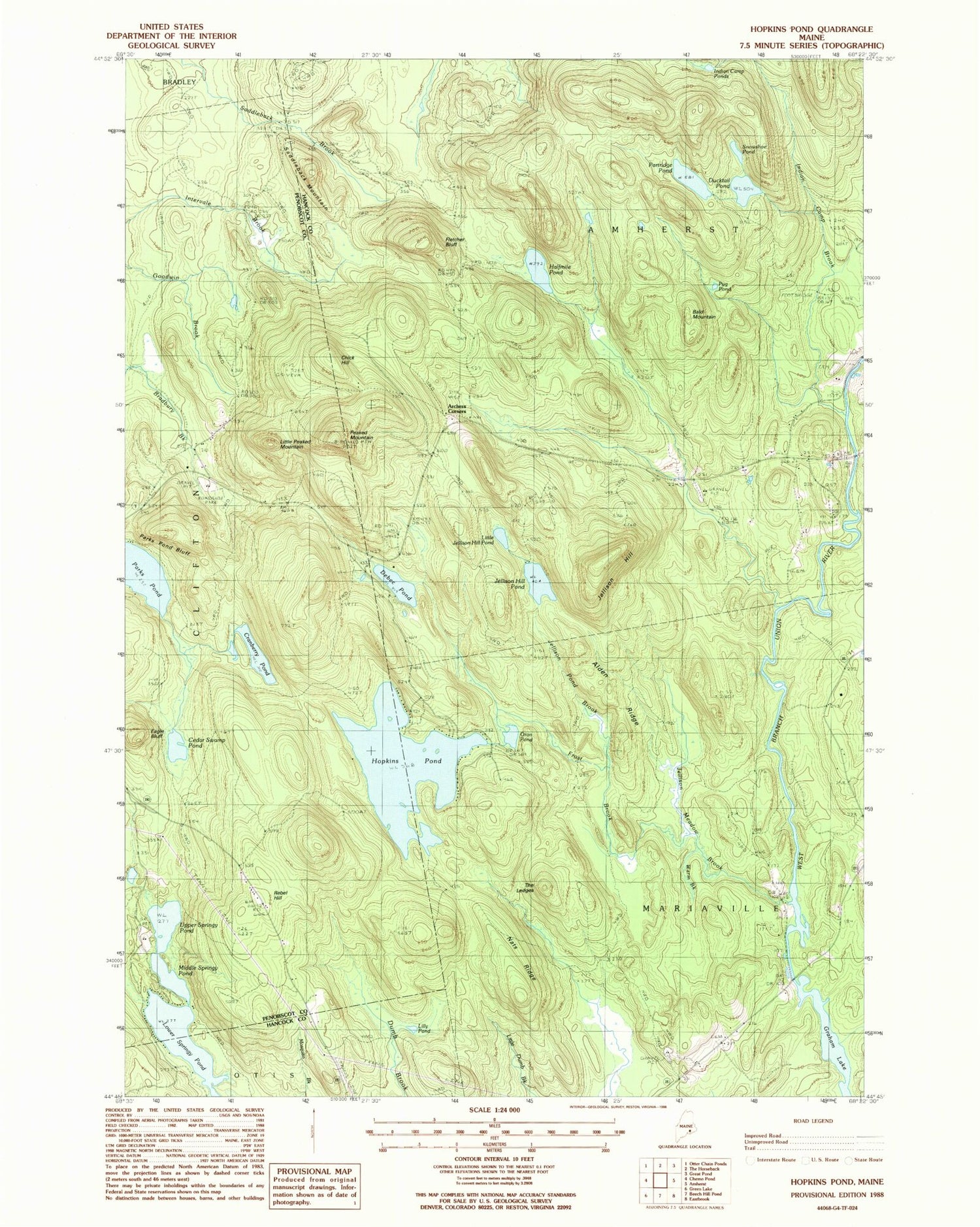
Classic USGS Hopkins Pond Maine 7.5'x7.5' Topo Map
Couldn't load pickup availability
Historical USGS topographic quad map of Hopkins Pond in the state of Maine. Typical map scale is 1:24,000, but may vary for certain years, if available. Print size: 24" x 27"
This quadrangle is in the following counties: Hancock, Penobscot.
The map contains contour lines, roads, rivers, towns, and lakes. Printed on high-quality waterproof paper with UV fade-resistant inks, and shipped rolled.
Contains the following named places: Alden Ridge, Amherst Cemetery, Bald Mountain, Cedar Swamp Pond, Chick Hill, Cranberry Pond, Debec Pond, Ducktail Pond, Eagle Bluff, Fletcher Bluff, Frost Brook, Frost Cemetery, Goodwin Bridge, Hadley Cemetery, Halfmile Pond, Hopkins Pond, Indian Camp Brook, Indian Camp Ponds, Jellison Hill, Jellison Hill Pond, Jellison Meadow Brook, Jellison Pond Brook, Lilly Pond, Little Jellison Hill Pond, Little Peaked Mountain, Lower Springy Pond, Middle Springy Pond, Nats Ridge, Oran Pond, Parks Pond, Parks Pond Bluff, Partridge Pond, Peaked Mountain, Pershing School, Pug Pond, Rebel Hill, Saddleback Mountain, Snowshoe Pond, The Ledges, Twin Bridges, Upper Springy Pond, Warm Brook, Archers Corners, Chick Hill Lookout Tower, Peaked Mountain Trail


