MyTopo
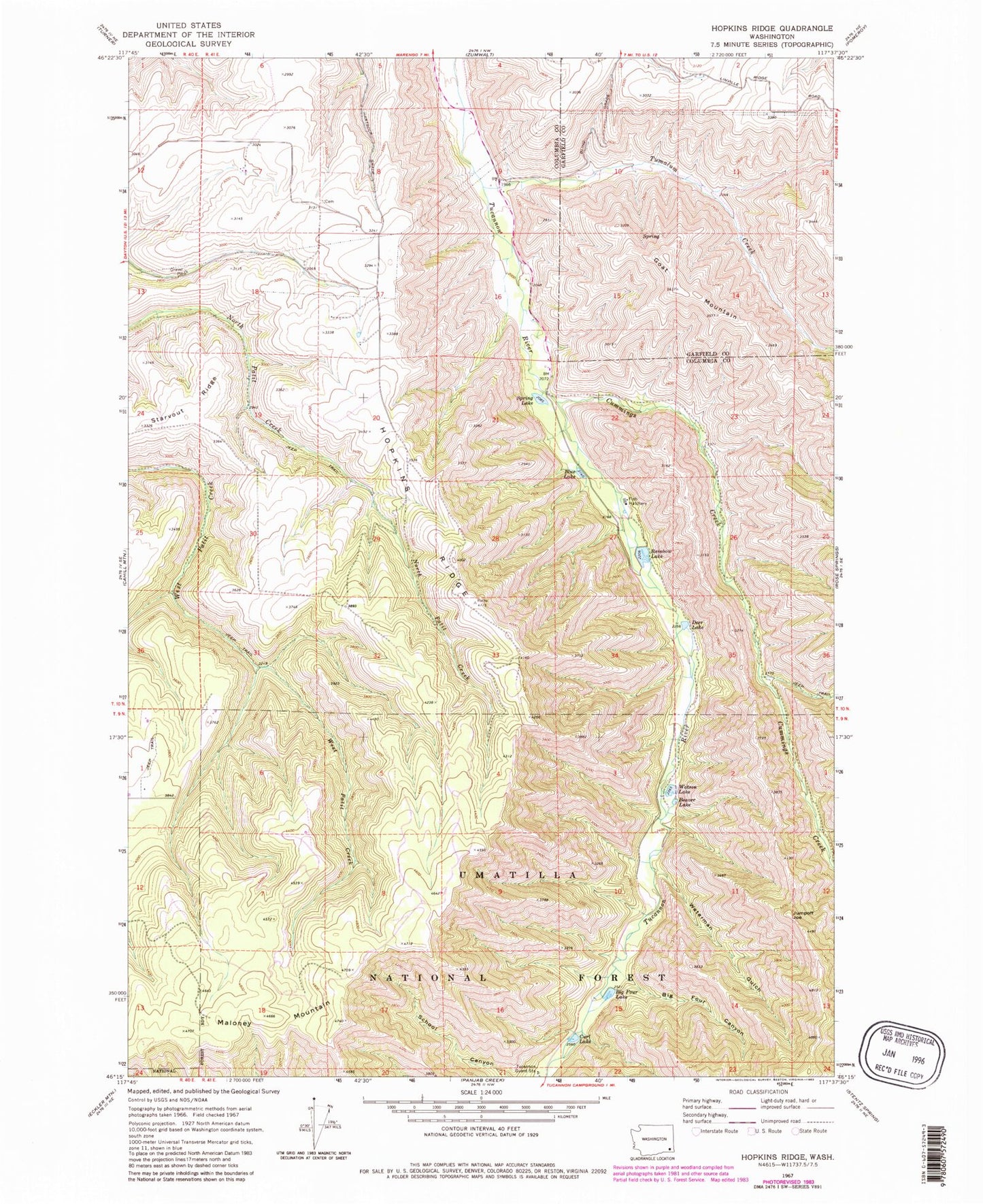
Classic USGS Hopkins Ridge Washington 7.5'x7.5' Topo Map
Couldn't load pickup availability
Historical USGS topographic quad map of Hopkins Ridge in the state of Washington. Map scale may vary for some years, but is generally around 1:24,000. Print size is approximately 24" x 27"
This quadrangle is in the following counties: Columbia, Garfield.
The map contains contour lines, roads, rivers, towns, and lakes. Printed on high-quality waterproof paper with UV fade-resistant inks, and shipped rolled.
Contains the following named places: Beaver Lake, Big Four Canyon, Big Four Lake, Big Four Lake Dam, Blue Lake, Blue Lake Dam, Cummings Creek, Curl Lake, Curl Lake Dam, Deer Lake, Deer Lake Dam, Goat Mountain, Hopkins Ridge, Jumpoff Joe, Maloney Mountain, Rainbow Lake, Rainbow Lake Dam, Spring Lake, Spring Lake Dam, Starvout Ridge, Tucannon Fish Hatchery, Tucannon Guard Station, Tumalum Creek, Waterman Gulch, Watson Lake, Watson Lake Dam, Wooten Game Reserve, Wooten State Fish Hatchery, Wooten State Wildlife Recreation Area