MyTopo
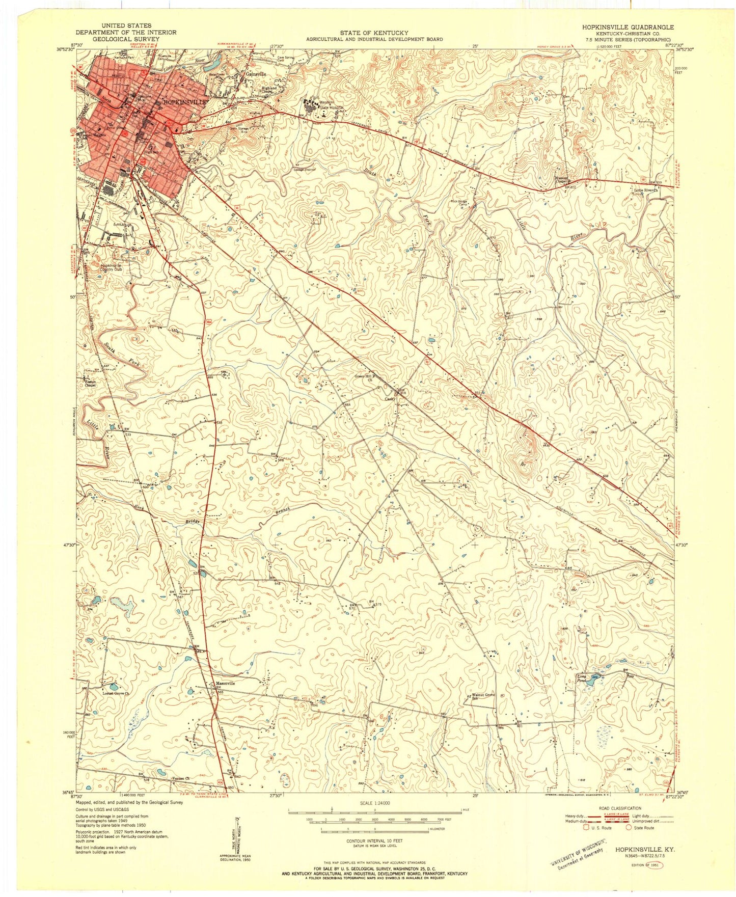
Classic USGS Hopkinsville Kentucky 7.5'x7.5' Topo Map
Couldn't load pickup availability
Historical USGS topographic quad map of Hopkinsville in the state of Kentucky. Map scale may vary for some years, but is generally around 1:24,000. Print size is approximately 24" x 27"
This quadrangle is in the following counties: Christian.
The map contains contour lines, roads, rivers, towns, and lakes. Printed on high-quality waterproof paper with UV fade-resistant inks, and shipped rolled.
Contains the following named places: Bethel College, Bethel College Historical Marker, Big Walnut Grove Church, Canton Heights School, Casky, Cave Spring Cemetery, Charles Slaughter Morehead Historical Marker, Christian County Sheriff's Department, City of Hopkinsville, Colonel William Christian Historical Marker, Edwards Mill, First Presbyterian Church Historical Marker, Foston Chapel, Gainsville Highland School, General Hylan Lyons Raid Historical Marker, Grace Episcopal Church Historical Marker, Green Hill Church, Highland Chapel, Highland Volunteer Fire Department, Hookinsville Country Club, Hopkinsville, Hopkinsville - Christian County Emergency Medical Services, Hopkinsville Fire Department and Emergency Medical Services Station 1, Hopkinsville Fire Department Station 2, Hopkinsville Fire Department Station 4, Hopkinsville Police Department, Hopkinsville Post Office, Hopkinsville-Christian County Airport, Hotel Latham Historical Marker, Jennie Stuart Health System, John C Latham Bequest Historical Marker, Kentucky Veteran's Cemetery West, Little River Church, Locust Grove Church, Long Pond, Longview, Masonville, Massies Chapel, Moringside School, Pioneer Graveyard Historical Marker, Rock Bridge Branch, Trail of Tears Historical Marker, Vernon Church, Western State Hospital, William Clark Historical Marker, WKKT-TV (Hopkinsville), WNKJ-FM (Hopkinsville)


