MyTopo
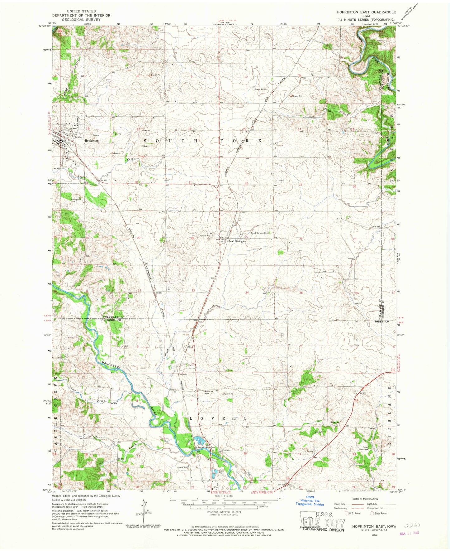
Classic USGS Hopkinton East Iowa 7.5'x7.5' Topo Map
Couldn't load pickup availability
Historical USGS topographic quad map of Hopkinton East in the state of Iowa. Map scale may vary for some years, but is generally around 1:24,000. Print size is approximately 24" x 27"
This quadrangle is in the following counties: Delaware, Dubuque, Jones.
The map contains contour lines, roads, rivers, towns, and lakes. Printed on high-quality waterproof paper with UV fade-resistant inks, and shipped rolled.
Contains the following named places: Camp De Shaw, City of Hopkinton, Cline Creek, Deer Creek, Delaware County Historical Museum, East Monticello Cemetery, Highway Thirty-Eight Speedway, Hopkinton, Hopkinton Ambulance Service, Hopkinton Cemetery, Hopkinton City Hall, Hopkinton City Park, Hopkinton Family Medical Center, Hopkinton Feed and Grain Incorporated Elevator, Hopkinton Fire Department, Hopkinton Post Office, Hopkinton Public Library, Johnston Elementary School, Junction Switch, Livingston Cemetery, Milo Number Seven School, Mount Pleasant Cemetery, Sacred Heart Cemetery, Saint Luke Catholic Church, Sand Springs, Sand Springs Cemetery, Sand Springs Post Office, Silver Creek, Township of Lovell, Township of South Fork, United Methodist Church, Walnut Acres Campground, Wet Creek Bridge, Willard Cemetery, ZIP Code: 52237