MyTopo
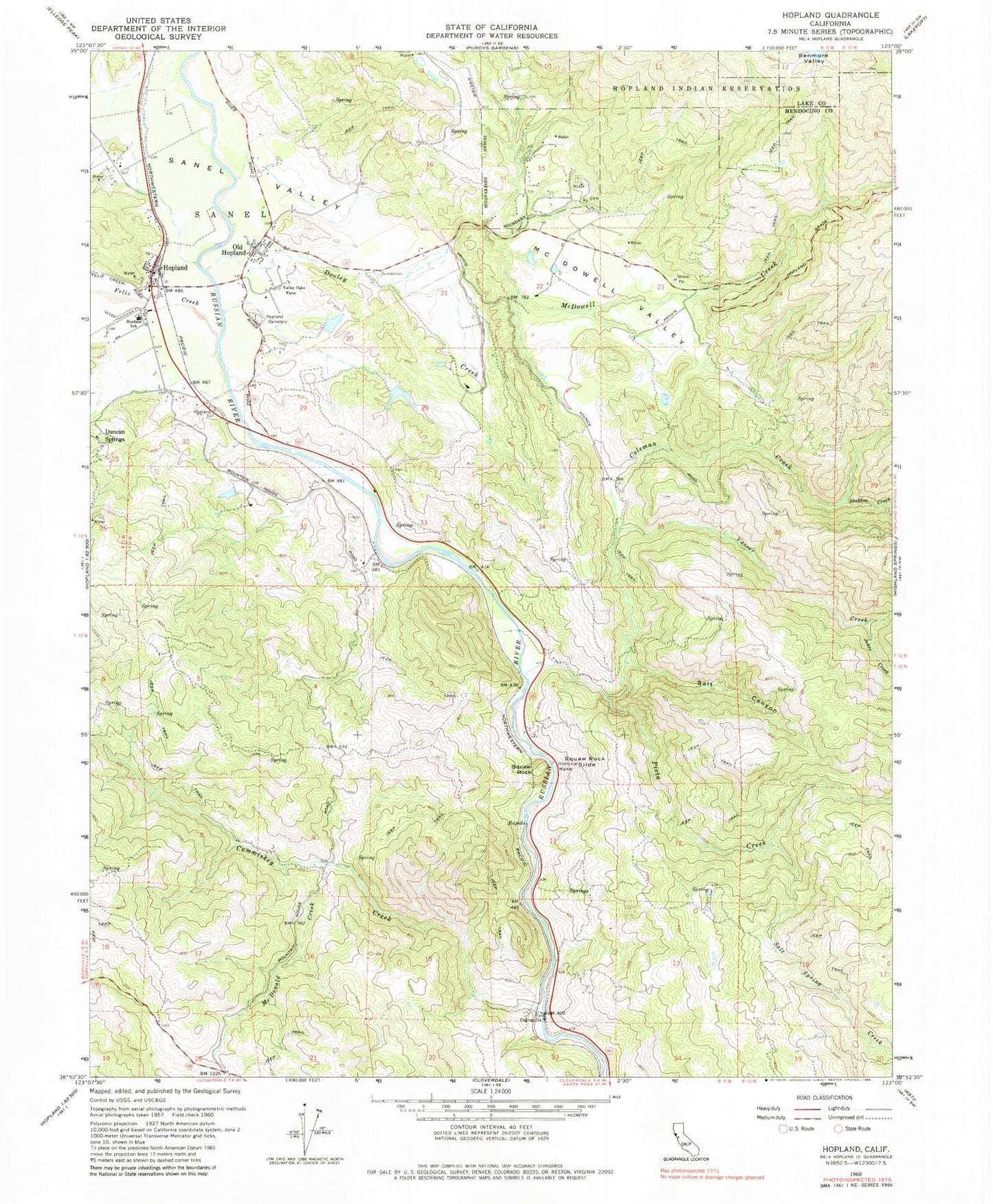
Classic USGS Hopland California 7.5'x7.5' Topo Map
Couldn't load pickup availability
Historical USGS topographic quad map of Hopland in the state of California. Map scale may vary for some years, but is generally around 1:24,000. Print size is approximately 24" x 27"
This quadrangle is in the following counties: Lake, Mendocino.
The map contains contour lines, roads, rivers, towns, and lakes. Printed on high-quality waterproof paper with UV fade-resistant inks, and shipped rolled.
Contains the following named places: Beattie Ranch, Braccialin Ranch, Buckman Ranch, Coleman Creek, Cornett 1385 Dam, Crawford Ranch 1387 Dam, Cummiskey Creek, Dawes, Dooley Creek, Duncan Springs, Feliz Creek, Fountain Ranch, Fox Ranch, Hopland, Hopland Cemetery, Hopland Census Designated Place, Hopland Division, Hopland Elementary School, Hopland Post Office, Hopland Quarry, Hopland Rancheria, Hopland Rancheria Cemetery, Jakes Creek, Lambert Ranch, McDonald Creek, McDonald Mountain House, McDonald School, McDowell Creek, McDowell Ranch, McDowell Valley, Nacomis Indian Rancheria, Oasis, Old Hopland, Old Hopland Census Designated Place, Pieta, Pieta Creek, Rancho Del Sanel, Rankin, Salt Canyon, Salt Spring Creek, Sanel, Sanel Valley, Sheldon Creek, Squaw Rock, Squaw Rock Slide, Thorn Siding, Valley Oaks Farm, Vasser Creek, Vasser Ranch, ZIP Code: 95449