MyTopo
Classic USGS Hopper Gulch Idaho 7.5'x7.5' Topo Map
Couldn't load pickup availability
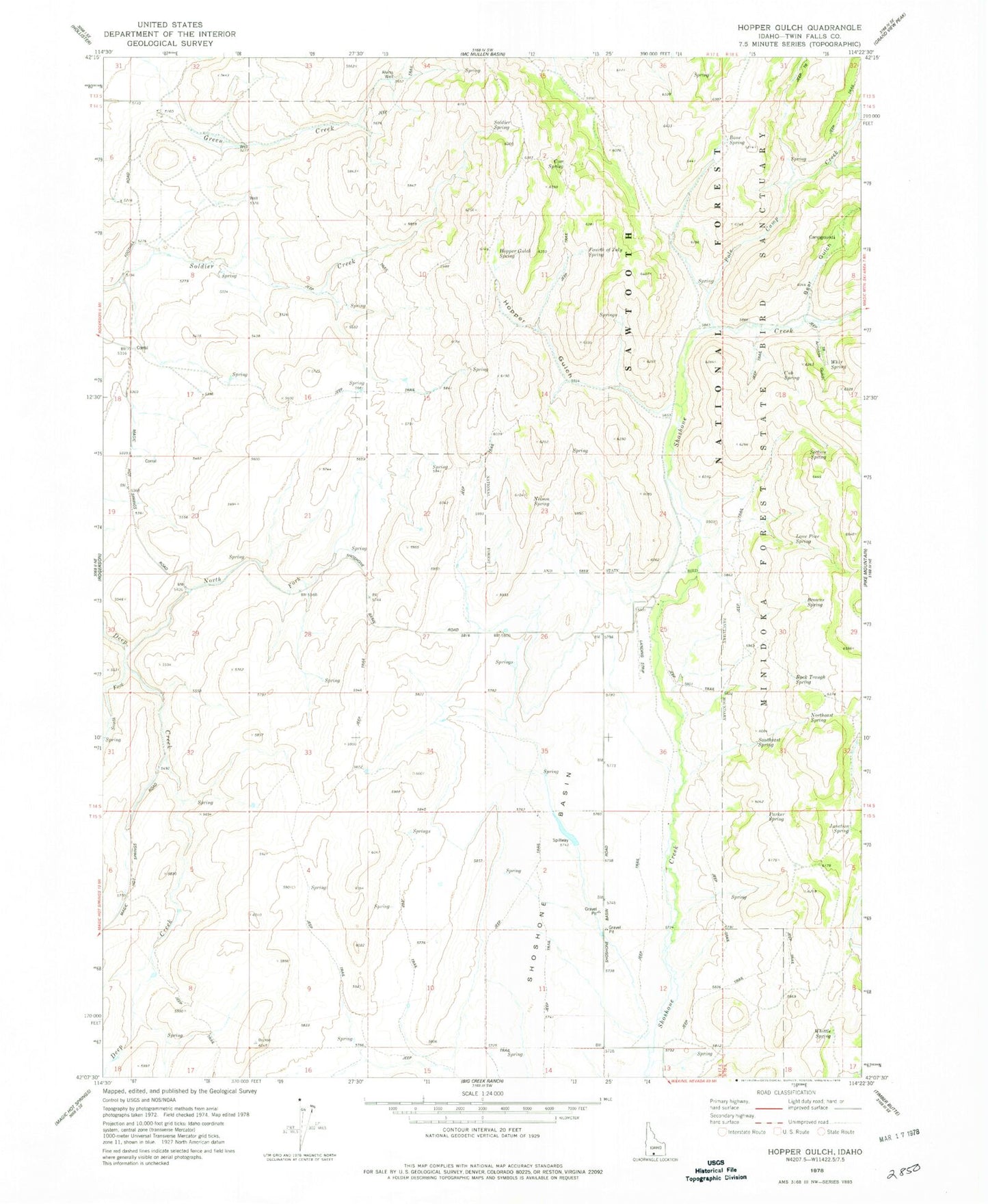
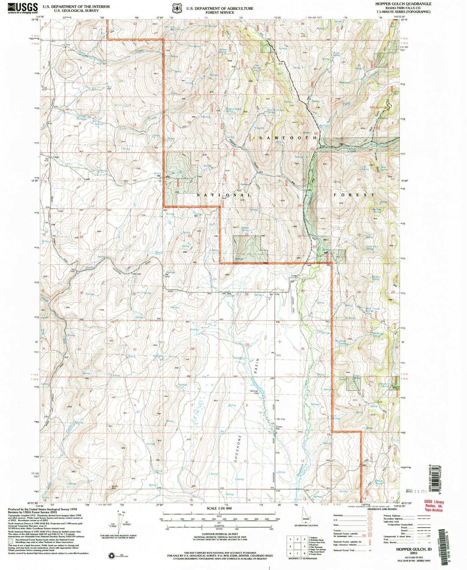
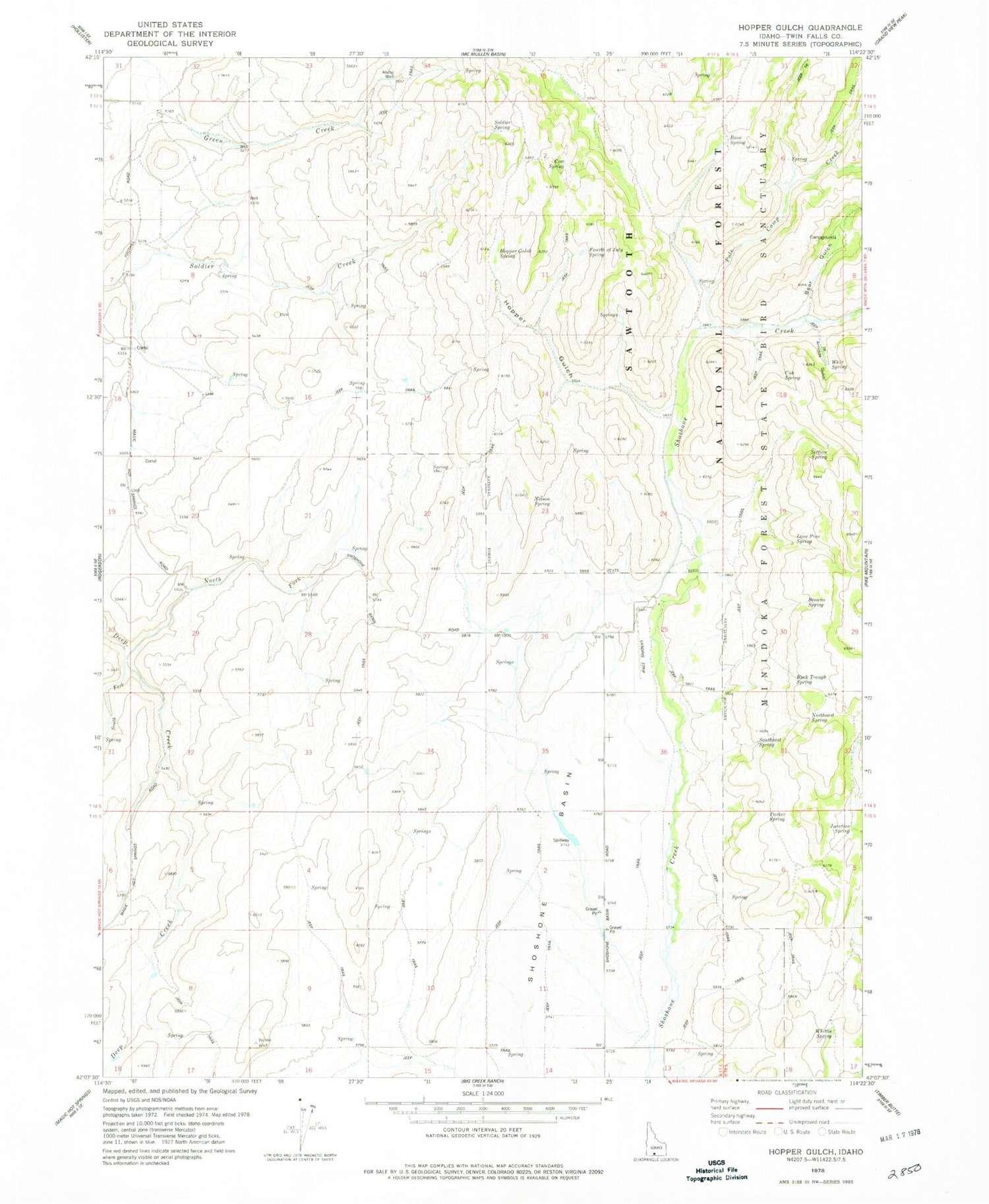
Historical USGS topographic quad map of Hopper Gulch in the state of Idaho. Map scale may vary for some years, but is generally around 1:24,000. Print size is approximately 24" x 27"
This quadrangle is in the following counties: Twin Falls.
The map contains contour lines, roads, rivers, towns, and lakes. Printed on high-quality waterproof paper with UV fade-resistant inks, and shipped rolled.
Contains the following named places: Alvins Well, Arnolds Gulch, Bear Gulch, Bear Gulch Campground, Bone Spring, Browns Spring, Buck Trough Spring, Cow Spring, Cub Spring, Fourth of July Spring, Hopper Gulch, Hopper Gulch Spring, Junction Spring, Lone Pine Spring, Nelson Spring, North Fork Deep Creek, Northeast Spring, Parker Spring, Pole Camp Creek, Section Spring, Soldier Spring, South Fork Deep Creek, Southeast Spring, Stratton Spring, Whir Spring, Whittle Spring