MyTopo
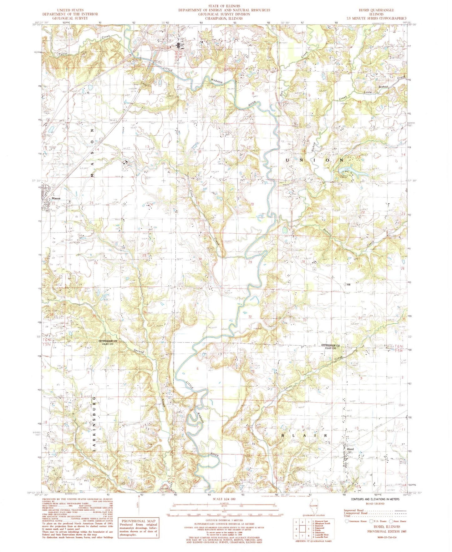
Classic USGS Hord Illinois 7.5'x7.5' Topo Map
Couldn't load pickup availability
Historical USGS topographic quad map of Hord in the state of Illinois. Map scale may vary for some years, but is generally around 1:24,000. Print size is approximately 24" x 27"
This quadrangle is in the following counties: Clay, Effingham.
The map contains contour lines, roads, rivers, towns, and lakes. Printed on high-quality waterproof paper with UV fade-resistant inks, and shipped rolled.
Contains the following named places: Bishop Creek, Coon Creek, Fender Cemetery, Flemingsburg, Fulfer Creek, Hill, Hord, Hull Cemetery, Lake Walter Scott, Leith Cemetery, Little Bishop Creek, Mason, Mason Post Office, Ramsey Creek, Ridge Cemetery, Salt Creek, Township of Union, Union Church, Union Town Hall, Walter Scott Lake Dam, Wright Cemetery