MyTopo
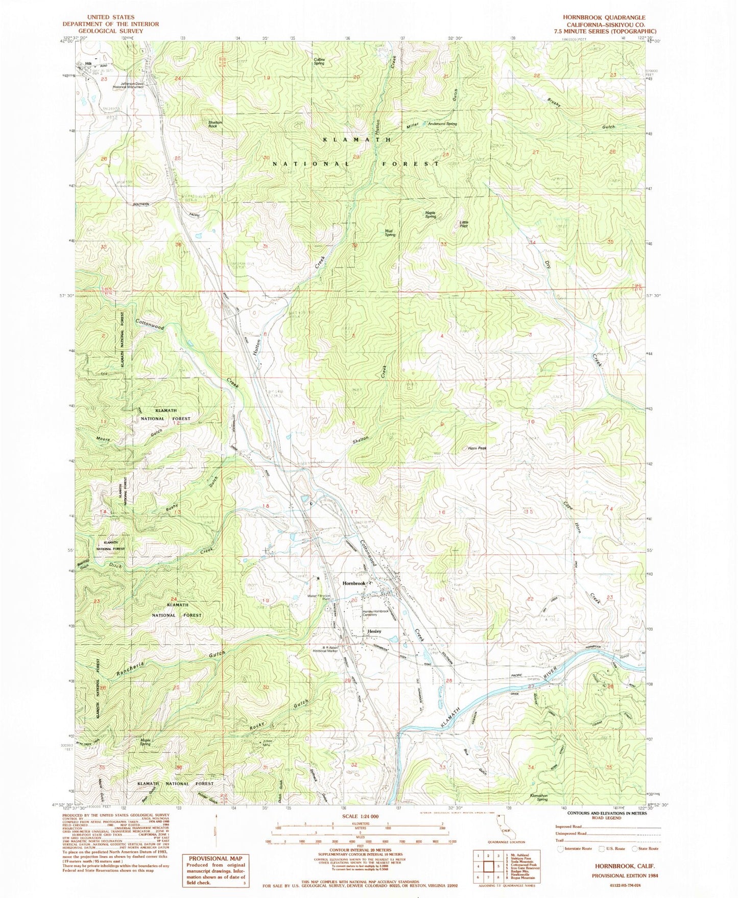
Classic USGS Hornbrook California 7.5'x7.5' Topo Map
Couldn't load pickup availability
Historical USGS topographic quad map of Hornbrook in the state of California. Map scale may vary for some years, but is generally around 1:24,000. Print size is approximately 24" x 27"
This quadrangle is in the following counties: Siskiyou.
The map contains contour lines, roads, rivers, towns, and lakes. Printed on high-quality waterproof paper with UV fade-resistant inks, and shipped rolled.
Contains the following named places: Alden Historical Marker, Andersons Spring, B R Alden Historical Marker, Bailey Hill, Beartrap Gulch, Blue Gulch, Bushy Gulch, California Department of Forestry and Fire Protection Hornbrook, Camp Lowe, Cape Horn Creek, Colestin Rural Fire District Station 2, Collins Spring, Cottonwood Creek, Ditch Creek, Hazel Mine, Henley, Henley and Hornbrook Cemetery, Hilt, Horn Peak, Hornbrook, Hornbrook Census Designated Place, Hornbrook Elementary School, Hornbrook Post Office, Hornbrook Volunteer Fire Station, Hutton Creek, Jefferson Davis Historical Monument, Jilson Mine, Klamathon, Klamathon Spring, Little Pilot, Maple Spring, McCavick Mine, Miller Gulch, Moore Gulch, Mud Spring, Olsen Mine, Osburger Gulch, Rancheria Gulch, Rocky Gulch, Shelton Creek, ZIP Code: 96044