MyTopo
Classic USGS Horner Mountain Arizona 7.5'x7.5' Topo Map
Couldn't load pickup availability
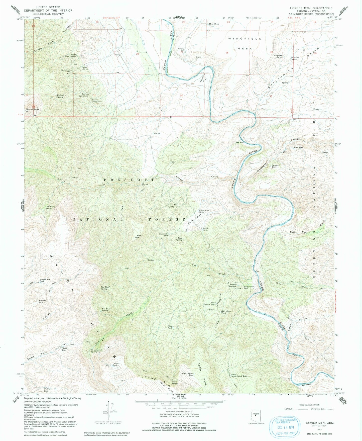
Historical USGS topographic quad map of Horner Mountain in the state of Arizona. Map scale may vary for some years, but is generally around 1:24,000. Print size is approximately 24" x 27"
This quadrangle is in the following counties: Yavapai.
The map contains contour lines, roads, rivers, towns, and lakes. Printed on high-quality waterproof paper with UV fade-resistant inks, and shipped rolled.
Contains the following named places: Amerone Spring Number One, Amerone Spring Number Two, Bear Grass Tank, Bear Grass Tank Number Two, Bear Spring, Beasley Flat, Beasley Flat Recreation Site, Billy Tank, Bootleg Tank, Boulder Tank, Brown Springs, Brown Springs Ranch, Bull Run Creek, Bull Run Rapid, Bushman Rapid, Cedar Bench, Cedar Bench Tank, Cedar Bench Wilderness, Cedar Spring, Chalk Tank, Chasm Corral, Chasm Creek, Cold Water Creek, Cold Water Trail, Cold Water Trail Number Twenty Seven, Cottonwood Basin, Cottonwood Creek, Cottonwood Spring, Dripping Spring, Esperanza Spring, Gap Creek, Goat Camp Spring, Gospel Hollow, Government Spring, Horner Mountain, Horner Mountain Tank, Jims Tank, Laddens Tank, Ladder Tank, Lithograph Spring, Lower Cedar Bench Corral, Lower Cedar Bench Tank, Lower Mine Spring, Mesa Tank, Mesquite Spring, Mine Spring, Monkey Tank, Mud Spring, North Mine Spring, Off-the-Wall Rapid, Ox Bow Trail Number One Hundred Sixty Three, Oxbow Tank, Pre-Falls Rapid, Punk Rock, Red Basin Spring, Red Blow Spring, Red Bluff Spring, Road Tank, Rodeo Flat, Rodeo Flat Spring, Rodeo Flat Tank, South Pasture Tank, Squaw Peak Mine, Sycamore Canyon, Sycamore Tank, Table Mountain, Table Mountain Spring, Table Mountain Tank, The Falls, Towel Creek, Turkey Gobbler Rapid, Verde Tank, Walnut Spring, White Flash Rapid