MyTopo
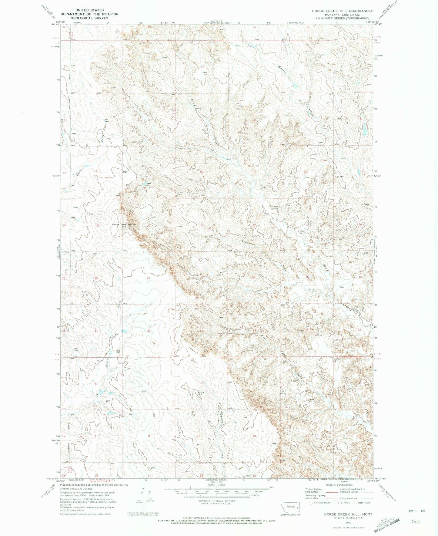
Classic USGS Horse Creek Hill Montana 7.5'x7.5' Topo Map
Couldn't load pickup availability
Historical USGS topographic quad map of Horse Creek Hill in the state of Montana. Map scale may vary for some years, but is generally around 1:24,000. Print size is approximately 24" x 27"
This quadrangle is in the following counties: Custer.
The map contains contour lines, roads, rivers, towns, and lakes. Printed on high-quality waterproof paper with UV fade-resistant inks, and shipped rolled.
Contains the following named places: 10N46E06DBCC01 Well, 10N46E06DBCC02 Well, 10N46E08CCCC01 Well, 11N46E07CBCB01 Well, 11N46E07CBCC01 Well, 11N46E07DBAB01 Well, 11N46E09BDBB01 Well, 11N46E17BABC01 Well, 11N46E19BBDB01 Well, 11N46E31CCBD01 Well, 11N46E31DDDB01 Well, 11N46E33CCAB01 Well, 22N46E21DC__10 Well, Cap Rock Number 1 Dam, Clevenger Spring, Hilcrest, Hillcrest Post Office, Horse Creek Hill, Meredith Post Office, Thompson Creek