MyTopo
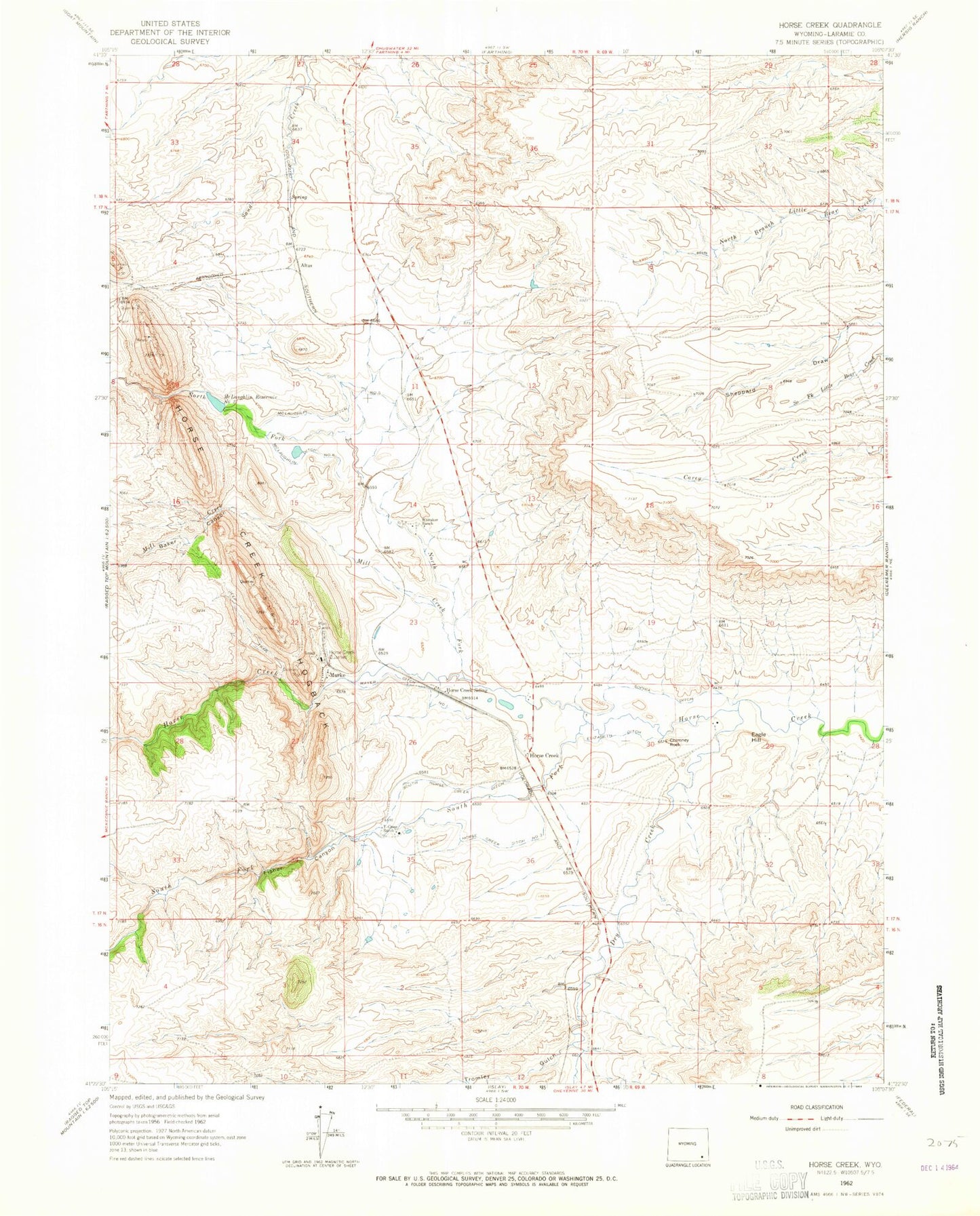
Classic USGS Horse Creek Wyoming 7.5'x7.5' Topo Map
Couldn't load pickup availability
Historical USGS topographic quad map of Horse Creek in the state of Wyoming. Map scale may vary for some years, but is generally around 1:24,000. Print size is approximately 24" x 27"
This quadrangle is in the following counties: Laramie.
The map contains contour lines, roads, rivers, towns, and lakes. Printed on high-quality waterproof paper with UV fade-resistant inks, and shipped rolled.
Contains the following named places: Altus, Baker Canyon, Chimney Rock, Dry Creek, Eagle Hill, Elizabeth Ditch, Fisher Canyon, Horse Creek, Horse Creek Ditch Number 3, Horse Creek Hogback, Horse Creek Post Office, Horse Creek Quarries, Horse Creek Quarry, Horse Creek Siding, Ingleside School, Laramie County Fire District 2 Horse Creek Station 3, Mayer Ditch, McLaughlin Ditch Number 5, McLaughlin Ditch Number 6, McLaughlin Number 2 Dam, McLaughlin Reservoir Number 2, Mill Creek, Murke, North Fork Horse Creek, Sophia Ditch, South Fork Horse Creek, South Horse Creek Ditch, Tromley Gulch, Whitaker Ranch, Y-Cross Ranch, ZIP Code: 82061