
MyTopo
Classic USGS Horse Gap North Carolina 7.5'x7.5' Topo Map
Couldn't load pickup availability
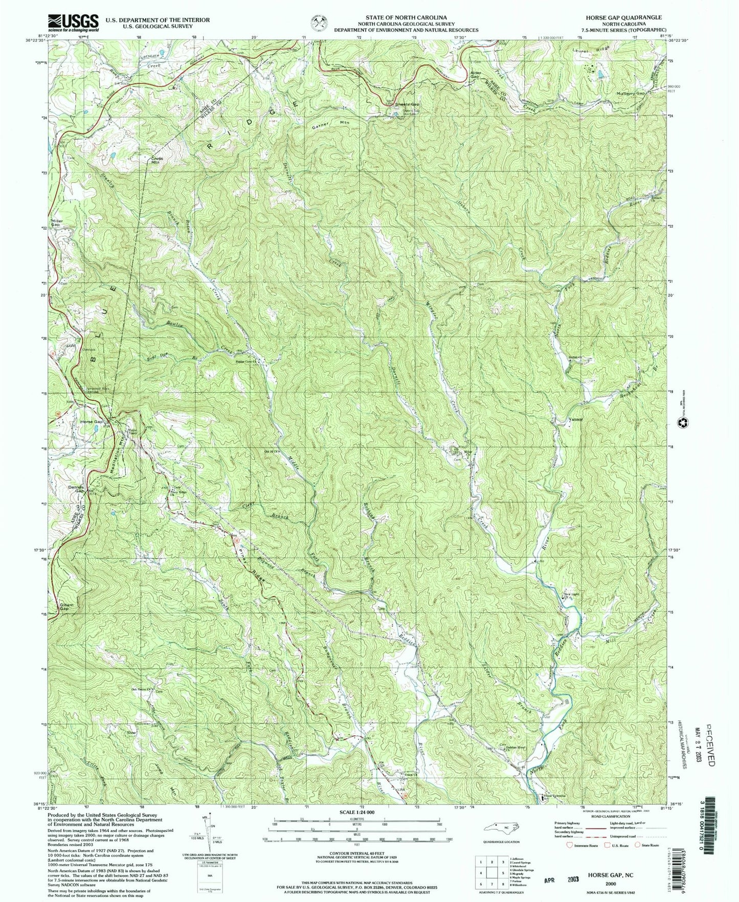
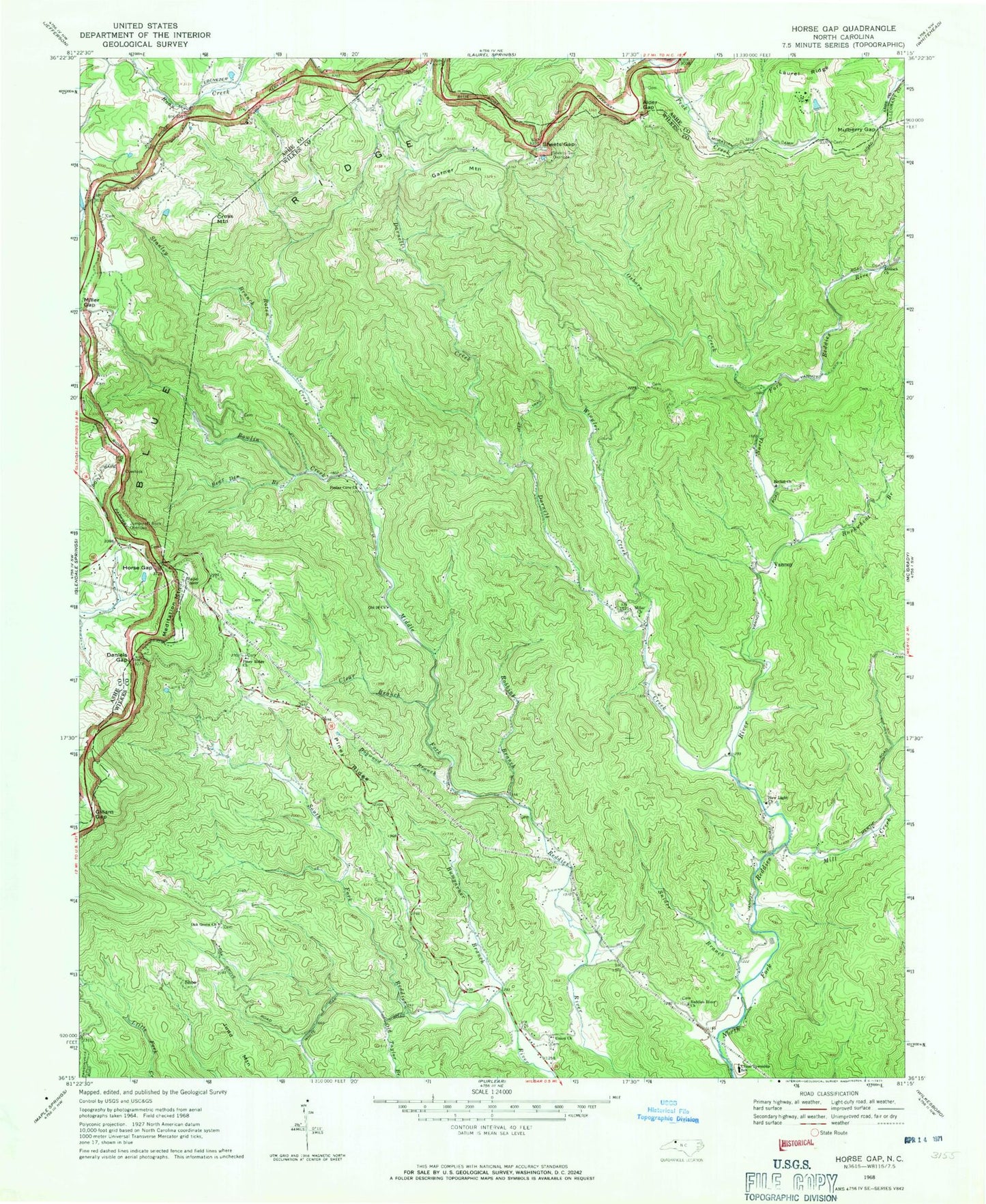
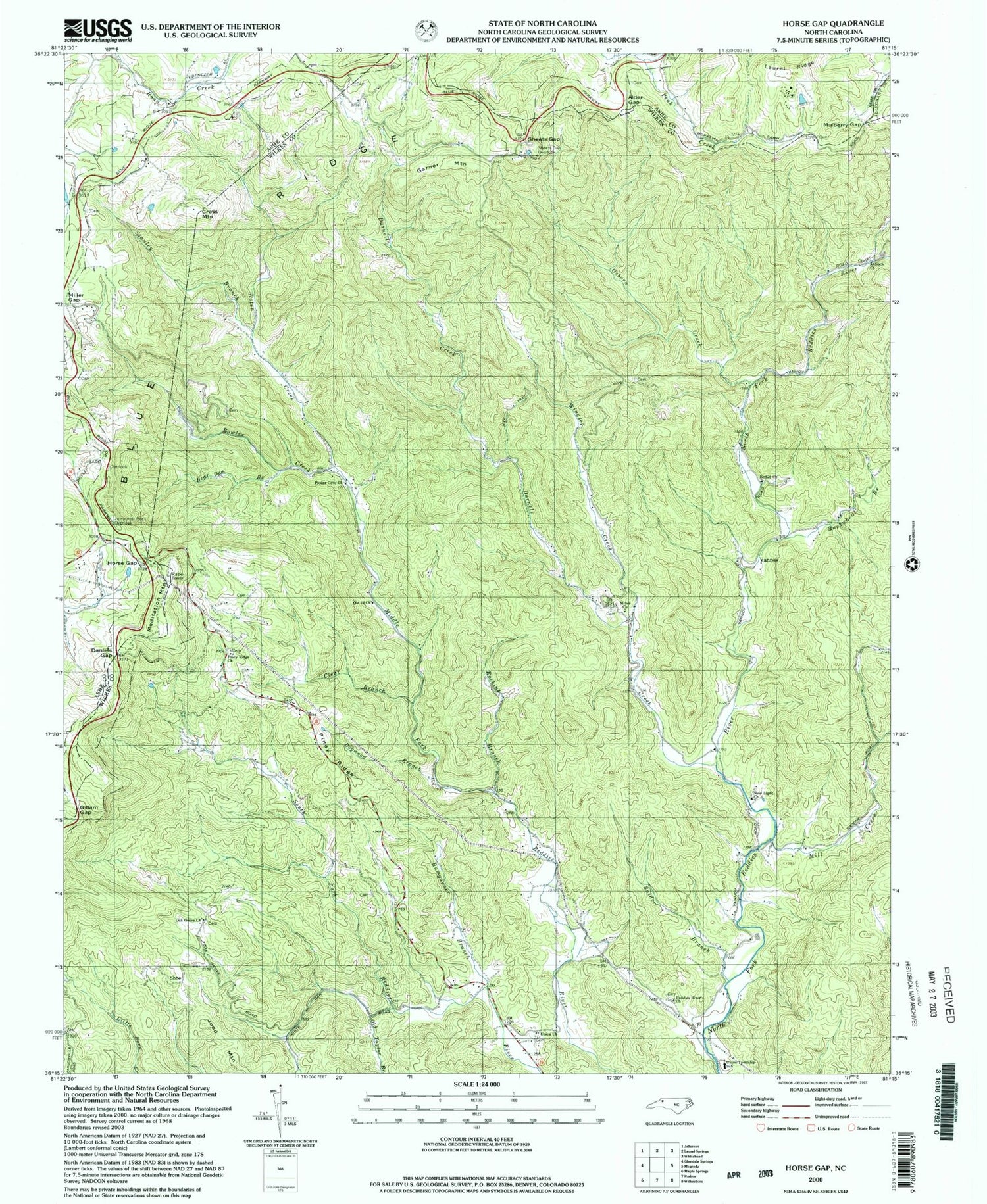
Historical USGS topographic quad map of Horse Gap in the state of North Carolina. Map scale may vary for some years, but is generally around 1:24,000. Print size is approximately 24" x 27"
This quadrangle is in the following counties: Alleghany, Ashe, Wilkes.
The map contains contour lines, roads, rivers, towns, and lakes. Printed on high-quality waterproof paper with UV fade-resistant inks, and shipped rolled.
Contains the following named places: Alder Gap, Antioch Church, Aren Beshears Dam, Bear Den Branch, Bethel Church, Bowlin Creek, Buckwheat Branch, Bumgarner Branch, Clear Branch, Cross Mountain, Daniels Gap, Darnell Creek, Daylo, Dogwood Branch, Garner Mountain, Gillam Gap, Horse Gap, Judd Mountain, Jumpinoff Rock Overlook, K O A Dam, Laurel Ridge, Lester, Meditation Mountain, Mill Creek, Miller Church, Miller Gap, Millers Store, Moravian Camp Lake, Moravian Camp Lake Dam, Mulberry Gap, New Light Church, Noname, Oak Grove Church, Old 16 Church, Old Taylor Branch, Osborn Creek, Piney Ridge, Piney Ridge Church, Poplar Cove Church, Reddies River Church, Robbins Branch, Roberts Store, Roten Creek, Royals Mill, Sheets Gap, Sheets Gap Overlook, Shepherds Store, Sherman, Shoe, Snider Branch, Stanley Branch, Township of Union, Union Church, Union Township School, Vannoy, Wilbar, Wilbar Volunteer Fire Department Main Station, Wilbar Volunteer Fire Department Substation, Wingler Creek, ZIP Codes: 28629, 28651