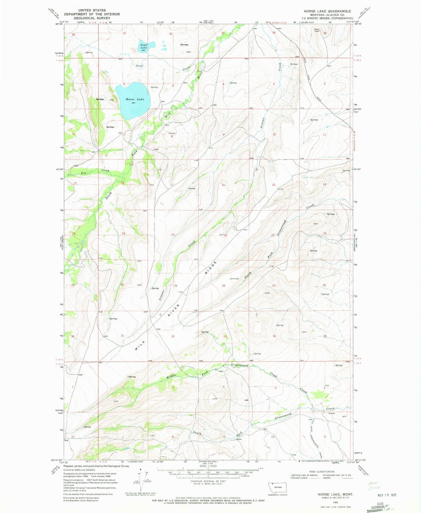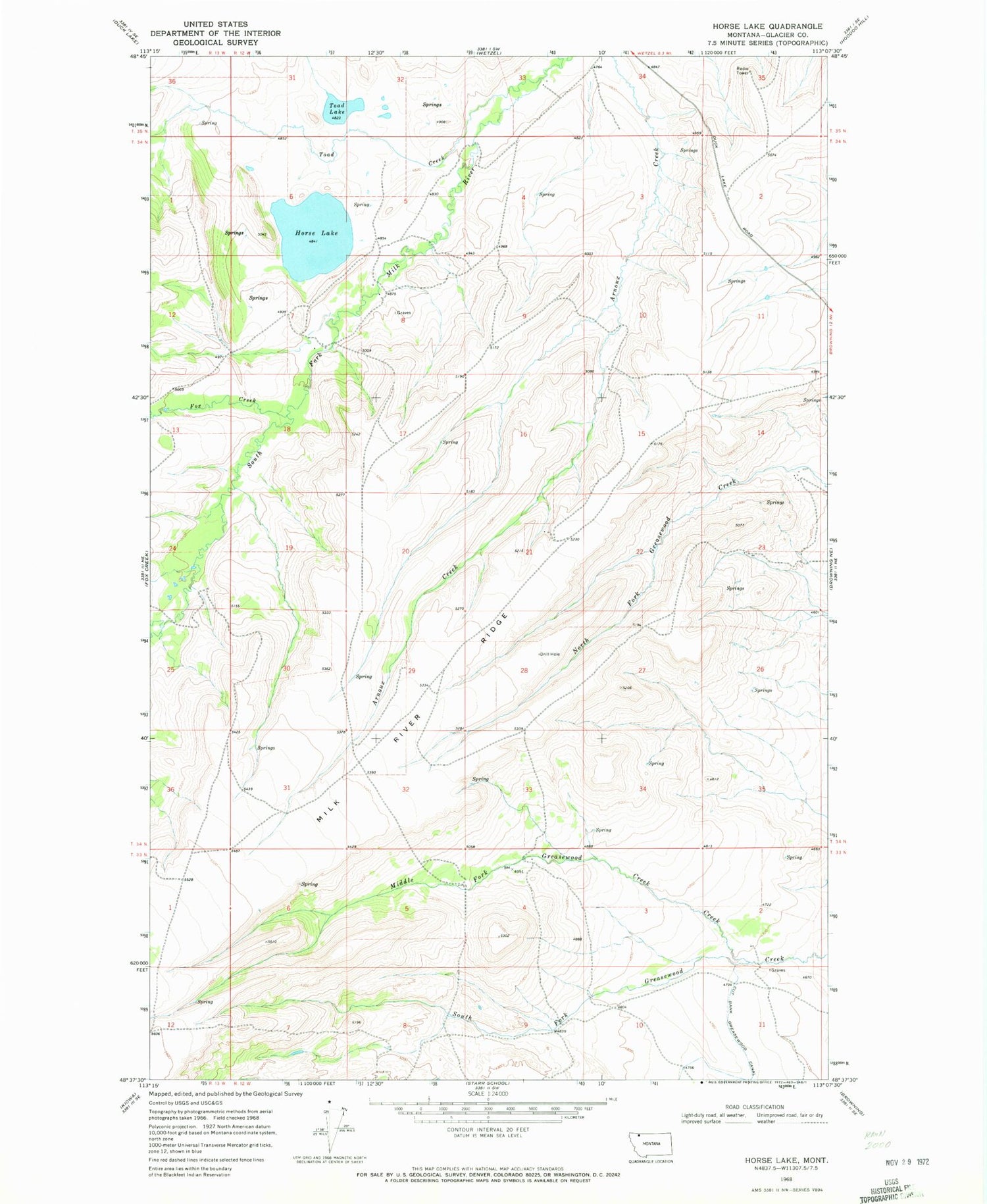
MyTopo
Classic USGS Horse Lake Montana 7.5'x7.5' Topo Map
Regular price
$16.95
Regular price
Sale price
$16.95
Unit price
per
Couldn't load pickup availability
Historical USGS topographic quad map of Horse Lake in the state of Montana. Map scale may vary for some years, but is generally around 1:24,000. Print size is approximately 24" x 27"
This quadrangle is in the following counties: Glacier.
The map contains contour lines, roads, rivers, towns, and lakes. Printed on high-quality waterproof paper with UV fade-resistant inks, and shipped rolled.
Contains the following named places: 34N12W15DABC01 Spring, 34N12W17DABB01 Spring, 34N12W28CBBA01 Spring, 59417, Cut Bank Greasewood Canal, Fox Creek, Horse Lake, Madman Coulee, Middle Fork Greasewood Creek, Toad Creek, Toad Lake