MyTopo
Classic USGS Horse Pasture Tank New Mexico 7.5'x7.5' Topo Map
Regular price
$16.95
Regular price
Sale price
$16.95
Unit price
per
Couldn't load pickup availability
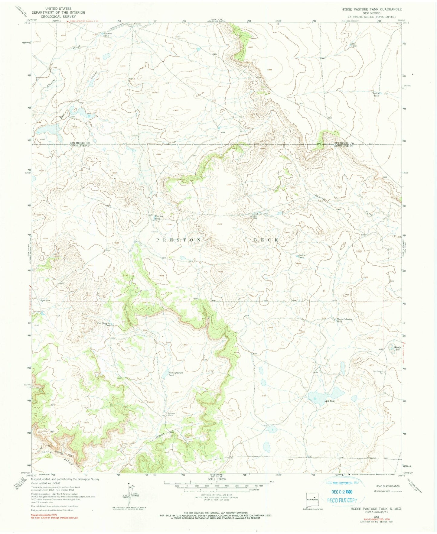
Historical USGS topographic quad map of Horse Pasture Tank in the state of New Mexico. Map scale may vary for some years, but is generally around 1:24,000. Print size is approximately 24" x 27"
This quadrangle is in the following counties: Guadalupe, San Miguel.
The map contains contour lines, roads, rivers, towns, and lakes. Printed on high-quality waterproof paper with UV fade-resistant inks, and shipped rolled.
Contains the following named places: Alamito Camp, Alamito Tank, Bell Tank, Boggie Windmill, Chalky Tank, Colonias Camp, Cowden, Eversaw Tank, Four Corners Pen, Gold Prospect, Horse Pasture Tank, North Colonias Tank, Payne Ranch, Red Lake, Red Lakes, West Colonias Tank, Woody Tank