MyTopo
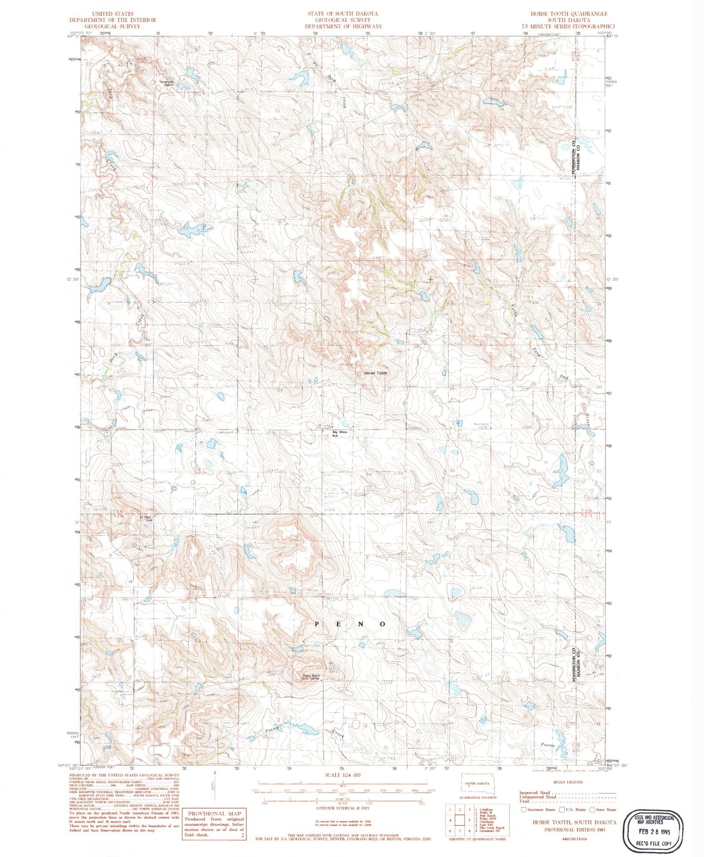
Classic USGS Horse Tooth South Dakota 7.5'x7.5' Topo Map
Couldn't load pickup availability
Historical USGS topographic quad map of Horse Tooth in the state of South Dakota. Map scale may vary for some years, but is generally around 1:24,000. Print size is approximately 24" x 27"
This quadrangle is in the following counties: Haakon, Pennington.
The map contains contour lines, roads, rivers, towns, and lakes. Printed on high-quality waterproof paper with UV fade-resistant inks, and shipped rolled.
Contains the following named places: Big White Elementary School, Harold Severson Dam, Horse Tooth, Jerry Willuweit Dam, Kirk Cordes Dam, Kirk Cordes Number 10 Reservoir, Kirk Cordes Number 20 Reservoir, Kirk Cordes Number 40 Reservoir, Peno Basin Civic Center, Saint Paul's Lutheran Cemetery, Severson Ranch, Willuweit Dam Number 10 Reservoir