MyTopo
Classic USGS Horsefly Mountain Oregon 7.5'x7.5' Topo Map
Couldn't load pickup availability
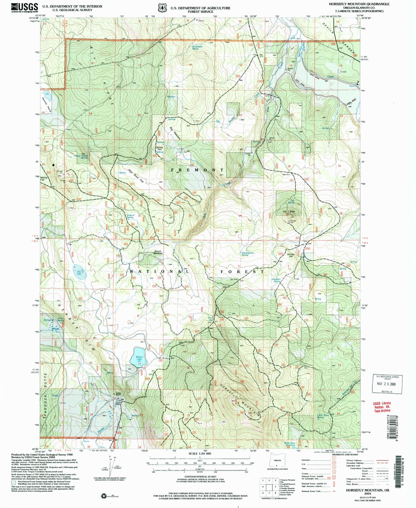
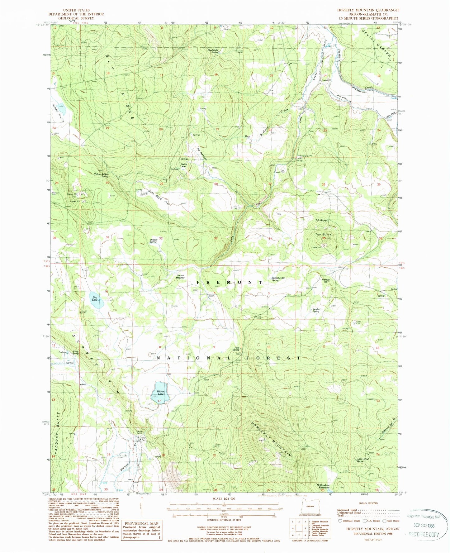
Historical USGS topographic quad map of Horsefly Mountain in the state of Oregon. Map scale may vary for some years, but is generally around 1:24,000. Print size is approximately 24" x 27"
This quadrangle is in the following counties: Klamath.
The map contains contour lines, roads, rivers, towns, and lakes. Printed on high-quality waterproof paper with UV fade-resistant inks, and shipped rolled.
Contains the following named places: Big Meadow, Driscoll Spring, Dry Boulder Creek, Dry Lake, Gerber Ranch, Gerber Spring, Gooch Meadow, Hamaker Spring, Horsefly Mountain, Horsefly Mountain Lookout, Horsefly Valley, Langell Valley Division, Little Blind Spring, McKendree Reservoir, Olete Post Office, Otto Boye Flat, Penney Hill, Pine Spring, Pole Creek, Privy Spring, Sheepherder Spring, Skedaddle Spring, Spring Flat, Tub Butte, Tub Spring, Wilson Lake, Wilson Lake Dam, Yellow Jacket Spring