MyTopo
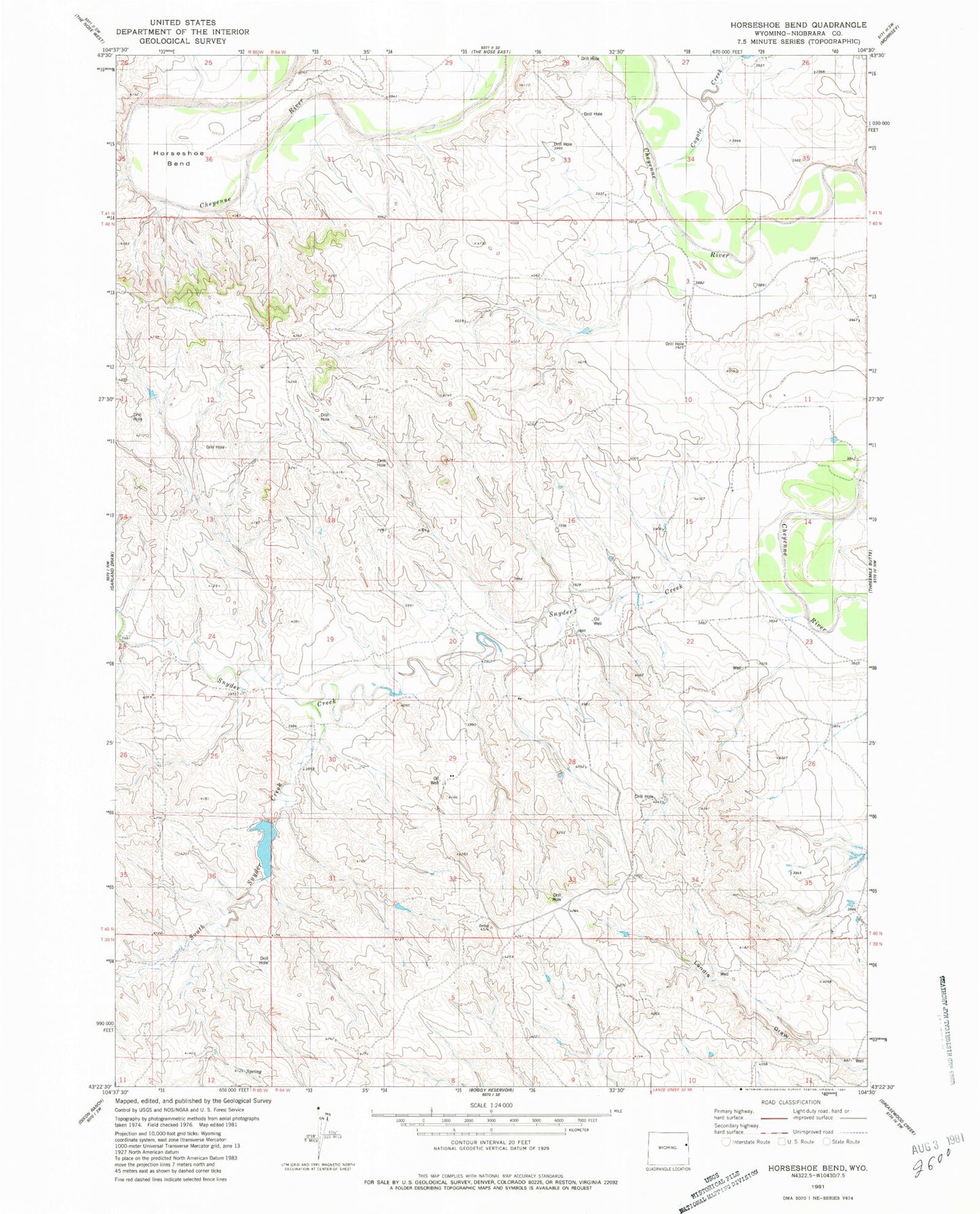
Classic USGS Horseshoe Bend Wyoming 7.5'x7.5' Topo Map
Regular price
$16.95
Regular price
Sale price
$16.95
Unit price
per
Couldn't load pickup availability
Historical USGS topographic quad map of Horseshoe Bend in the state of Wyoming. Map scale may vary for some years, but is generally around 1:24,000. Print size is approximately 24" x 27"
This quadrangle is in the following counties: Niobrara.
The map contains contour lines, roads, rivers, towns, and lakes. Printed on high-quality waterproof paper with UV fade-resistant inks, and shipped rolled.
Contains the following named places: Bob Dixon Number 1 Reservoir, Bob Dixon Number 1 Reservoir Dam, Coyote Creek, Gaskill Dam, Gaskill Reservoir, Horse Shoe Bend, Snyder Creek, South Snyder Creek, Zerbst Dam, Zerbst Reservoir