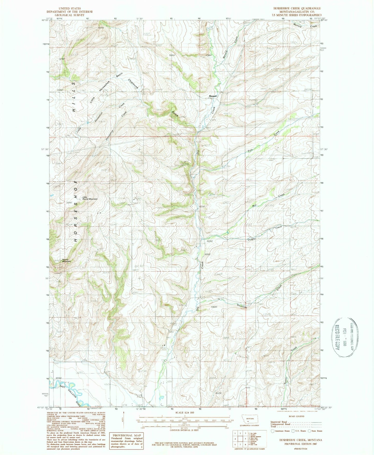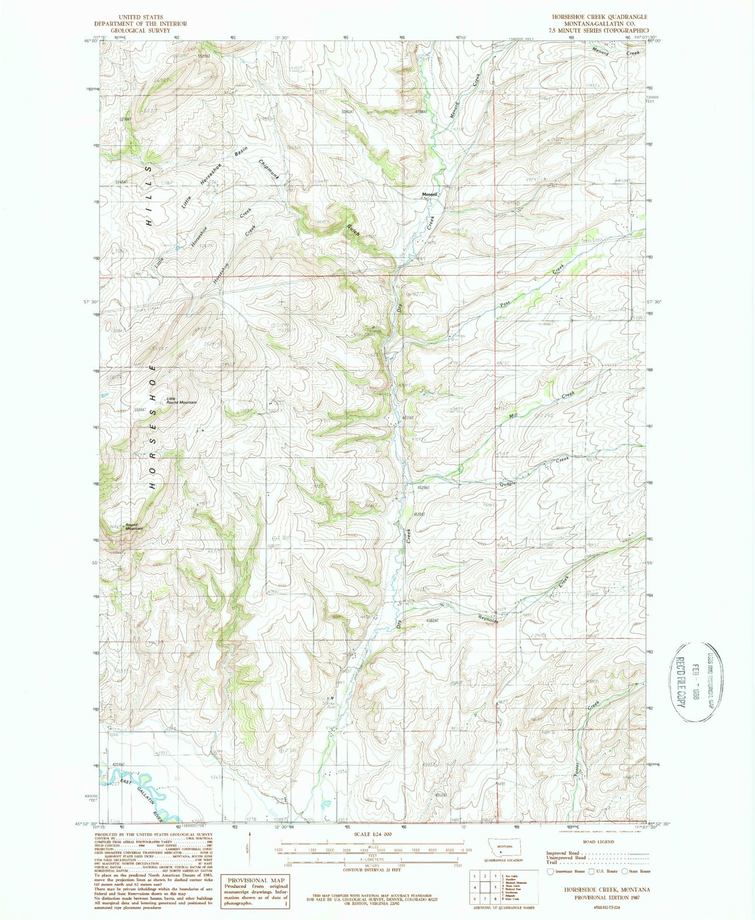
MyTopo
Classic USGS Horseshoe Creek Montana 7.5'x7.5' Topo Map
Couldn't load pickup availability
Historical USGS topographic quad map of Horseshoe Creek in the state of Montana. Map scale may vary for some years, but is generally around 1:24,000. Print size is approximately 24" x 27"
This quadrangle is in the following counties: Gallatin.
The map contains contour lines, roads, rivers, towns, and lakes. Printed on high-quality waterproof paper with UV fade-resistant inks, and shipped rolled.
Contains the following named places: 02N04E02DDDB01 Well, 02N04E12CC__01 Well, 02N04E23DA__01 Well, 02N04E23DB__01 Well, 02N04E23DBDD01 Well, 02N04E24BB__01 Well, 02N04E24DD__01 Well, 02N04E26BA__01 Well, 02N04E26BA__02 Well, 02N04E28CC__01 Well, 02N04E29DD__01 Well, 02N04E33BC__01 Well, 02N04E33CA__01 Well, 02N04E35BDCC01 Well, 02N04E36CC__01 Well, 02N05E06AC__01 Well, 02N05E06AC__02 Well, 02N05E06ADDA01 Well, 02N05E08BC__01 Well, 02N05E18ABBB01 Well, 02N05E18BA__01 Well, 02N05E18BC__01 Well, 02N05E30BB__01 Well, 02N05E31DAAA01 Well, 02N05E31DAAA02 Well, 03N04E36BB__01 Well, 59714, Accola, Chipmunk Gulch, Dry Creek Cemetery, Edilou, Fly Cemetery, Hillman, Hillsdale Post Office, Horseshoe Creek, Little Horseshoe Basin, Little Horseshoe Creek, Little Round Mountain, McCrea Ranch, Meadowlark School, Menard, Menard Creek, Menard Post Office, Menard School, Menard Wye, Mill Creek, Pass Creek, Quagle Creek, Reynolds Creek, Round Mountain, Spaulding Bridge, Sunnyside School, Valley View School