MyTopo
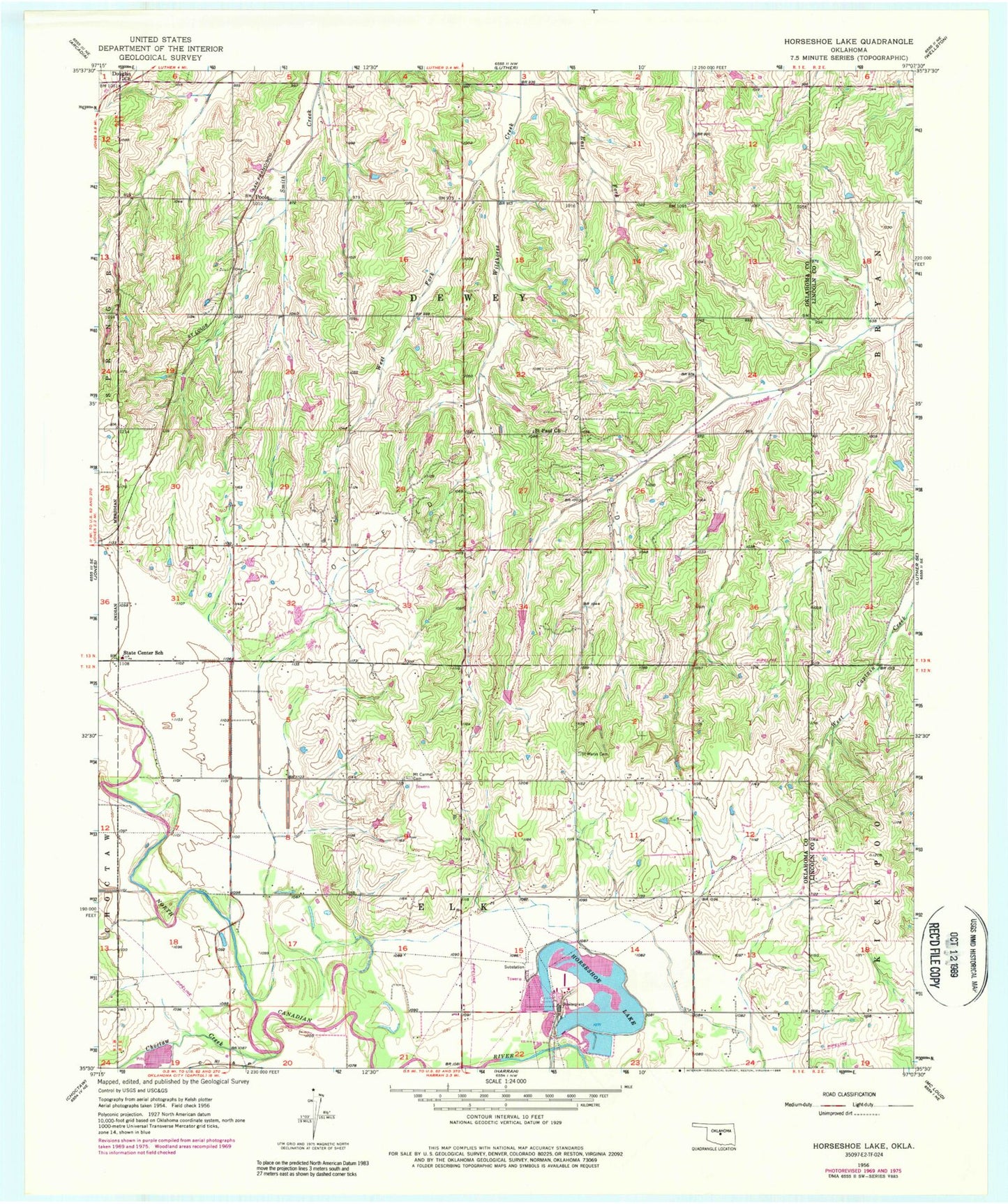
Classic USGS Horseshoe Lake Oklahoma 7.5'x7.5' Topo Map
Couldn't load pickup availability
Historical USGS topographic quad map of Horseshoe Lake in the state of Oklahoma. Map scale may vary for some years, but is generally around 1:24,000. Print size is approximately 24" x 27"
This quadrangle is in the following counties: Lincoln, Oklahoma.
The map contains contour lines, roads, rivers, towns, and lakes. Printed on high-quality waterproof paper with UV fade-resistant inks, and shipped rolled.
Contains the following named places: Booher Dam, Booher Lake, Choctaw Creek, Douglas Church, East Fork Wildhorse Creek, Hickory Hills Volunteer Fire Department, Horseshoe Lake, Jones Middle School, Mills Cemetery, Mission Field, Oklahoma Academy, Poole, Saint Mary Cemetery, Saint Paul Baptist Cemetery, Saint Paul Church, Summit Ridge Cemetery, Township of Dewey, Township of Elk, West Fork Wildhorse Creek, Wolf Ridge Dam, Wolf Ridge Lake, ZIP Code: 73045