MyTopo
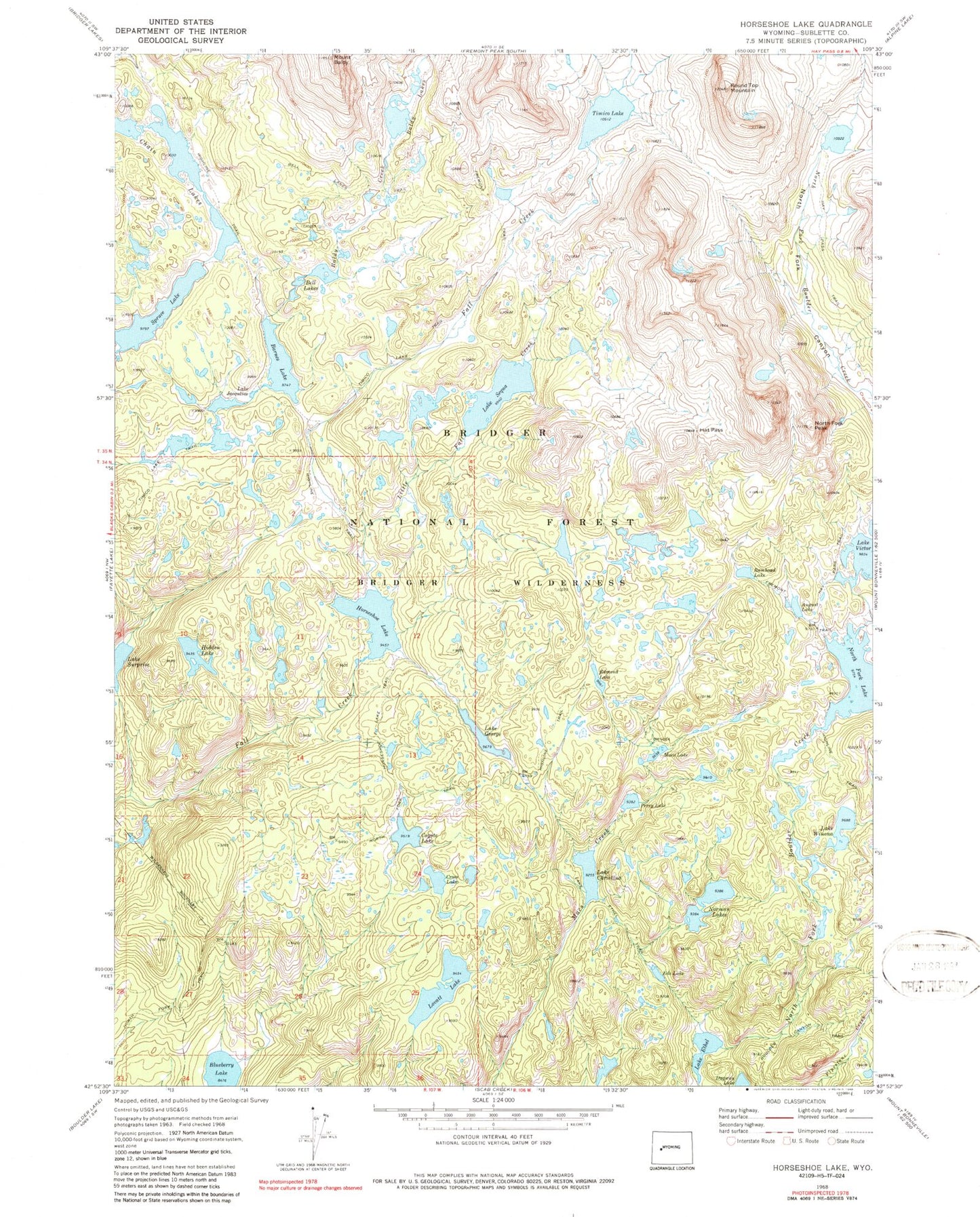
USGS Classic Horseshoe Lake Wyoming 7.5'x7.5' Topo Map
Couldn't load pickup availability
Historical USGS topographic quad map of Horseshoe Lake in the state of Wyoming. Scale: 1:24000. Print size: 24" x 27"
This quadrangle is in the following counties: Sublette.
The map contains contour lines, roads, rivers, towns, lakes, and grids including latitude / longitude and UTM / MGRS. Printed on high-quality waterproof paper with UV fade-resistant inks.
Contains the following named places: August Lake, Baldy Lakes, Mount Baldy, Barnes Lake, Bell Lakes, Bell Lakes Trail, Blueberry Lake, Chris Lake, Coyote Lake, Cross Lake, Dugway Lake, Edmond Lake, Eds Lake, Lake Ethel, Lake George, Hat Pass, Hay Pass Trail, Hidden Lake, Horseshoe Lake, Horseshoe Lake Trail, Lake Jacquline, Lake Ethel Trail, Little Fall Creek, Lovatt Lake, Macs Lake, Norman Lakes, North Fork Canyon, North Fork Lake, North Fork Peak, Perry Lake, Rambaud Lake, Round Top Mountain, Lake Sequa, Spruce Lake, Timico Lake, Timico Lake Trail, Wind River Range, Lake Winona, Baldy Lake Trail, Ruff Lake Trail, Bridger Wilderness, The Ruin, Chain Lakes