MyTopo
Classic USGS Horseshoe Mountain Arkansas 7.5'x7.5' Topo Map
Couldn't load pickup availability
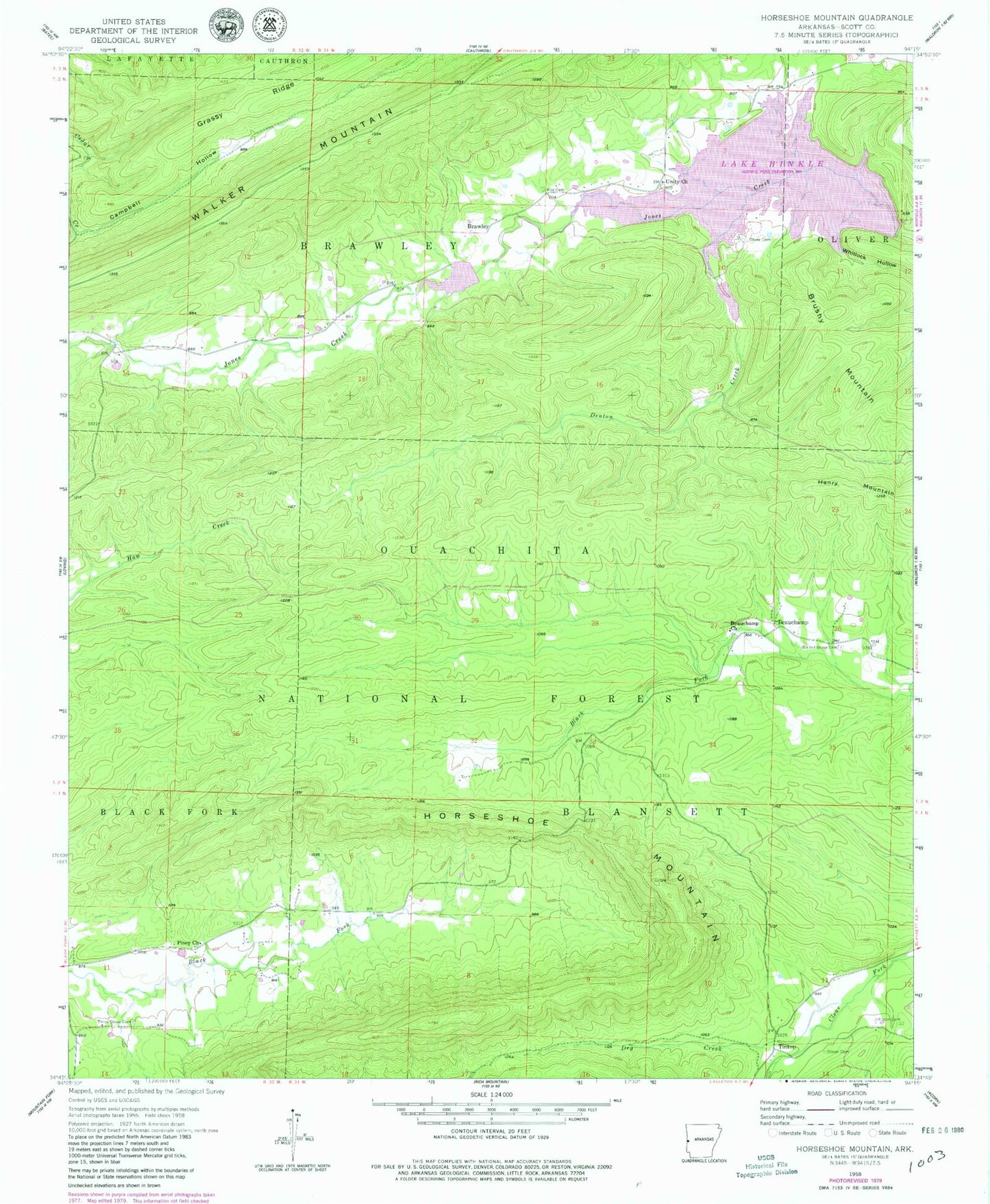
Historical USGS topographic quad map of Horseshoe Mountain in the state of Arkansas. Map scale may vary for some years, but is generally around 1:24,000. Print size is approximately 24" x 27"
This quadrangle is in the following counties: Scott.
The map contains contour lines, roads, rivers, towns, and lakes. Printed on high-quality waterproof paper with UV fade-resistant inks, and shipped rolled.
Contains the following named places: Arkansas Noname 163 Dam, Beauchamp, Beauchamp Church, Brawley, Campbell Hollow, Denton Creek, Dry Creek, Grassy Ridge, Horseshoe Mountain, Lake Hinkle, Lake Hinkle Fire Station, Little Pines Recreation Site, Multiple-Purpose Structure Number 15 Dam, Oliver Cemetery, Piney Church, Piney Grove Cemetery, Poteau River Site 11 Dam, Poteau River Site 13 Lake, Poteau River Watershed Site 11 Dam, Poteau River Watershed Site 12 Reservoir, Poteau River Watershed Site 13 Dam, Sensation, Slover Cemetery, Terrapin Creek, Tintop, Township of Brawley, Unity Church, Vise Cemetery, Walnut Grove Cemetery, Whitlock Hollow