
MyTopo
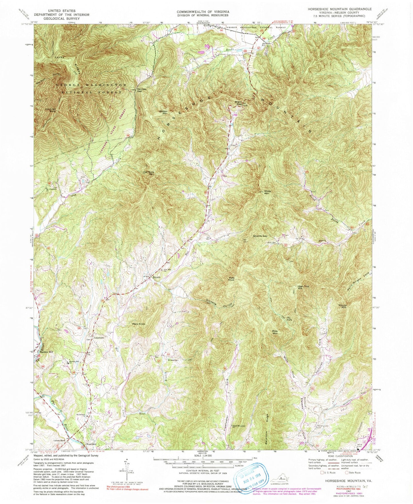
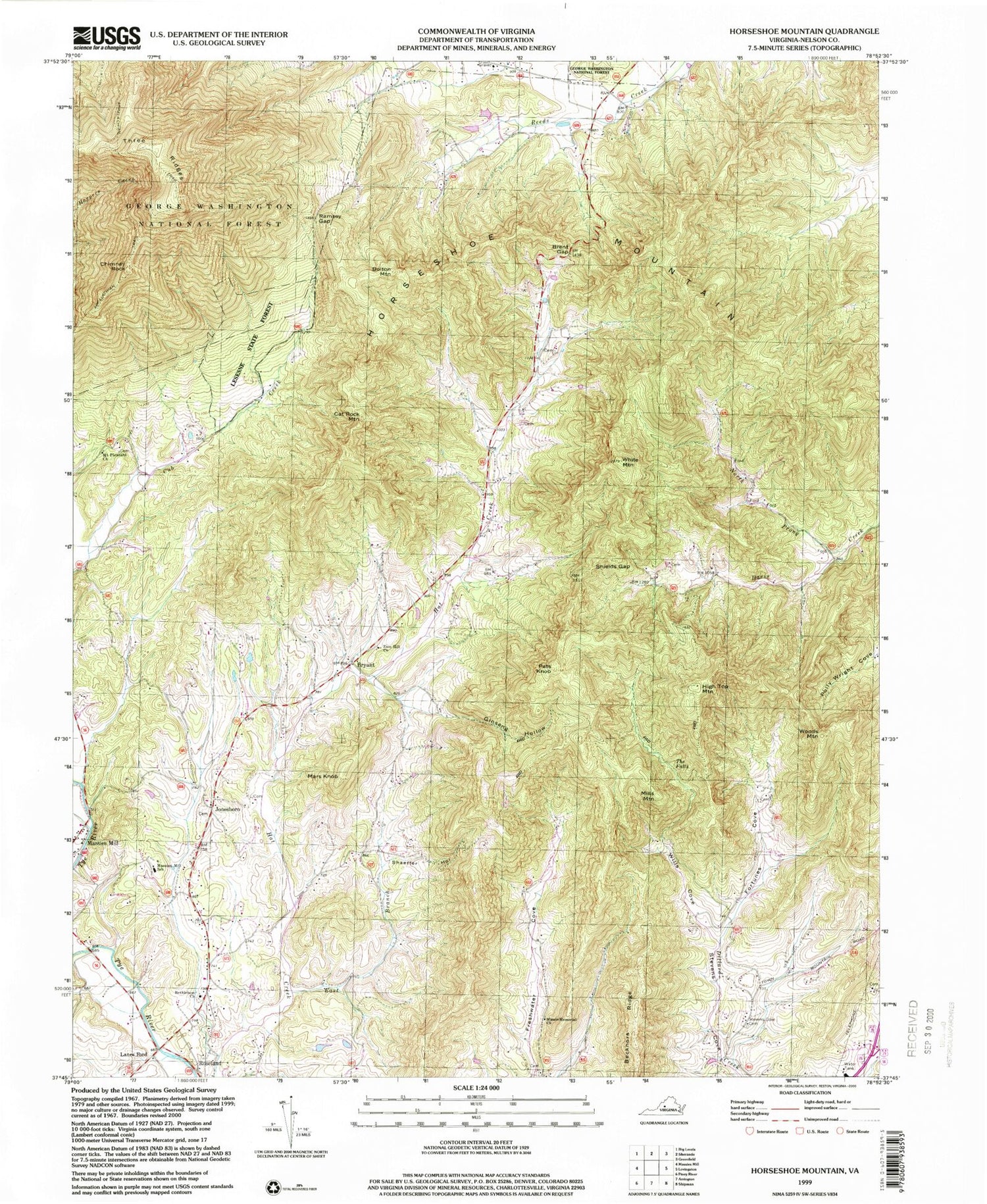
Classic USGS Horseshoe Mountain Virginia 7.5'x7.5' Topo Map
Couldn't load pickup availability
Historical USGS topographic quad map of Horseshoe Mountain in the state of Virginia. Typical map scale is 1:24,000, but may vary for certain years, if available. Print size: 24" x 27"
This quadrangle is in the following counties: Nelson.
The map contains contour lines, roads, rivers, towns, and lakes. Printed on high-quality waterproof paper with UV fade-resistant inks, and shipped rolled.
Contains the following named places: Becknors Ridge, Bethlehem Church, Bolton Mountain, Brent Gap, Bryant, Cat Rock Mountain, Chimney Rock, Cow Hollow, East Branch Hat Creek, Fortunes Cove, Ginseng Hollow, Horseshoe Mountain, Lanes Ford, Mars Knob, Massie Memorial Church, Fleetwood-Massies Mill Elementary School, Mill Dam Creek, Mount Pleasant Church, North Prong Davis Creek, Pats Knob, Ramsey Gap, Shaeffer Hollow, Zion Hill Church, Shields Gap, Stevens Cove Cemetery, The Falls, Three Ridges, White Mountain, Wills Cove, Woods Mountain, Ramsey, Lesesne State Forest, Harpers Creek Shelter, High Top Mountain, Jonesboro, Mills Mountain, Stevens Helicopters Heliport, Roseland Rescue Squad Heliport, Beech Grove Christian Church, Bethlehem Cemetery, Freshwater, Jonesboro Baptist Church, Jonesboro Cemetery, Lovingston Elementary School, Massies Mill Presbyterian Church, Nelson County, Stevens Cove Church (historical), Wintergreen School (historical), Three Ridges Wilderness, Roseland Rescue Squad, Roseland Post Office