
MyTopo
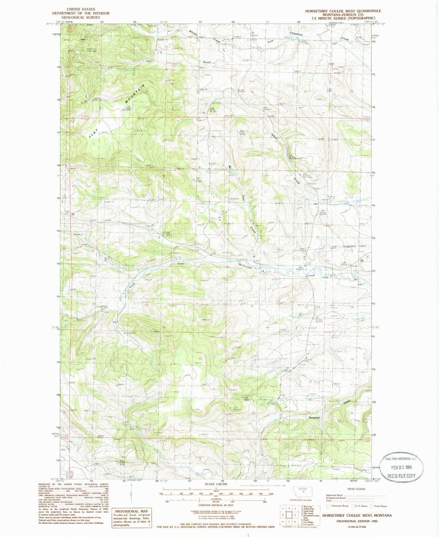
Classic USGS Horsethief Coulee West Montana 7.5'x7.5' Topo Map
Couldn't load pickup availability
Historical USGS topographic quad map of Horsethief Coulee West in the state of Montana. Map scale may vary for some years, but is generally around 1:24,000. Print size is approximately 24" x 27"
This quadrangle is in the following counties: Fergus.
The map contains contour lines, roads, rivers, towns, and lakes. Printed on high-quality waterproof paper with UV fade-resistant inks, and shipped rolled.
Contains the following named places: 15N19E12DA__01 Well, 15N20E03CCCB01 Well, 15N20E09ABDA01 Well, 15N20E09ADCB01 Well, 15N20E14CAAA01 Well, Big Six Mine, Cheadle, Cheadle Post Office, Cheadle School, Flat Mountain, Nelson, Parr Creek, Skaggs, Skaggs School, Whiskey Gulch Mine, Whisky Creek, Whisky Gulch, Whisky Gulch Mine


