MyTopo
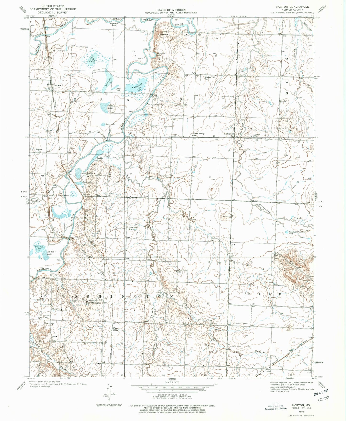
Classic USGS Horton Missouri 7.5'x7.5' Topo Map
Couldn't load pickup availability
Historical USGS topographic quad map of Horton in the state of Missouri. Map scale may vary for some years, but is generally around 1:24,000. Print size is approximately 24" x 27"
This quadrangle is in the following counties: Vernon.
The map contains contour lines, roads, rivers, towns, and lakes. Printed on high-quality waterproof paper with UV fade-resistant inks, and shipped rolled.
Contains the following named places: Antioch Cemetery, Antioch Church, Berea Cemetery, Berea Church, Burr Lake, Cephas Ford Public Access, Compton Junction, Compton Junction Fire Department, Cottonwood Branch, Cottonwood Lake, Douglas Branch, East Fork Bee Branch, East Washington School, Elks Lake, Ellis Cemetery, Green Valley School, Horseshoe Lake, Horton, Horton School, Hubler Lake, Humble School, Irrigation Lake, Ketterman, Lone Star School, Long Lake, Long Lower Lake Dam, Long Upper Lake Dam, Marmaton River, Marshall Cummins Pond, McDowell Lake, Mound Cemetery, New Pence Lake, Old Pence Lake, Old Town Branch, Spile Lake, Stearns Lake, Timber Hill, Timber Hill Church, Timber Hill River Bend Incorporated Dam, Timber Hill School, Township of Osage, Township of Washington, Wales Siding, West Point School