MyTopo
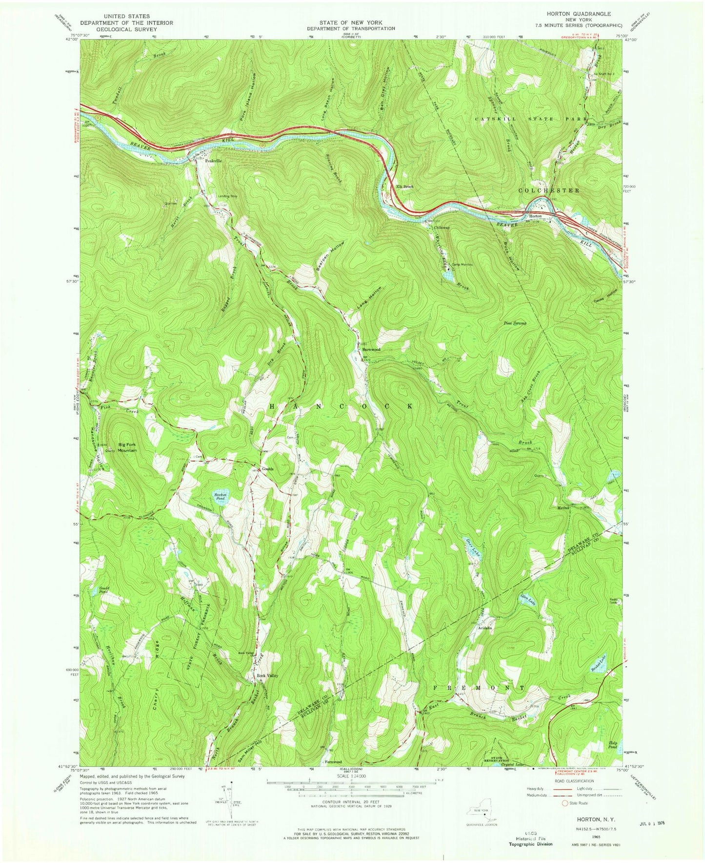
Classic USGS Horton New York 7.5'x7.5' Topo Map
Couldn't load pickup availability
Historical USGS topographic quad map of Horton in the state of New York. Typical map scale is 1:24,000, but may vary for certain years, if available. Print size: 24" x 27"
This quadrangle is in the following counties: Delaware, Sullivan.
The map contains contour lines, roads, rivers, towns, and lakes. Printed on high-quality waterproof paper with UV fade-resistant inks, and shipped rolled.
Contains the following named places: Air Shaft Number 3, Ash Clove Brook, Basket Lake, Basket Pond, Bearpen Hollow, Ben Gray Hollow, Big Fork Mountain, Buck Hollow, Camp Manitou, Cherry Ridge, Crystal Brook, Deer Lake, Dry Brook, Dry Brook, Glen Lake, Gould Pond, Handsome Hollow, Hoffman Brook, Horse Brook, Horton Brook, Knowles Brook, Lang Hollow, Long Beach Hollow, Peakville, Pine Swamp, Ragged Brook, Roaring Brook, Rock Valley, Rock Valley Church, Spooner Brook, Trout Brook, Pork Island Hollow, Twadell Brook, Whirling Eddy Brook, Acidalia, Burnwood, Chiloway, Elk Brook, Goulds, Horton, Methol, Campbell Covered Bridge, Lower Shavertown Bridge, Rickard Cemetery, Gould Cemetery, Horton Cemetery, Rock Valley Cemetery, Andersens Maple Farm