MyTopo
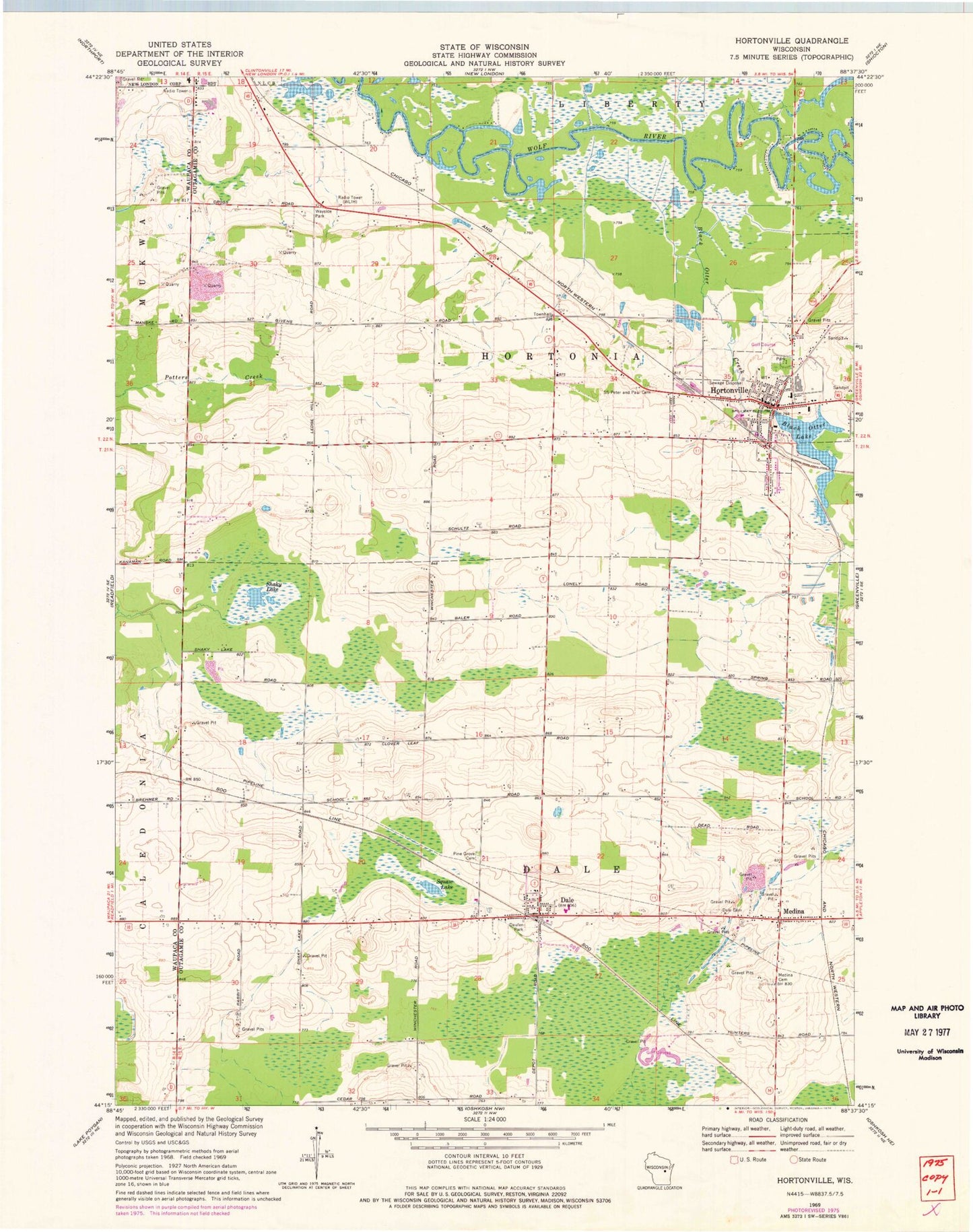
Classic USGS Hortonville Wisconsin 7.5'x7.5' Topo Map
Couldn't load pickup availability
Historical USGS topographic quad map of Hortonville in the state of Wisconsin. Map scale may vary for some years, but is generally around 1:24,000. Print size is approximately 24" x 27"
This quadrangle is in the following counties: Outagamie, Waupaca.
The map contains contour lines, roads, rivers, towns, and lakes. Printed on high-quality waterproof paper with UV fade-resistant inks, and shipped rolled.
Contains the following named places: Bethlehem Evangelical Lutheran School, Black Creek Limestone Quarry, Black Otter Airport, Black Otter Creek, Black Otter Lake, Cloverleaf School, Dale, Dale Census Designated Place, Dale Fire and Rescue, Dale Post Office, Dale Union Cemetery, Dalonia Airport, Daufen Park, Hickory Grove School, Horton Ville Dam, Hortonville, Hortonville Elementary School, Hortonville High School, Hortonville Hortonia Fire Department, Hortonville Middle School, Hortonville Police Department, Hortonville Post Office, Hortonville Union Cemetery, Hortonville Wastewater Treatment Plant, Medina, Medina Cemetery, Pine Grove Cemetery, Saints Peter and Paul Cemetery, Shaky Lake, Shaky Lake State Natural Area, Squaw Lake, Town of Dale, Town of Hortonia, Village of Hortonville, ZIP Codes: 54931, 54944