MyTopo
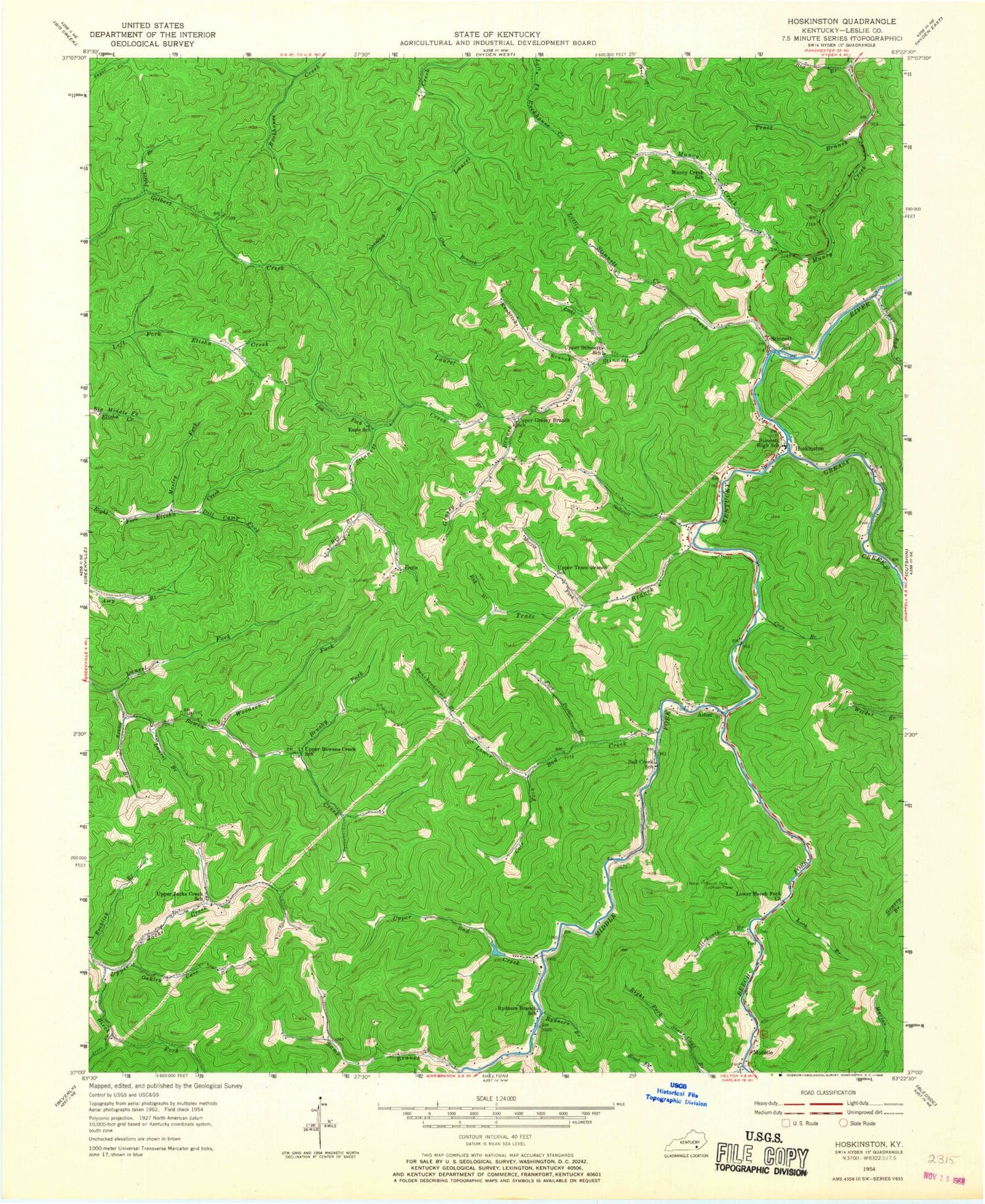
Classic USGS Hoskinston Kentucky 7.5'x7.5' Topo Map
Couldn't load pickup availability
Historical USGS topographic quad map of Hoskinston in the state of Kentucky. Map scale may vary for some years, but is generally around 1:24,000. Print size is approximately 24" x 27"
This quadrangle is in the following counties: Leslie.
The map contains contour lines, roads, rivers, towns, and lakes. Printed on high-quality waterproof paper with UV fade-resistant inks, and shipped rolled.
Contains the following named places: Asher, Asher Post Office, Bad Creek School, Beech Fork, Beech Fork Lookout Tower, Big Branch, Birch Fork, Bowen Creek Church, Brushy Fork, Cole Fork, Corn Branch, Dill Camp Fork, Essie, Essie Post Office, Essie School, Fort Parker Branch, Grassy Branch, Grassy Branch Church, Greasy Creek, Halls Rest Haven, Hoskinston, Hoskinston Post Office, Jesse Fork, Knoblick Branch, Lady Branch, Laurel Branch, Laurel Fork, Leslie County, Lick Branch, Lick Fork, Little Stinnett Creek, Low Gap Branch, Lower Bad Creek, Lower Beech Fork Church, Lower Stinnett School, Middle Fork Church, Morris Fork, Mosley Fork, Mozelle, Muncy Creek Church, Muncy Creek School, Oakley Cave Branch, Peters Branch, Puncheoncamp Branch, Rydners Branch, Rydners Branch School, Saltwell Branch, Sams Branch, Sandlick Branch, Sassy Branch, Slickrock Branch, Stinnett, Stinnett Creek, Stinnett Elementary School, Stinnett Gap Church, Stinnett High School, Stinnett Post Office, Stinnett Volunteer Fire Department, Stone Coal Branch, Trace Branch, Upper Bad Creek, Upper Bowens Creek School, Upper Grassy Branch School, Upper Jacks Creek School, Upper Stinnett School, Upper Trace Branch School, Woodson Fork, ZIP Codes: 40858, 40868