MyTopo
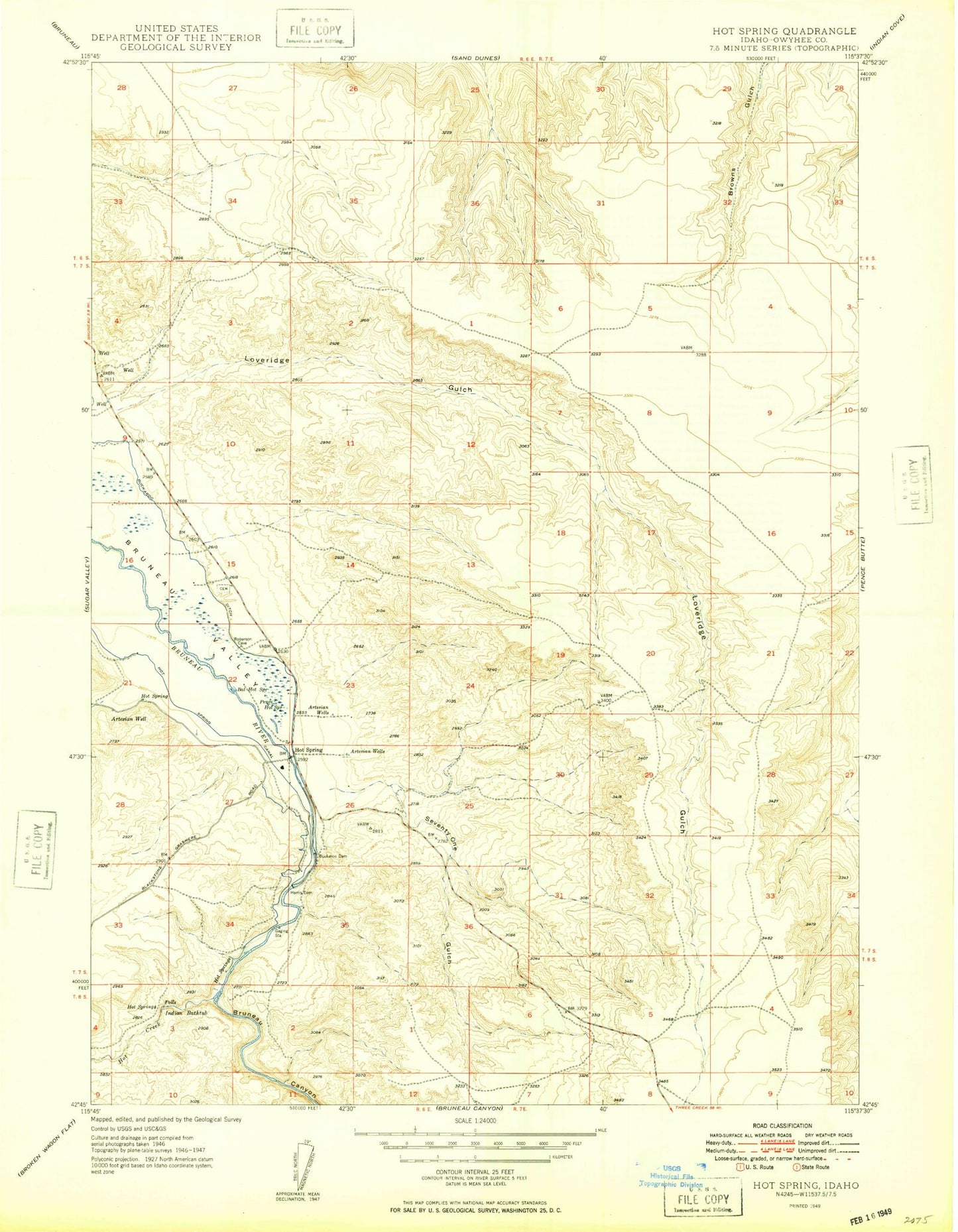
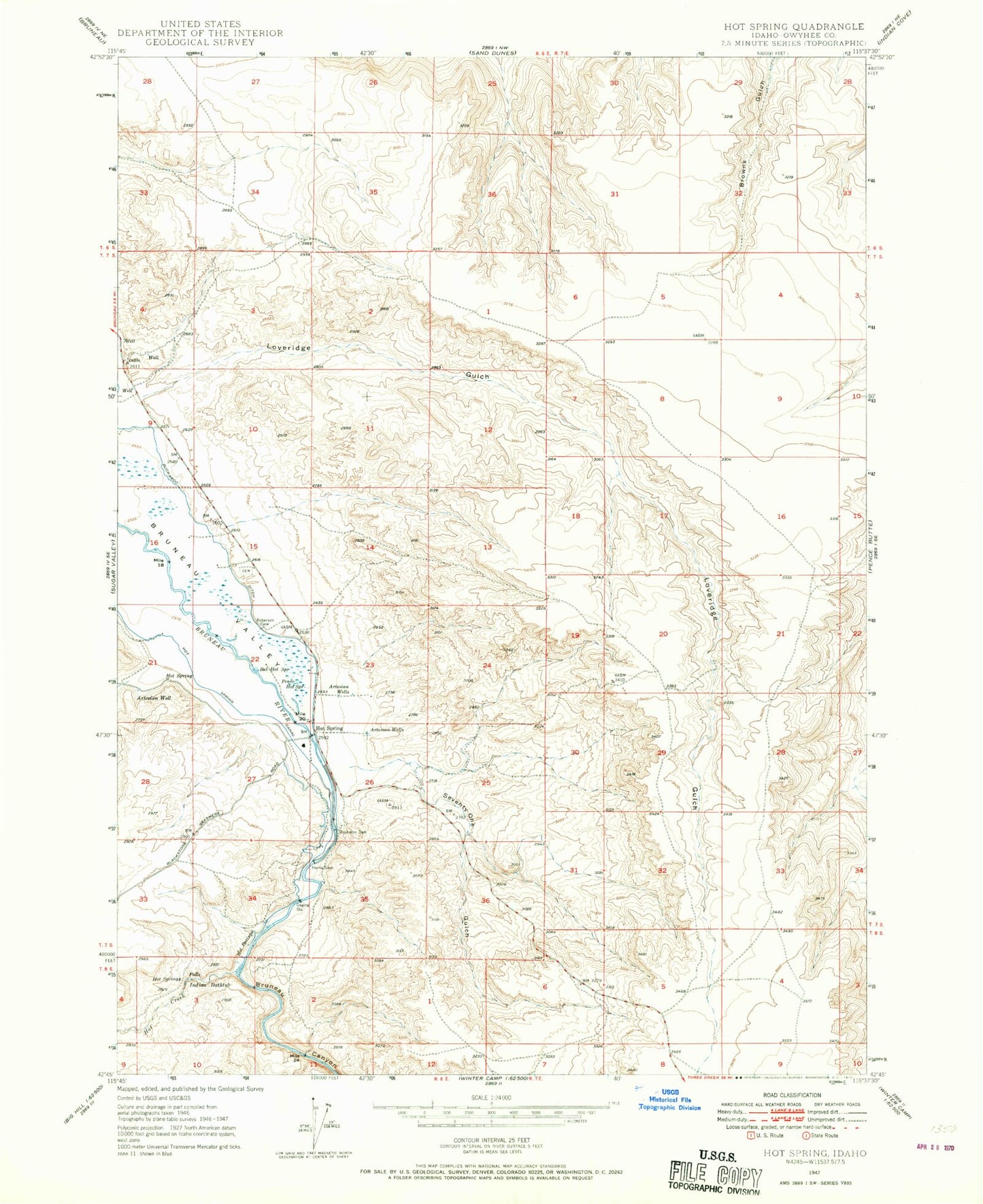
Classic USGS Hot Springs Idaho 7.5'x7.5' Topo Map
Regular price
$16.95
Regular price
Sale price
$16.95
Unit price
per
Couldn't load pickup availability
Historical USGS topographic quad map of Hot Springs in the state of Idaho. Map scale may vary for some years, but is generally around 1:24,000. Print size is approximately 24" x 27"
This quadrangle is in the following counties: Owyhee.
The map contains contour lines, roads, rivers, towns, and lakes. Printed on high-quality waterproof paper with UV fade-resistant inks, and shipped rolled.
Contains the following named places: Bat Hot Spring, Bruneau Canyon, Buckaroo Dam, Falls Hot Springs, Harris Dam, Hot Creek, Hot Spring Canal, Hot Springs, Hot Springs Cemetery, Indian Bathtub, Loveridge Gulch, Owen Ranches Inc Airport, Pence Hot Spring, Seventy One Gulch