MyTopo
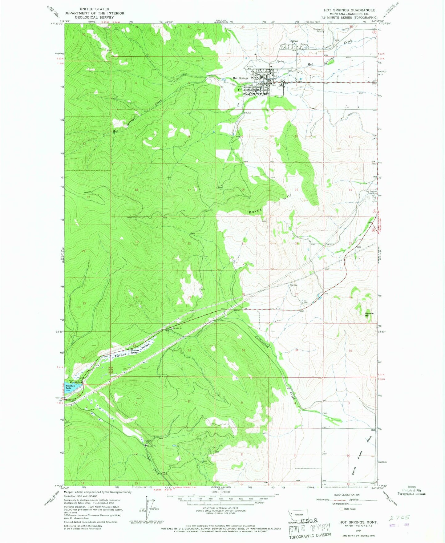
Classic USGS Hot Springs Montana 7.5'x7.5' Topo Map
Couldn't load pickup availability
Historical USGS topographic quad map of Hot Springs in the state of Montana. Map scale may vary for some years, but is generally around 1:24,000. Print size is approximately 24" x 27"
This quadrangle is in the following counties: Sanders.
The map contains contour lines, roads, rivers, towns, and lakes. Printed on high-quality waterproof paper with UV fade-resistant inks, and shipped rolled.
Contains the following named places: 20N24W03CCCD01 Well, 20N24W03CCD_01 Well, 20N24W11CCC_01 Well, 20N24W15ABB_01 Well, 21N24W01CCC_01 Well, 21N24W02ADC_01 Well, 21N24W02BDBC01 Well, 21N24W03BBA_01 Spring, 21N24W03BBC_01 Well, 21N24W03DBAB01 Well, 21N24W03DCBB01 Well, 21N24W04ADAB01 Well, 21N24W04DABD01 Well, 21N24W04DBC_01 Well, 21N24W04DBD_01 Well, 21N24W09ACBA01 Well, 21N24W09CABC01 Well, 21N24W11DDDD01 Well, 22N24W34CDC_02 Spring, 22N24W34DCC_01 Well, 24N24W27CDCA01 Well, 24N24W27CDCA02 Well, 24N24W27CDCA03 Well, 24N24W27CDCA04 Well, 24N24W34ACD_01 Well, Bobs Place, Burke Hill, Camas, Camas Census Designated Place, Camas Post Office, Central Avenue Trailer Court, First Presbyterian Church, Hot Springs, Hot Springs Ambulance, Hot Springs Bible Church, Hot Springs City Park, Hot Springs Convalescent Center, Hot Springs Medical Clinic, Hot Springs Police Department, Hot Springs Post Office, Hot Springs Public Schools, Hot Springs Substation, Hot Springs Town-County Library, Hot Springs Volunteer Fire Department, Maillet Cemetery, Markle Hill, Moore Cemetery, NIARADA_CANAL_ Well, Sacred Heart Catholic Church, Seventh Day Adventist Church, Shady Grove RV Park, Toolman Slough, Town of Hot Springs, Trinity Lutheran Church, Ventling Cemetery, Welcome Spring