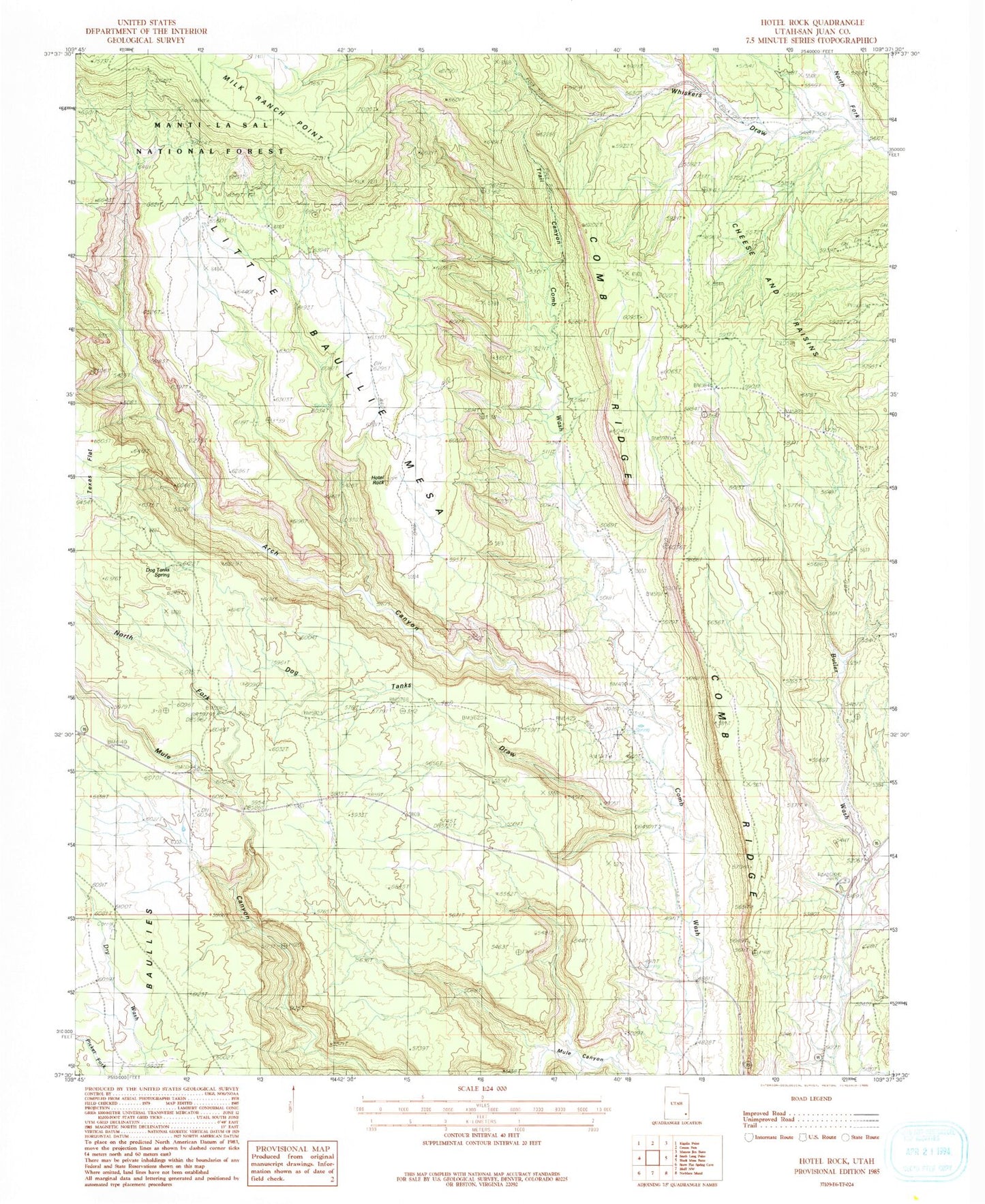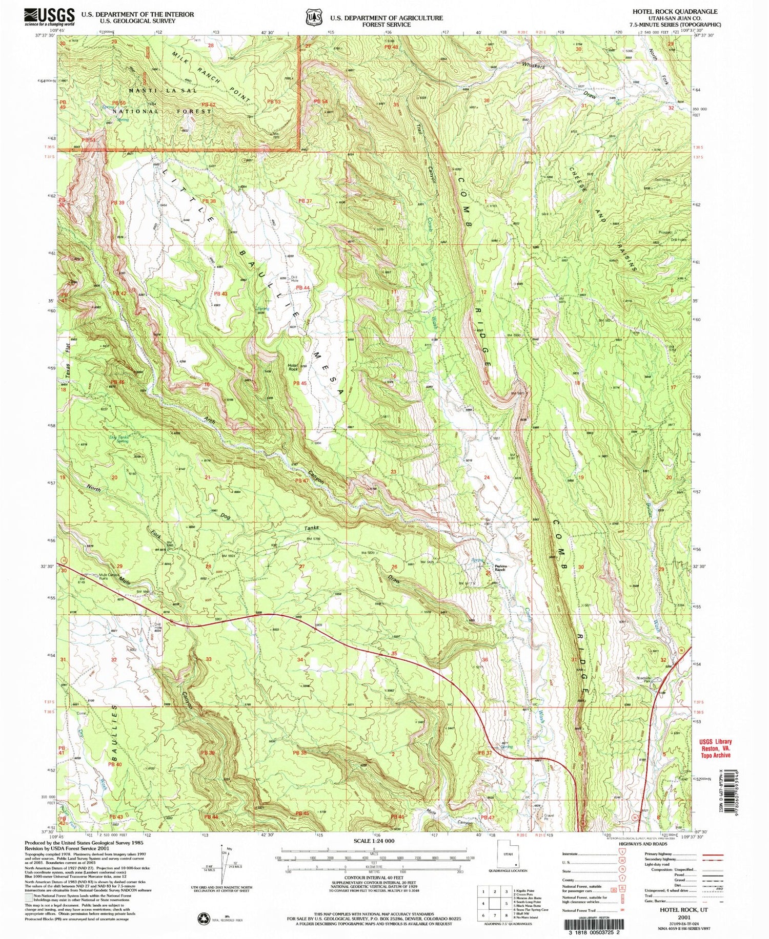
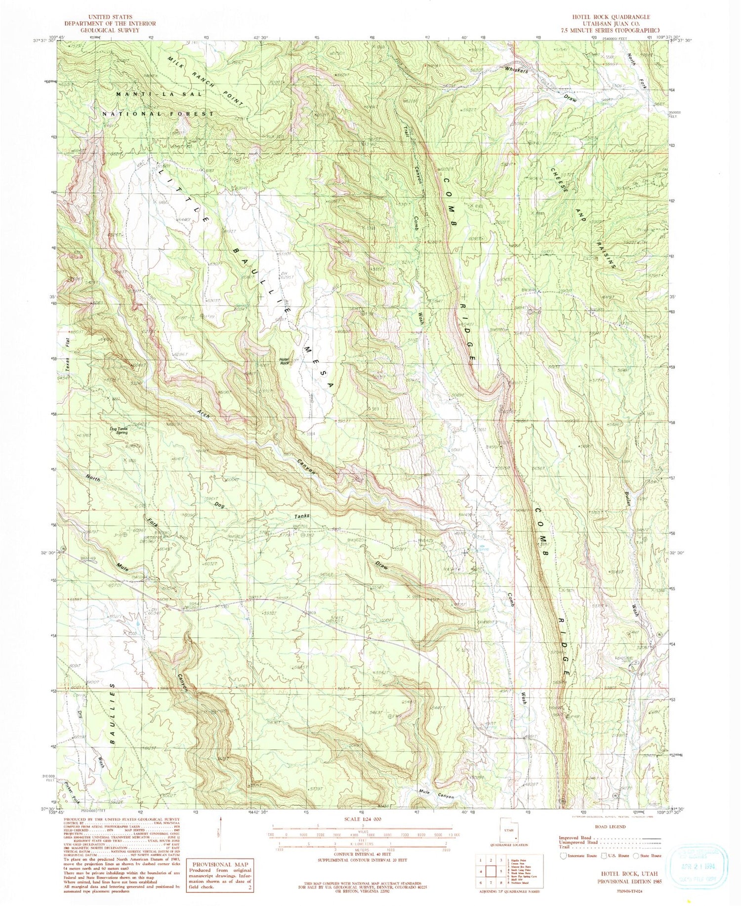
MyTopo
Classic USGS Hotel Rock Utah 7.5'x7.5' Topo Map
Regular price
$16.95
Regular price
Sale price
$16.95
Unit price
per
Couldn't load pickup availability
Historical USGS topographic quad map of Hotel Rock in the state of Utah. Typical map scale is 1:24,000, but may vary for certain years, if available. Print size: 24" x 27"
This quadrangle is in the following counties: San Juan.
The map contains contour lines, roads, rivers, towns, and lakes. Printed on high-quality waterproof paper with UV fade-resistant inks, and shipped rolled.
Contains the following named places: Dog Tanks Draw, Hotel Rock, Perkins Ranch, Trail Canyon, Butler Wash Viewpoint, Dog Tanks Spring, Arch Canyon, Little Baullie Mesa, North Fork Mule Canyon, North Fork Whiskers Draw, Arch Canyon Trail