MyTopo
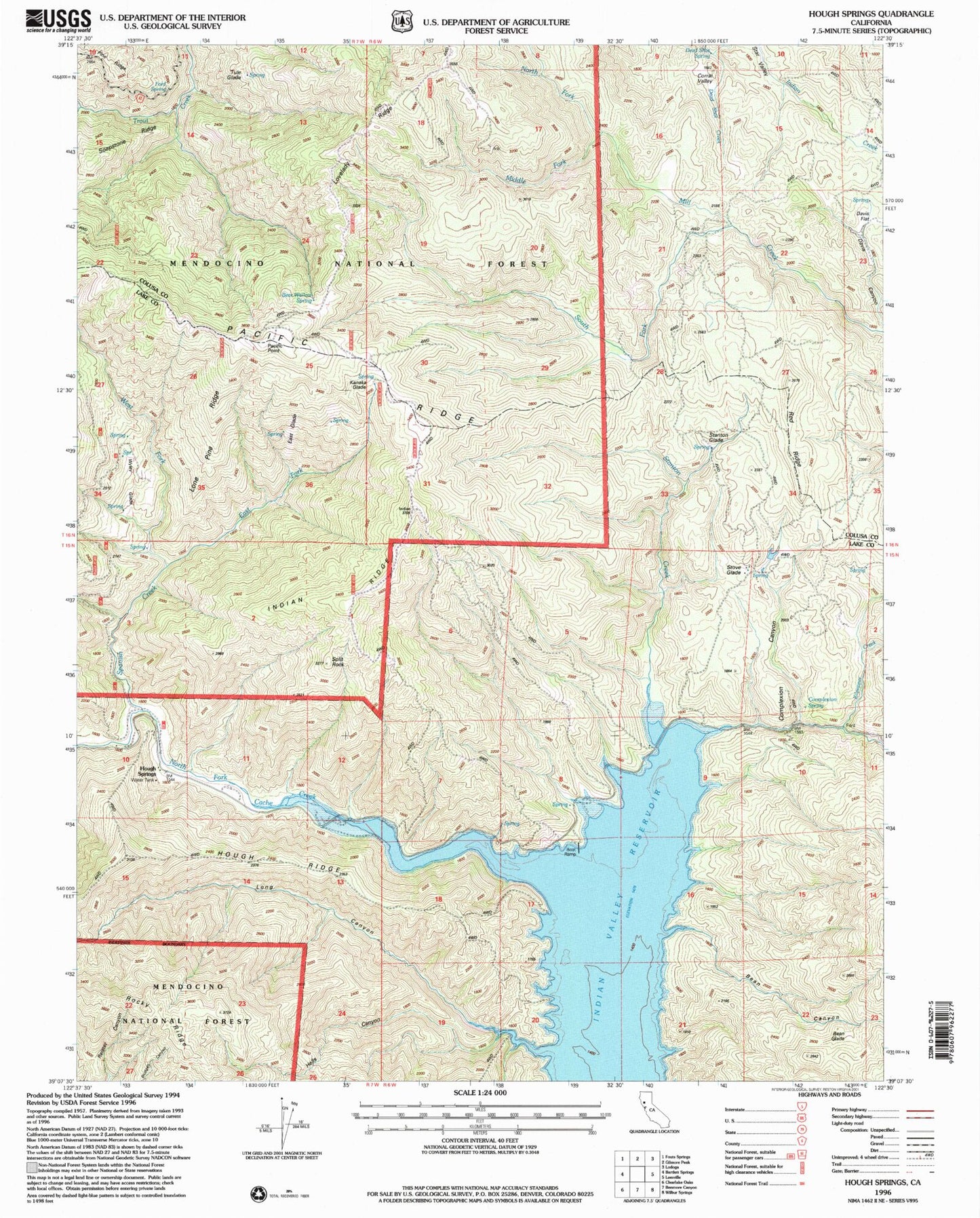
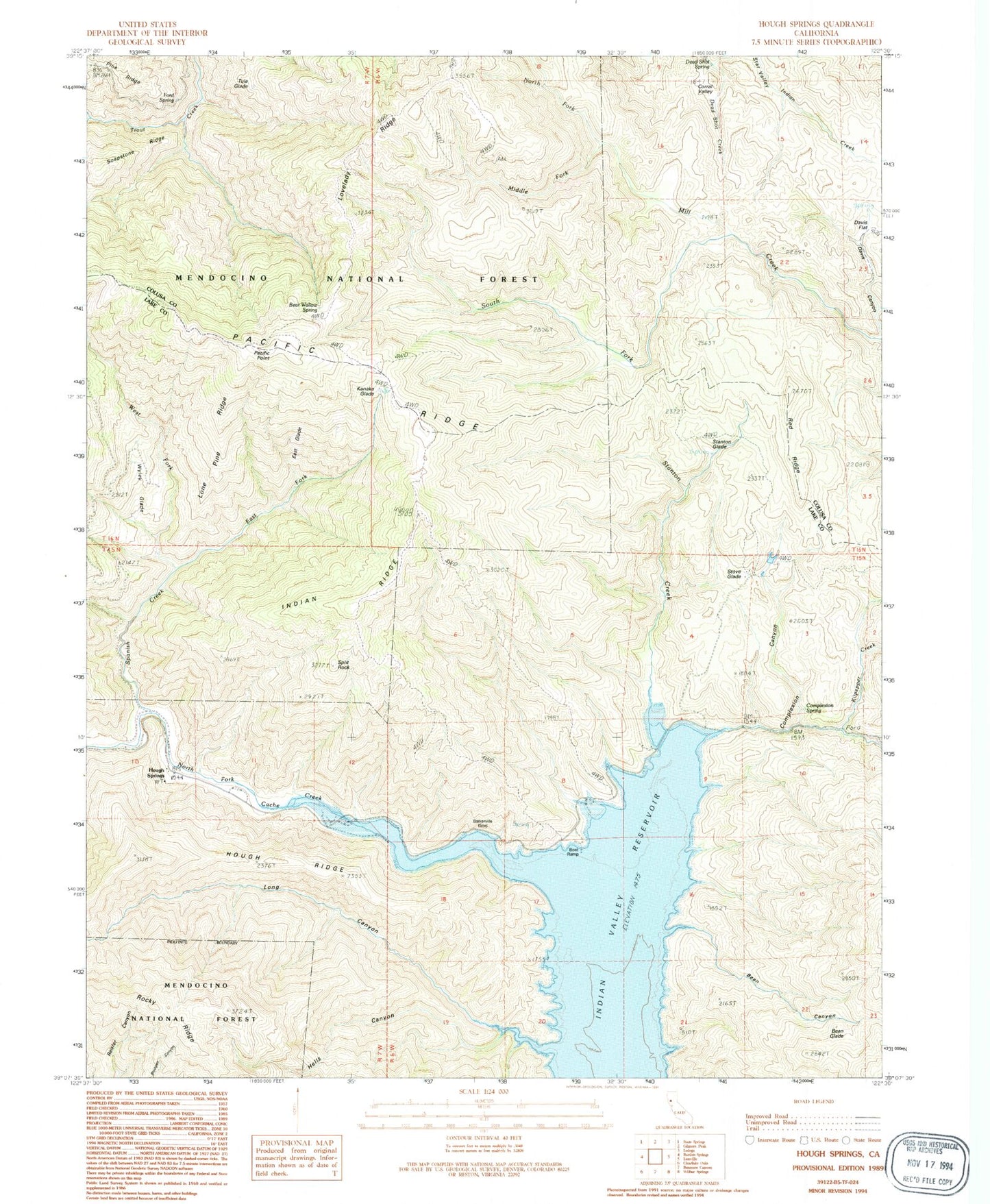
Classic USGS Hough Springs California 7.5'x7.5' Topo Map
Couldn't load pickup availability
Historical USGS topographic quad map of Hough Springs in the state of California. Map scale may vary for some years, but is generally around 1:24,000. Print size is approximately 24" x 27"
This quadrangle is in the following counties: Colusa, Lake.
The map contains contour lines, roads, rivers, towns, and lakes. Printed on high-quality waterproof paper with UV fade-resistant inks, and shipped rolled.
Contains the following named places: Barkerville, Bean Canyon, Bean Glade, Bear Wallow Spring, Berryessa Snow Mountain National Monument, Complexion Canyon, Complexion Spring, Corral Valley, Davis Canyon, Davis Flat, Dead Shot Creek, Dead Shot Spring, East Fork Spanish Creek, East Glade, Ford Spring, Hells Canyon, Hough Ridge, Hough Springs, Indian Ridge, Kanaka Glade, Kilpepper Creek, Kowalski Ranch, Lone Pine Ridge, Long Canyon, Lovelady Ridge, Middle Fork Mill Creek, North Fork Mill Creek, Pacific Point, Pacific Point Guard Station, Red Ridge, Rocky Ridge, South Fork Mill Creek, Spanish Creek, Split Rock, Stanton Creek, Stanton Glade, Stove Glade, Tule Glade, West Fork Spanish Creek, Wyley Glade