MyTopo
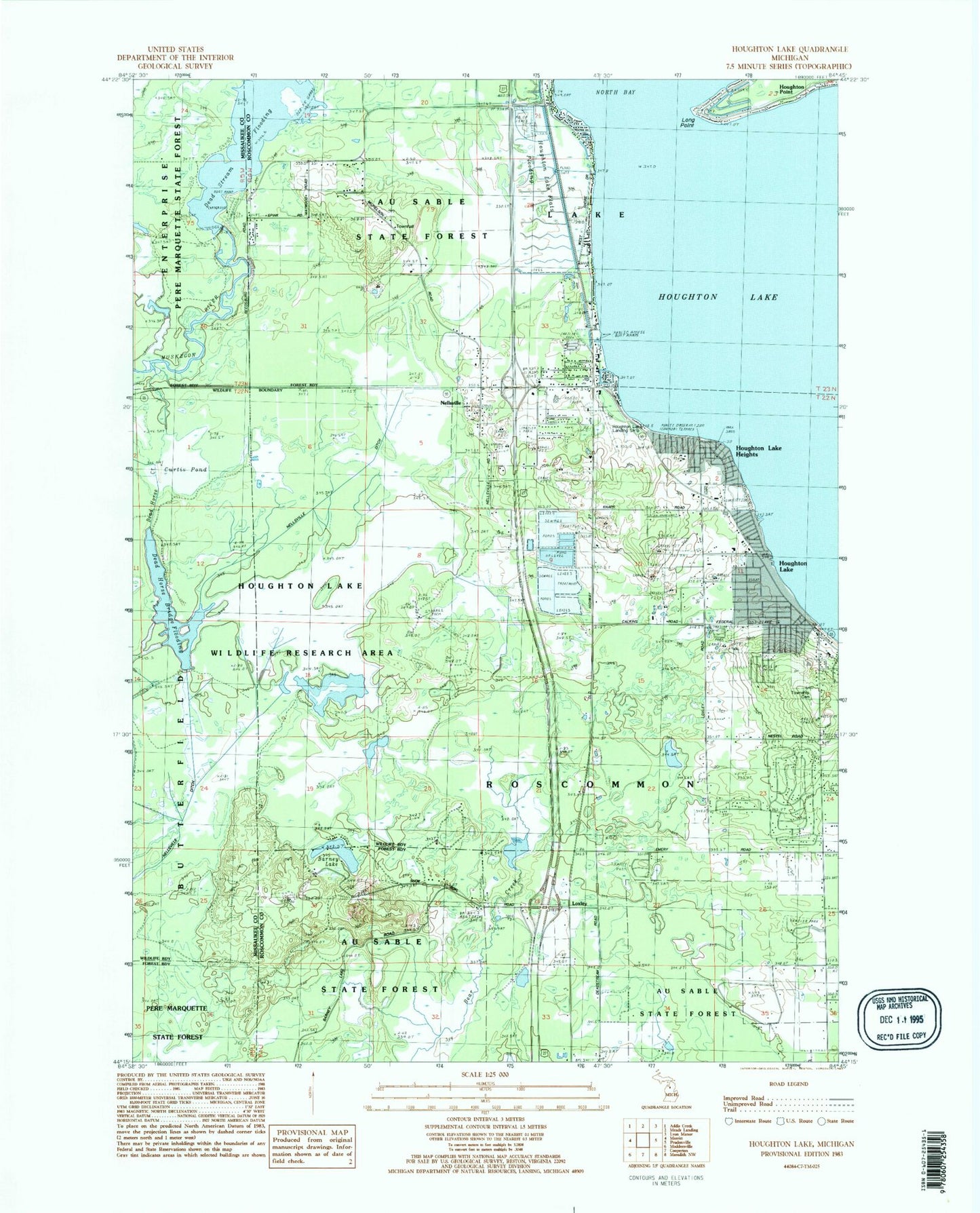
Classic USGS Houghton Lake Michigan 7.5'x7.5' Topo Map
Couldn't load pickup availability
Historical USGS topographic quad map of Houghton Lake in the state of Michigan. Typical map scale is 1:24,000, but may vary for certain years, if available. Print size: 24" x 27"
This quadrangle is in the following counties: Missaukee, Roscommon.
The map contains contour lines, roads, rivers, towns, and lakes. Printed on high-quality waterproof paper with UV fade-resistant inks, and shipped rolled.
Contains the following named places: Anderson School, Barney Lake, Houghton Lake, Houghton Lake Heights, Houghton Lake Park, Houghton Point, Nellsville, Nellsville Ditch, Reedsburg Dam, Houghton Lake Lookout Tower, Houghton Lake State Airport, Loxley, Roscommon Township Cemetery, Curtis Pond, Houghton Lake Wildlife Research Area, Long Point, Houghton Lake Flats Flooding, Dead Stream Flooding, Reedsburg Dam State Forest Campground, Nellsville Post Office (historical), Loxley Post Office (historical), Houghton Point Post Office (historical), King Nursing Center, Heights Marina, MidMichigan Health Park, Lake Township Hall, Roscommon Township Hall, Poplars Resort and Campground, Wooded Acres Family Campground, Houghton Lake Post Office, Houghton Lake Wesleyan Church, Houghton Lake Church of Christ, Houghton Lake Baptist Church, Houghton Lake Community Church, Faith Community Church, United Methodist Church, Church on the Lakes Free Methodist Church, Quest Golf Club, Roscommon Township Fire Department, Houghton Lake Ambulance Authority, Michigan State Police District 7 Houghton Lake Post 75, Houghton Lake Heights Post Office