MyTopo
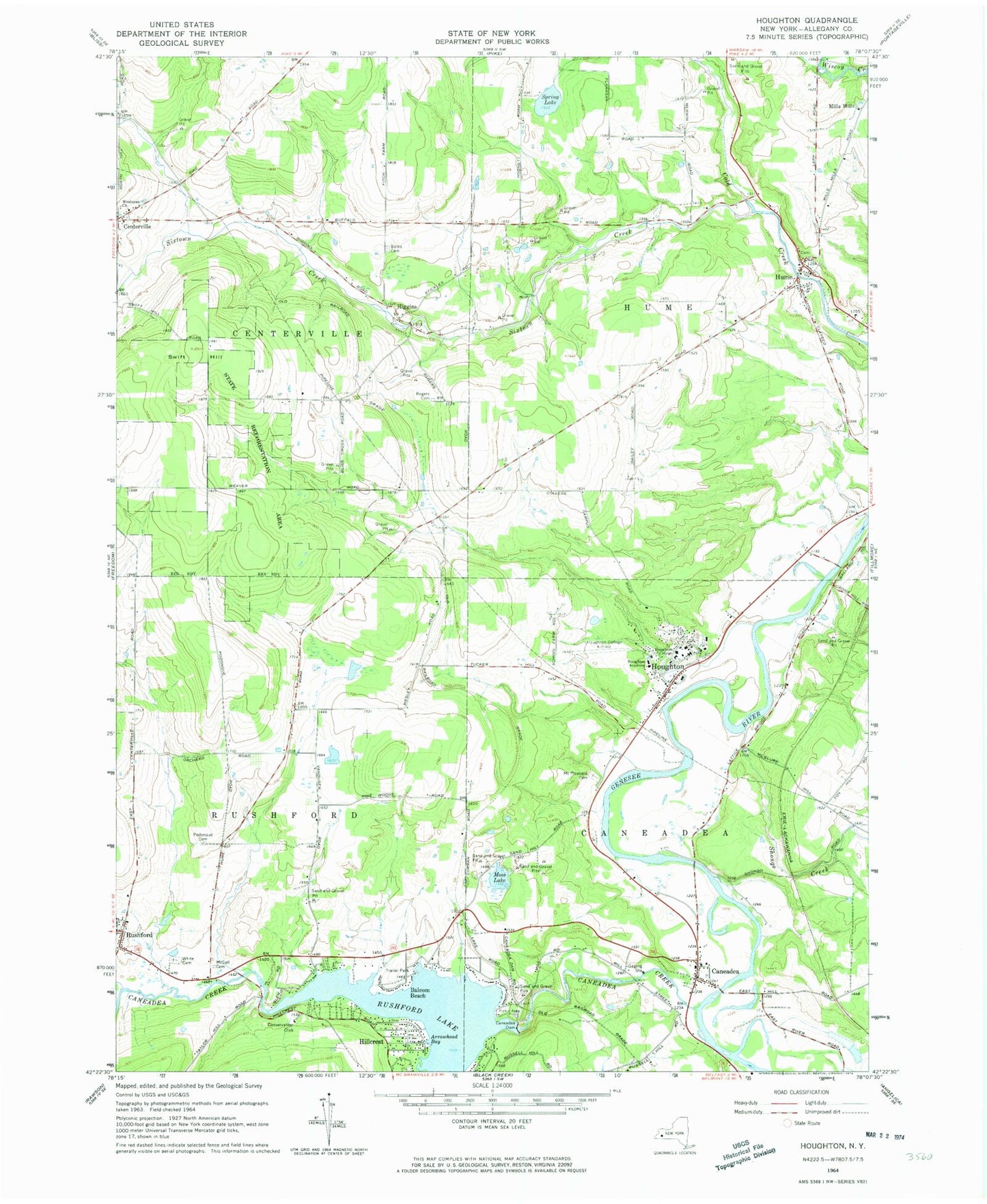
Classic USGS Houghton New York 7.5'x7.5' Topo Map
Couldn't load pickup availability
Historical USGS topographic quad map of Houghton in the state of New York. Map scale may vary for some years, but is generally around 1:24,000. Print size is approximately 24" x 27"
This quadrangle is in the following counties: Allegany.
The map contains contour lines, roads, rivers, towns, and lakes. Printed on high-quality waterproof paper with UV fade-resistant inks, and shipped rolled.
Contains the following named places: Arrowhead Bay, Balcom Beach, Bates Cemetery, Caneadea, Caneadea Bridge, Caneadea Cemetery, Caneadea Creek, Caneadea Dam, Caneadea Post Office, Centerville, Centerville Memorial Volunteer Fire Department, Centerville Post Office, Chamberlain Center, Fancher Hall, Fiegl Maintenance Building, First Baptist Church of Hume, Gillette Hall, Higgins, Hillcrest, Hoffman Farms, Houghton, Houghton Academy, Houghton Census Designated Place, Houghton College, Houghton College Airport, Houghton College Center For The Arts, Houghton Post Office, Houghton Volunteer Fire Department, Houghton Wesleyan Church, Hume, Hume Post Office, Hume Village Cemetery, Lambein Hall, Luckey Building, Mariposa Ponds Campground, Moss Lake, Mount Pleasant Cemetery, Nielsen Physical Education Center, Paine Science Center, Plane Haven Airport, Podonque Cemetery, Rogers Cemetery, Rothenbuhler Hall, Rushford Fire District Rescue Squad, Rushford Lake, Rushford Volunteer Fire Department, Shenawana Dormitory, Shongo Creek, Sixtown Creek, Speicher Farms, Spring Lake, Stevens Art Studio, Swift Hill, The Waters of Houghton, Town of Caneadea, Town of Centerville, Town of Hume, Wesley Chapel, Wesleyan Church, White Cemetery, William J Houghton Memorial Library, WJSL-FM (Houghton), ZIP Code: 14744