MyTopo
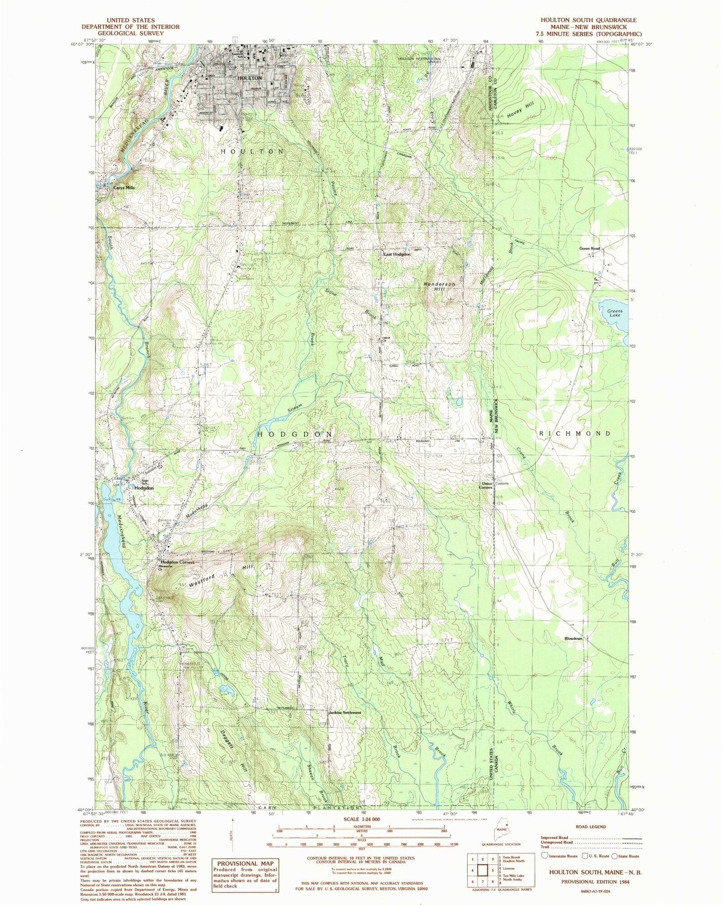
Classic USGS Houlton South Maine 7.5'x7.5' Topo Map
Couldn't load pickup availability
Historical USGS topographic quad map of Houlton South in the state of Maine. Map scale may vary for some years, but is generally around 1:24,000. Print size is approximately 24" x 27"
This quadrangle is in the following counties: Aroostook.
The map contains contour lines, roads, rivers, towns, and lakes. Printed on high-quality waterproof paper with UV fade-resistant inks, and shipped rolled.
Contains the following named places: Airport Industrial Park, Aroostook County Courthouse and Jail, Aroostook County Jail, Aroostook County Law Library Houlton, Aroostook County Sheriff's Office, Carys Mills, Daggett Hill, East Hodgdon, First Baptist Church, First Church of Houlton Unitarian Universalist, Greater Houlton Christian Academy, Henderson Hill, Hodgdon, Hodgdon Cemetery, Hodgdon Corners, Hodgdon Dam, Hodgdon Middle High School, Hodgdon Volunteer Fire Department, Houlton Ambulance Service, Houlton Army Air Field, Houlton Census Designated Place, Houlton Christian Science Society, Houlton Church of Christ, Houlton Elementary School, Houlton Fire Department, Houlton Grange, Houlton Police Department, Houlton Post Office, Houlton Southside School, Hovey Hill, Jackins Settlement, Lincoln School, London School, MacDonald Brook, Maduskeag Stream, Maranatha Church, Mill Pond School, Monument Park, Reservoir Hill, Ricker Classical Institute, S A D 70 Elementary School, Salvation Army, South Branch Meduxnekeag River, South Branch Meduxnekeag River Reservoir, Stewart Brook, Stone Brook, Stone School, The Houlton Wesleyan Church, Town of Hodgdon, Tracy Brook, Union Church, Union Church Cemetery, Union Corners, Unitarian Church of Houlton, United Methodist Church, United Pentecostal Church, Westford Hill, WHOU-AM (Houlton), WHOU-FM (Houlton)