MyTopo
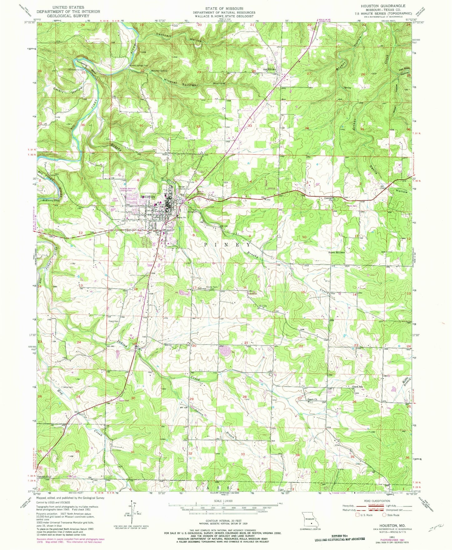
Classic USGS Houston Missouri 7.5'x7.5' Topo Map
Couldn't load pickup availability
Historical USGS topographic quad map of Houston in the state of Missouri. Map scale may vary for some years, but is generally around 1:24,000. Print size is approximately 24" x 27"
This quadrangle is in the following counties: Texas.
The map contains contour lines, roads, rivers, towns, and lakes. Printed on high-quality waterproof paper with UV fade-resistant inks, and shipped rolled.
Contains the following named places: Brown Hill School, Brushy Creek, Cathcart Hollow, Central Church, City of Houston, Cleveland Church, Cleveland School, Devils Hollow, Emery Hollow, Flat Rock Hollow, Foard Cemetery, Horseshoe Bend, Houston, Houston Fire Department, Houston Memorial Airport, Houston Police Department, Houston Post Office, Houston Rural Fire Protection Association, Hutcheson Lake, Hutcheson Lake Dam, Indian Creek, Johnson Branch, KBTC-AM (Houston), KUNQ-FM (Houston), Mark Twain National Forest Houston - Rolla - Cedar Creek Ranger District Houston Office, McKinney Eddy, Mineral Spring, Mineral Springs City, Mineral Springs Ford, Mineral Springs Hollow, Missouri Department of Conservation Forestry Ozark Regional Field Fire Office Houston, Oak Hill School, Oakdale Church, Ozark Church, Ozark School, Pine Lawn Cemetery, Samoa, Sunset Drive-In, Texas County, Texas County Memorial Hospital, Texas County Memorial Hospital Heliport, Texas County Poor Farm Cemetery, Texas County Sheriff's Office, Township of Piney, White Cemetery, Wood Hollow, ZIP Code: 65483