MyTopo
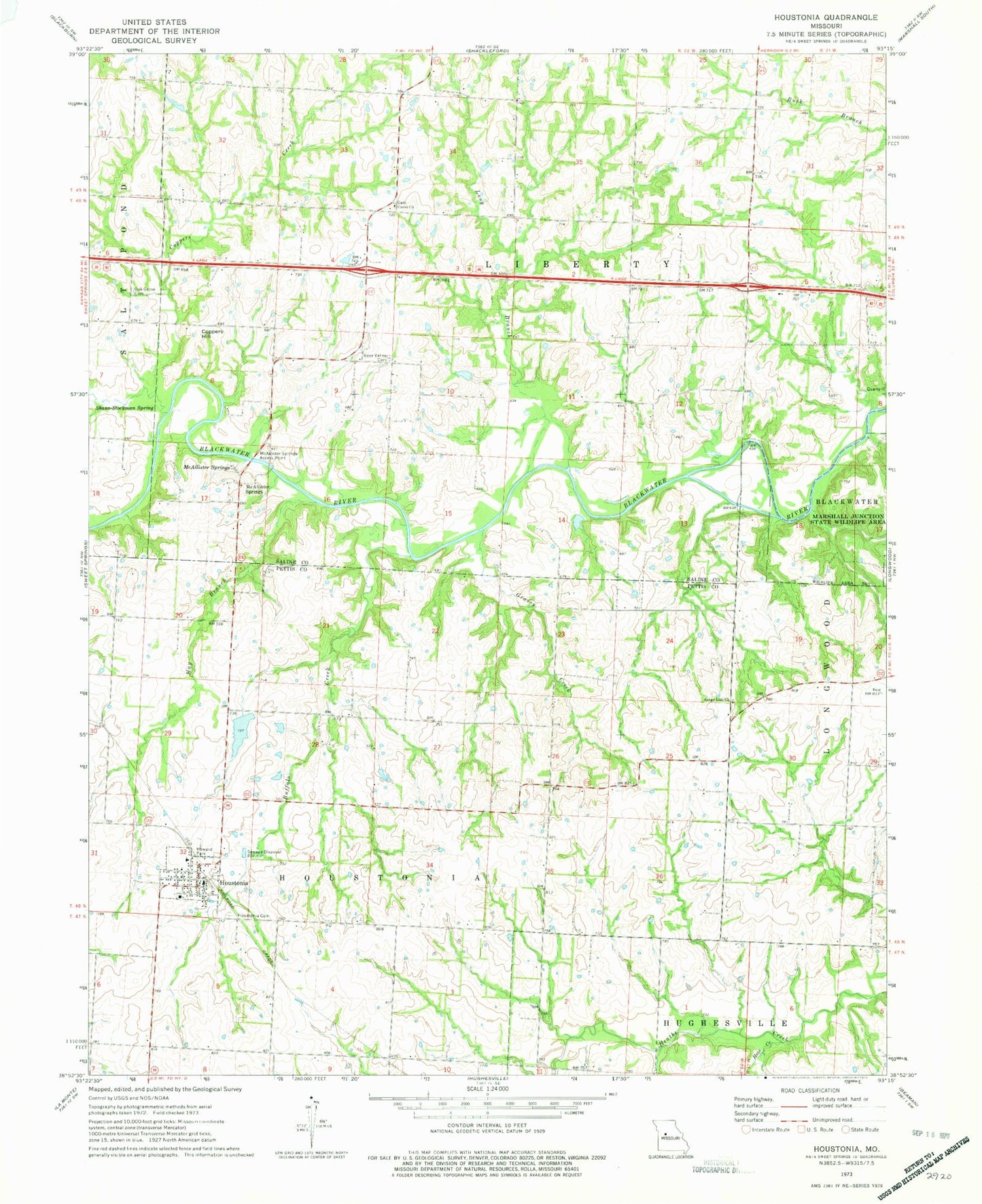
Classic USGS Houstonia Missouri 7.5'x7.5' Topo Map
Couldn't load pickup availability
Historical USGS topographic quad map of Houstonia in the state of Missouri. Map scale may vary for some years, but is generally around 1:24,000. Print size is approximately 24" x 27"
This quadrangle is in the following counties: Pettis, Saline.
The map contains contour lines, roads, rivers, towns, and lakes. Printed on high-quality waterproof paper with UV fade-resistant inks, and shipped rolled.
Contains the following named places: Buffalo Creek, Christ Church, City of Houstonia, Coppers Creek, Coppers Hill, Glenwood School, Grassy Creek, Hazel Hill School, Hess Creek, Houstonia, Houstonia Cemetery, Houstonia Fire Department, Houstonia Post Office, Howard Park, Liberty School, Long Branch, Marshall Junction State Wildlife Area, May Branch, McAllister Springs, McAllister Springs Access Point, Mission Church, Northwest Elementary School, Oak Grove Cemetery, Oak Grove School, Range Line Church, Raymond Wicker Lake, Rose Valley Cemetery, Rose Valley School, Section School, Shanz-Stockman Spring, Tedieville, Township of Houstonia, Township of Liberty, Union Church, Wicker Lake Dam, ZIP Code: 65333