MyTopo
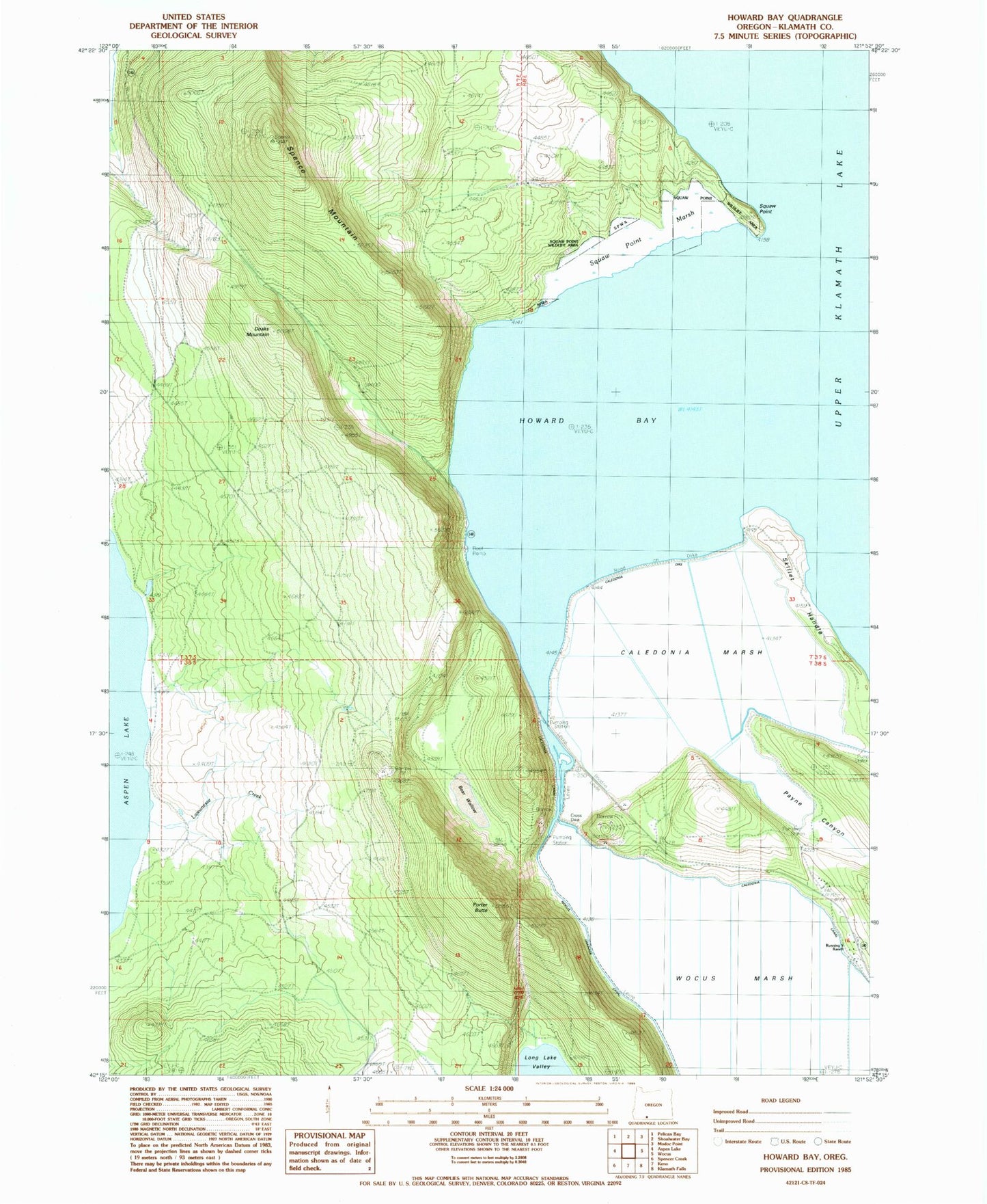
Classic USGS Howard Bay Oregon 7.5'x7.5' Topo Map
Couldn't load pickup availability
Historical USGS topographic quad map of Howard Bay in the state of Oregon. Map scale may vary for some years, but is generally around 1:24,000. Print size is approximately 24" x 27"
This quadrangle is in the following counties: Klamath.
The map contains contour lines, roads, rivers, towns, and lakes. Printed on high-quality waterproof paper with UV fade-resistant inks, and shipped rolled.
Contains the following named places: Bear Wallow, Bill Collier Community Ice Arena, Caledonia Canal, Caledonia Dike, Caledonia Marsh, Cross Dike, Doaks Mountain, Howard Bay, Howard Bay Park, Lajeunesse Creek, Melvins Pond, Payne Canyon, Porter Butte, Running Y Ranch, Sesti Tgawaals Marsh, Sesti Tgawaals Point, Sesti Tgawaals Wildlife Area, Skillet Handle, Spence Mountain, Wocus Bay Boat Ramp, Wocus Marsh