MyTopo
Classic USGS Howard Alabama 7.5'x7.5' Topo Map
Couldn't load pickup availability
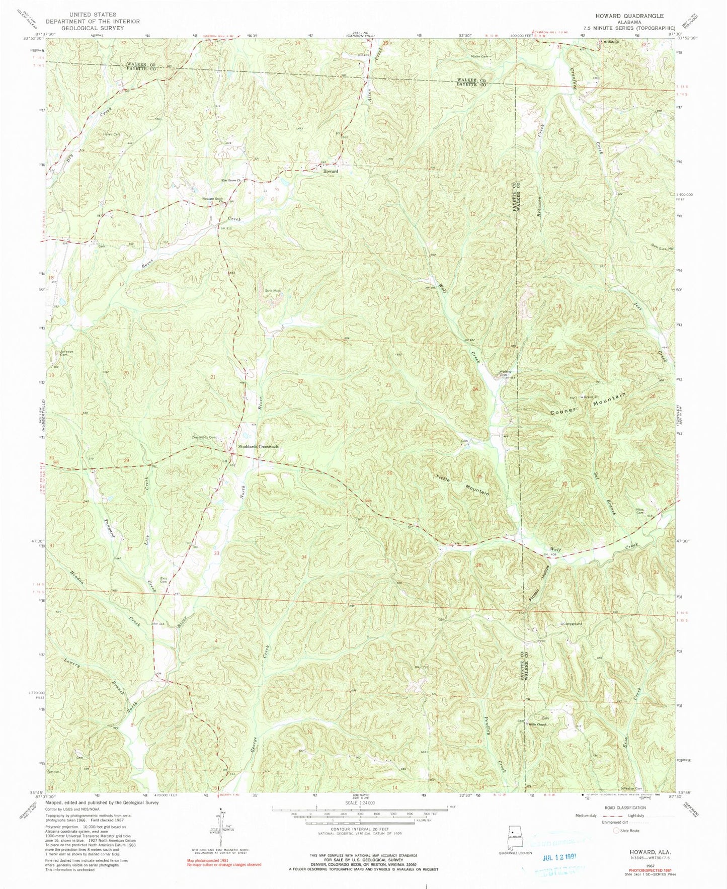
Historical USGS topographic quad map of Howard in the state of Alabama. Map scale may vary for some years, but is generally around 1:24,000. Print size is approximately 24" x 27"
This quadrangle is in the following counties: Fayette, Walker.
The map contains contour lines, roads, rivers, towns, and lakes. Printed on high-quality waterproof paper with UV fade-resistant inks, and shipped rolled.
Contains the following named places: Brannon Creek, Chisca Mine, Cooner Hollow, Cooner Mountain, Crossroads Cemetery, Crossroads Church, Elm Grove Cemetery, Elm Grove Church, Enis Cemetery, Files Cemetery, Frozen Hollow, Harris Cemetery, Hendon Creek, Holly Grove Post Office, Howard, Howard Church of Christ, Johnson Cemetery, Johnson School House Cemetery, Johnsons School, Johnston Cemetery, Lick Creek, Lowery Branch, McDade Church, Mill Creek Mine, Moore Cemetery, Phillips Cemetery, Pleasant Grove Baptist Church, Pleasant Grove Cemetery, Pleasant Hill Church, Sal Branch, Studdards Crossroads, Tanyard Creek, Tanyard Creek Gas Field, Tittle Mountain, Warrior River Mine, Whitley Cemetery, Willis Cemetery, Willis Chapel, Wolf Creek School, ZIP Code: 35549