
MyTopo
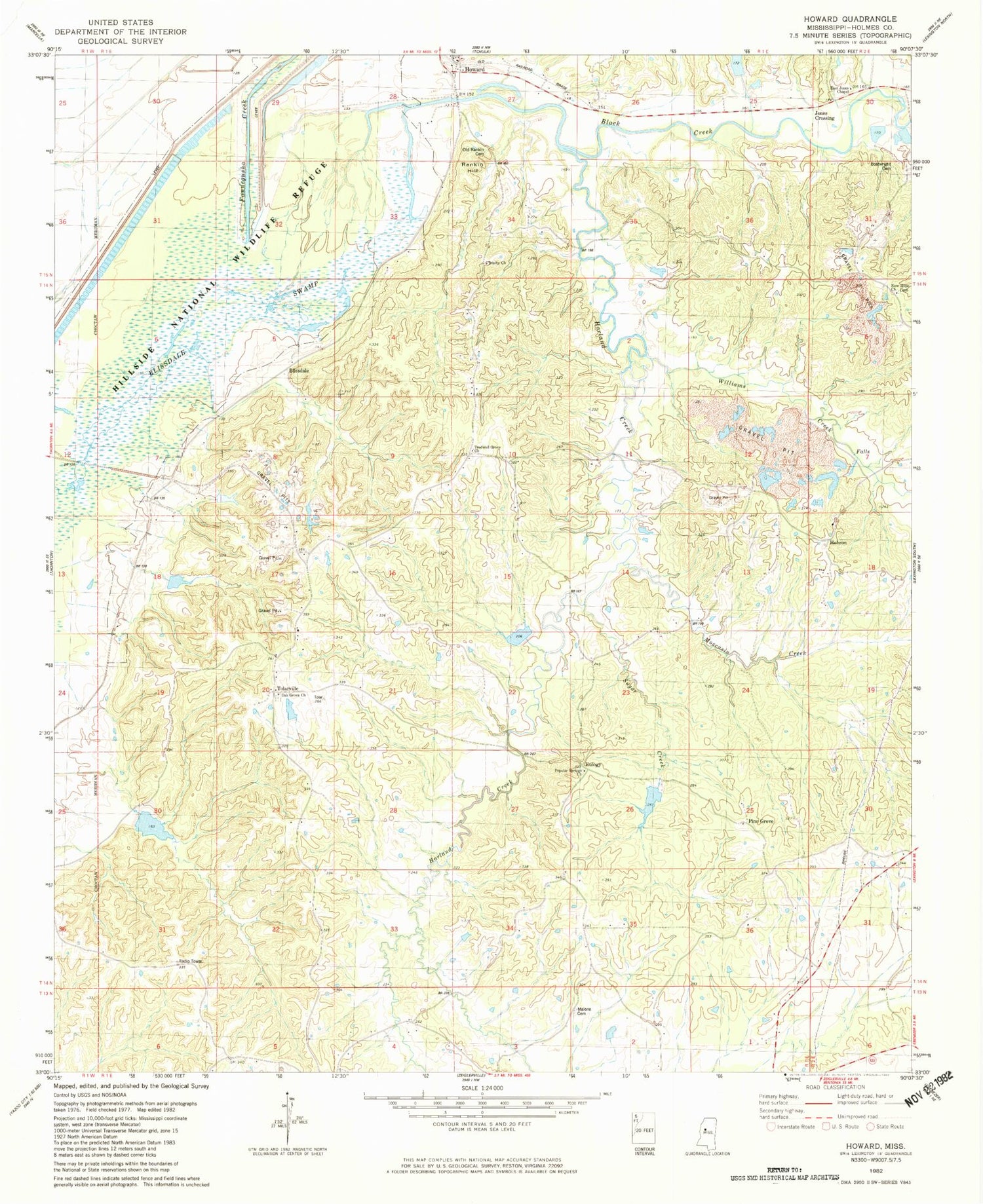
Classic USGS Howard Mississippi 7.5'x7.5' Topo Map
Couldn't load pickup availability
Historical USGS topographic quad map of Howard in the state of Mississippi. Map scale may vary for some years, but is generally around 1:24,000. Print size is approximately 24" x 27"
This quadrangle is in the following counties: Holmes.
The map contains contour lines, roads, rivers, towns, and lakes. Printed on high-quality waterproof paper with UV fade-resistant inks, and shipped rolled.
Contains the following named places: Belci, Black Creek, Black Watershed Y-36-39 Dam, Black Watershed Y-36-40 Dam, Black Watershed Y-36-43 Dam, Black Watershed Y-36-48 Dam, Black Watershed Y-36-49 Dam, Black Watershed Y-36-50 Dam, Blissdale, Blissdale School, Boatwright Cemetery, East Jones Chapel, Eulogy, Harland Creek, Hebron Cemetery, Hebron Church, Howard, Jones Crossing, MacMorrow-Hammett Lake Dam, Malone Cemetery, Meggs Cemetery, Mississippi No Name 24 Dam, Moccasin Creek, New Hope Church, Oak Grove Cemetery, Oak Grove Church, Old Rankin Cemetery, Pine Grove, Popular Springs Church, Rankin, Shady Grove Church, Sugar Creek, Supervisor District 4, Tolarville, Tredwell Cemetery, Tredwell Grove Church, Trinity Church, Valley Home Plantation, Watson Cemetery, Williams Creek


