MyTopo
Classic USGS Howell Ranch New Mexico 7.5'x7.5' Topo Map
Regular price
$16.95
Regular price
Sale price
$16.95
Unit price
per
Couldn't load pickup availability
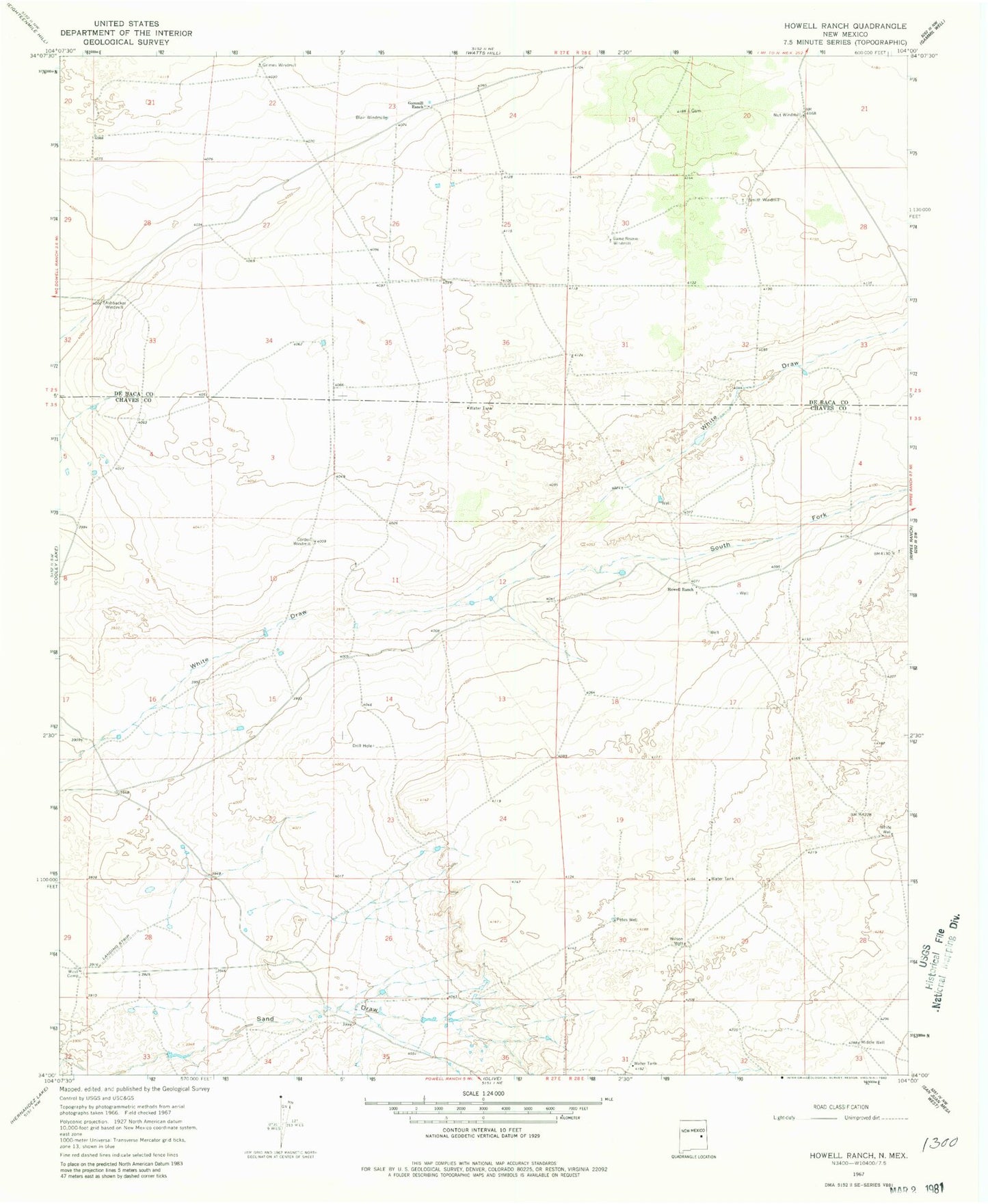
Historical USGS topographic quad map of Howell Ranch in the state of New Mexico. Map scale may vary for some years, but is generally around 1:24,000. Print size is approximately 24" x 27"
This quadrangle is in the following counties: Chaves, De Baca.
The map contains contour lines, roads, rivers, towns, and lakes. Printed on high-quality waterproof paper with UV fade-resistant inks, and shipped rolled.
Contains the following named places: Ashbacker Windmill, Blair Windmill, Bojax Ranch Airport, Cordell Windmill, Game Reserve Windmill, Gammill Ranch, Grimes Windmill, Howell Ranch, Middle Well, Nut Windmill, Petes Well, Smith Windmill, South Fork White Draw, West Camp, White Well, Wilson Well