MyTopo
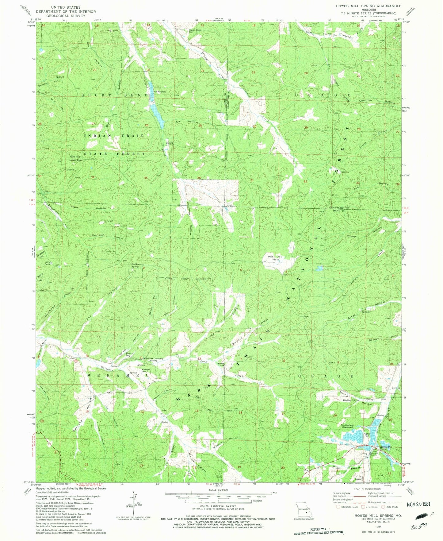
Classic USGS Howes Mill Spring Missouri 7.5'x7.5' Topo Map
Couldn't load pickup availability
Historical USGS topographic quad map of Howes Mill Spring in the state of Missouri. Map scale may vary for some years, but is generally around 1:24,000. Print size is approximately 24" x 27"
This quadrangle is in the following counties: Crawford, Dent.
The map contains contour lines, roads, rivers, towns, and lakes. Printed on high-quality waterproof paper with UV fade-resistant inks, and shipped rolled.
Contains the following named places: Ark, Bill Hollow, Bowers Cemetery, Bowers Hollow, Clark Lake Dam, Crooked Hill, Crooked Lookout, Denny Hollow, Doc Hollow, Elk Hollow, Fortune Hollow, Gambling Hollow, Gibson Hollow, Hamilton Hollow, Howes Mill Fish Hatchery Dam, Howes Mill Spring, Howes Mill Union Church, Hughes Cemetery, Hutson - Walker Cemetery, Huzzah Hatcheries Incorporated Dam, Indian Trail Fish Hatchery, Indian Trail Fish Hatchery Lake Dam, Indian Trail Lookout, Indian Trail State Forest, Indian Trail State Forest Lake, Kiln Hollow, Kiln Pond, Kittenger Cemetery, Lee Hollow, Levi Hollow, Majors Hollow, Martin Hollow, Meyers Hollow, Mounce Cemetery, Mounce Hollow, Number 117 Reservoir, Onion Hollow, Osage School, Park View School, Plank Hollow, Plugtown Hollow, Post Oak Flats, Powell Hollow, Rattlesnake Spring, Rowe Branch, Shovel Hollow, Thorny Hollow, Tiefenthalers Lake Retreat, Tiefenthalers Lake Retreat Dam, Township of Meramec, Water Fork Community Building, Water Fork Creek, Water Fork School, Wishing Spring, Young Hollow