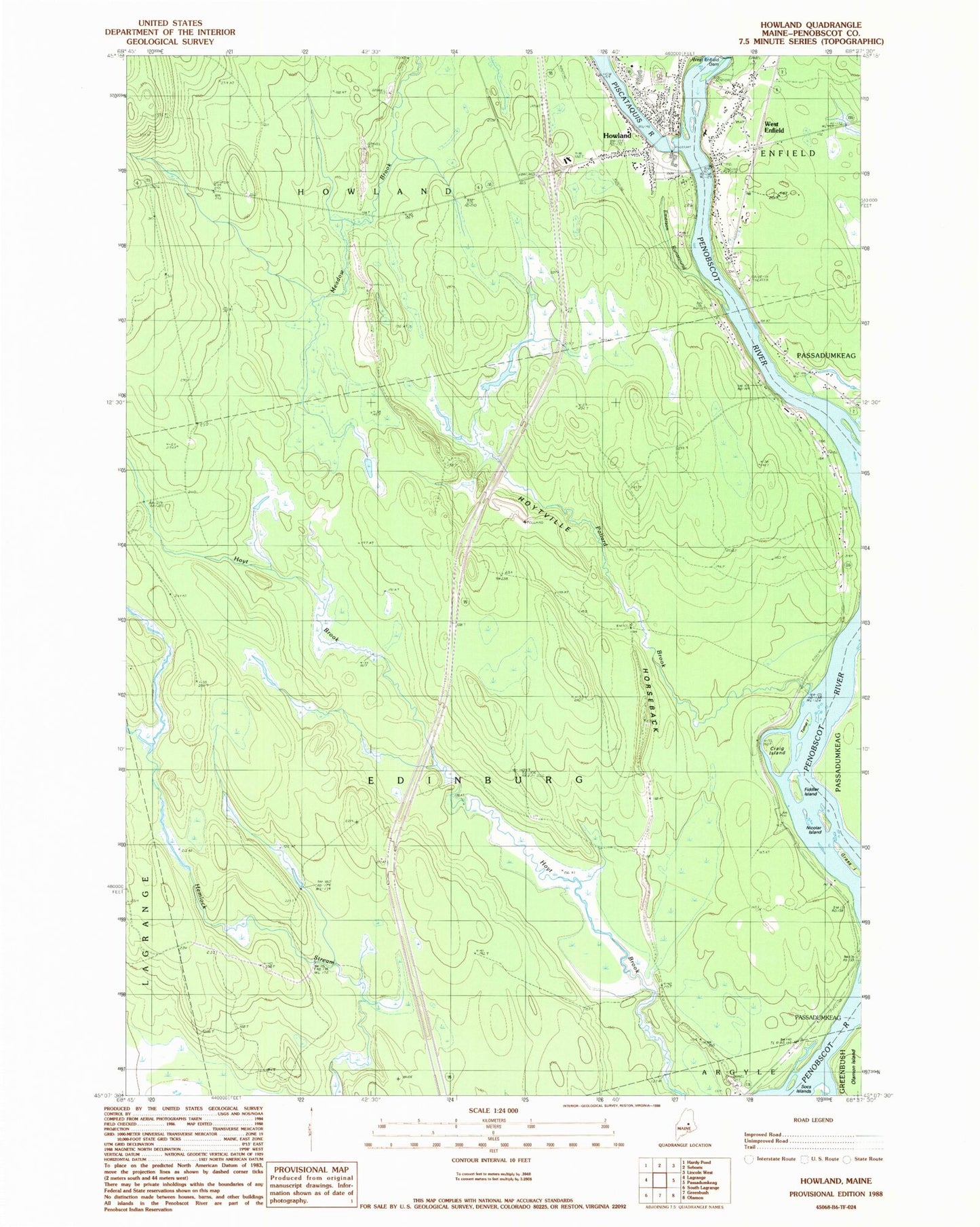
MyTopo
Classic USGS Howland Maine 7.5'x7.5' Topo Map
Couldn't load pickup availability
Historical USGS topographic quad map of Howland in the state of Maine. Map scale may vary for some years, but is generally around 1:24,000. Print size is approximately 24" x 27"
This quadrangle is in the following counties: Penobscot.
The map contains contour lines, roads, rivers, towns, and lakes. Printed on high-quality waterproof paper with UV fade-resistant inks, and shipped rolled.
Contains the following named places: Buzzport Airport, Church of God, Craig Island, Edinburg Cemetery, Emerson Runaround, Fiddler Island, Grass Island, Hichborn Middle School, Howland, Howland Baptist Church, Howland Dam, Howland Fire Department, Howland Post Office, Howland United Methodist Church, Hoytville Horseback, Nicolar Island, Olamon Island, Penobscot Valley High School, Piscataquis River, Piscataquis River Reservoir, Pollard Brook, Saint Leos Church, Thomas Free Library, Tomar Island, Town of Edinburg, West Enfield, West Enfield Cemetery, West Enfield Post Office